 BGS Metadata Catalogue
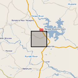
Groundwater-related data from basement aquifers in the Romwe Catchment, Southern Zimbabwe
These files include hydrochemical data and groundwater level time series for a number of boreholes and wells within the basement aquifers of the Romwe catchment. For each borehole/well there are associated depth, geology and use data. A time series study of abstraction was also carried out for a subset of wells. Time series rainfall data for a rain gauge in the catchment is also included. These data were collected through a series of projects: Small scale irrigation using collector wells: pilot project (CEH/BGS/Zimbabwe Ministry of Lands, Agriculture and Water Development; DfID funded) Sustainability of yield from wells and boreholes in hard rock aquifers (BGS; DfID funded) Regional groundwater recharge assessment in semi-arid areas (CEH/BGS; DfID-funded) The Hydrology of a dry land catchment in southern Zimbabwe, and the effects of climatic and land use change on shallow groundwater resources (PhD project, Uni. Reading/CEH) Integrated Catchment Management and Sustainable Water Resource Development in Semi-arid Zimbabwe (PhD project, Uni. Reading/CEH) Note: CEH (Center of Ecology and Hydrology) was known as ‘IH’ during the period of the study
Simple
- Date (Creation)
- 2019-09-11
- Citation identifier
- http://data.bgs.ac.uk/id/dataHolding/13607535
- Point of contact
-
Organisation name Individual name Electronic mail address Role British Geological Survey
Enquiries
Distributor British Geological Survey
Enquiries
Distributor British Geological Survey
Enquiries
Point of contact British Geological Survey
Enquiries
Point of contact
- Maintenance and update frequency
- Not planned
-
GEMET - INSPIRE themes, version 1.0
-
BGS Thesaurus of Geosciences
-
-
Groundwater
-
Aquifers
-
Ground water recharge
-
Water supply
-
- dataCentre
- Keywords
-
-
NERC_DDC
-
- Access constraints
- Other restrictions
- Other constraints
- no limitations
- Other constraints
- The dataset is made freely available for access, e.g. via the Internet. Either no third party data / information is contained in the dataset or BGS has secured written permission from the owner(s) of any third party data / information contained in the dataset to make the dataset freely accessible.
- Use constraints
- Other restrictions
- Other constraints
-
The copyright of materials derived from the British Geological Survey's work is vested in the Natural Environment Research Council [NERC]. No part of this work may be reproduced or transmitted in any form or by any means, or stored in a retrieval system of any nature, without the prior permission of the copyright holder, via the BGS Intellectual Property Rights Manager. Use by customers of information provided by the BGS, is at the customer's own risk. In view of the disparate sources of information at BGS's disposal, including such material donated to BGS, that BGS accepts in good faith as being accurate, the Natural Environment Research Council (NERC) gives no warranty, expressed or implied, as to the quality or accuracy of the information supplied, or to the information's suitability for any use. NERC/BGS accepts no liability whatever in respect of loss, damage, injury or other occurence however caused.
- Other constraints
-
Available under the Open Government Licence subject to the following acknowledgement accompanying the reproduced NERC materials "Contains NERC materials ©NERC [year]"
- Spatial representation type
- Text, table
- Language
- English
- Topic category
-
- Geoscientific information
- Geographic identifier
-
ZIMBABWE [id=677000]
British Geological Survey Gazetteer: Geographical hierarchy from Geosaurus 1979 creation
- Geographic identifier
-
ZW
ISO 3166_1 alpha-2 2009 revision
- Geographic identifier
-
ZWE
ISO 3166_1 alpha-3 2009 revision
))
- Begin date
- 1992-04-01
- End date
- 2000-03-31
- Unique resource identifier
- WGS 84 (EPSG::4326)
- Distribution format
-
Name Version Microsoft Excel
witheld
Microsoft Word
witheld
- Distributor contact
-
Organisation name Individual name Electronic mail address Role British Geological Survey
Enquiries
Distributor
- Distributor contact
-
Organisation name Individual name Electronic mail address Role British Geological Survey
Enquiries
Distributor
- OnLine resource
-
Protocol Linkage Name WWW:DOWNLOAD-1.0-http--download
https://webapps.bgs.ac.uk/services/ngdc/accessions/index.html#item130006 Groundwater-related data from basement aquifers in the Romwe Catchment, Southern Zimbabwe
- Hierarchy level
- Dataset
- Other
-
dataset
Conformance result
- Title
-
INSPIRE Implementing rules laying down technical arrangements for the interoperability and harmonisation of Geology
- Date (Publication)
- 2011
- Explanation
-
See the referenced specification
- Pass
- No
Conformance result
- Title
-
Commission Regulation (EU) No 1089/2010 of 23 November 2010 implementing Directive 2007/2/EC of the European Parliament and of the Council as regards interoperability of spatial data sets and services
- Date (Publication)
- 2010-12-08
- Explanation
-
See http://eur-lex.europa.eu/LexUriServ/LexUriServ.do?uri=OJ:L:2010:323:0011:0102:EN:PDF
- Pass
- No
- Statement
-
Large areas of the world are underlain by crystalline basement rock of igneous or metamorphic origin, for many people in arid and semi-arid areas these aquifers are seasonally important. Romwe Catchment was a site at which a number of projects undertook complementary research to assess controls on recharge to and yield from weathered basement aquifers. A range of data were collected including rainfall, groundwater levels and water chemistry of groundwaters, surface waters and precipitation. A geological map was also produced for the study area. Full methodology for the study can be found within the outputs from this work.
Metadata
- File identifier
- 9505fe19-e12e-380d-e054-002128a47908 XML
- Metadata language
- English
- Hierarchy level
- Dataset
- Date stamp
- 2026-06-11
- Metadata standard name
- UK GEMINI
- Metadata standard version
-
2.3
- Metadata author
-
Organisation name Individual name Electronic mail address Role British Geological Survey
Point of contact
- Dataset URI
)))
