 BGS Metadata Catalogue
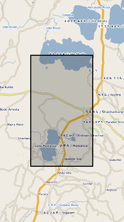
Seismic Catalog for Corbetti Volcano, Ethiopia (NERC grant NE/L013932/1)
This dataset contains the locations and other pertinent information for 122 well-constrained seismic events that occurred on or near Corbetti between February 2016 and September 2017. These locations were derived from data collected on 37 broadband seismometers deployed as part of the RiftVolc project. The data were originally published in Lavayssière, A., et al. "Local seismicity near the actively deforming Corbetti volcano in the Main Ethiopian Rift." Journal of Volcanology and Geothermal Research (2019). https://doi.org/10.1016/j.jvolgeores.2019.06.008
Simple
- Date (Creation)
- 2019-09-06
- Citation identifier
- http://data.bgs.ac.uk/id/dataHolding/13607523
- Point of contact
-
Organisation name Individual name Electronic mail address Role University of Edinburgh
Whaler, Kathy
Principal investigator University of Bristol
Ophelia George
not available
Point of contact
- Maintenance and update frequency
- notApplicable
-
GEMET - INSPIRE themes, version 1.0
-
BGS Thesaurus of Geosciences
-
-
Volcanoes
-
Seismicity
-
Tectonics
-
Rift zone
-
- dataCentre
- Keywords
-
-
NERC_DDC
-
- Access constraints
- Other restrictions
- Other constraints
- no limitations
- Other constraints
- The dataset is made freely available for access, e.g. via the Internet. Either no third party data / information is contained in the dataset or BGS has secured written permission from the owner(s) of any third party data / information contained in the dataset to make the dataset freely accessible.
- Use constraints
- Other restrictions
- Other constraints
-
The copyright of materials derived from the British Geological Survey's work is vested in the Natural Environment Research Council [NERC]. No part of this work may be reproduced or transmitted in any form or by any means, or stored in a retrieval system of any nature, without the prior permission of the copyright holder, via the BGS Intellectual Property Rights Manager. Use by customers of information provided by the BGS, is at the customer's own risk. In view of the disparate sources of information at BGS's disposal, including such material donated to BGS, that BGS accepts in good faith as being accurate, the Natural Environment Research Council (NERC) gives no warranty, expressed or implied, as to the quality or accuracy of the information supplied, or to the information's suitability for any use. NERC/BGS accepts no liability whatever in respect of loss, damage, injury or other occurence however caused.
- Other constraints
-
Available under the Open Government Licence subject to the following acknowledgement accompanying the reproduced NERC materials "Contains NERC materials ©NERC [year]"
- Spatial representation type
- Grid
- Language
- English
- Topic category
-
- Geoscientific information
- Geographic identifier
-
ET
ISO 3166_1 alpha-2 2009 revision
- Geographic identifier
-
ETH
ISO 3166_1 alpha-3 2009 revision
- Geographic identifier
-
ETHIOPIA [id=692000]
British Geological Survey Gazetteer: Geographical hierarchy from Geosaurus 1979 creation
))
- Begin date
- 2016-02-16
- End date
- 2017-09-25
- Unique resource identifier
- WGS 84 (EPSG::4326)
- Distribution format
-
Name Version Text file (TXT)
witheld
PDF
witheld
- OnLine resource
-
Protocol Linkage Name WWW:DOWNLOAD-1.0-http--download
https://webapps.bgs.ac.uk/services/ngdc/accessions/index.html#item130005 Data
- Hierarchy level
- Dataset
- Other
-
dataset
Conformance result
- Title
-
INSPIRE Implementing rules laying down technical arrangements for the interoperability and harmonisation of Geology
- Date (Publication)
- 2011
- Explanation
-
See the referenced specification
- Pass
- No
Conformance result
- Title
-
Commission Regulation (EU) No 1089/2010 of 23 November 2010 implementing Directive 2007/2/EC of the European Parliament and of the Council as regards interoperability of spatial data sets and services
- Date (Publication)
- 2010-12-08
- Explanation
-
See http://eur-lex.europa.eu/LexUriServ/LexUriServ.do?uri=OJ:L:2010:323:0011:0102:EN:PDF
- Pass
- No
- Statement
-
Earthquakes were detected from the raw waveform data using the Coalescence Microseismic Mapping technique. Phase picks with high signal-to-noise ratio derived from this auto-detection stage were then manually refined to improve accuracy. Earthquake locations were derived from these phase picks using the program NonLinLoc which estimates the probability density function of the hypocentre.
Metadata
- File identifier
- 92e94a80-9438-4db4-e054-002128a47908 XML
- Metadata language
- English
- Hierarchy level
- Dataset
- Date stamp
- 2026-07-11
- Metadata standard name
- UK GEMINI
- Metadata standard version
-
2.3
- Metadata author
-
Organisation name Individual name Electronic mail address Role British Geological Survey
Point of contact
- Dataset URI
)))
