 BGS Metadata Catalogue
Tephra layer summary for Lake Abijata and Lake Langano cores, Ethiopia (NERC grant NE/L013932/1)
Tephra layer summary for Lake Abijata and Lake Langano cores, Ethiopia. Data are referenced in McNamara et al., 2018: Using Lake Sediment Cores to Improve Records of Volcanism at Aluto Volcano in the Main Ethiopian Rift; https://doi.org/10.1029/2018GC007686
- Identification
- Distribution
- Quality
- Spatial rep.
- Ref. system
- Content
- Portrayal
- Metadata
- Md. constraints
- Md. maintenance
- Schema info
Identification
Data identification
Citation
- Date (Creation)
- 2019-08-22
- Citation identifier
- http://data.bgs.ac.uk/id/dataHolding/13607512
- Maintenance and update frequency
- notApplicable
-
GEMET - INSPIRE themes, version 1.0
-
BGS Thesaurus of Geosciences
-
-
Peralkaline
-
Volcanism
-
NGDC Deposited Data
-
Rift zone
-
Volcanic ejecta
-
- dataCentre
- Keywords
-
-
NERC_DDC
-
Legal constraints
- Access constraints
- Other restrictions
- Other constraints
- no limitations
- Other constraints
- The dataset is made freely available for access, e.g. via the Internet. Either no third party data / information is contained in the dataset or BGS has secured written permission from the owner(s) of any third party data / information contained in the dataset to make the dataset freely accessible.
Legal constraints
- Use constraints
- Other restrictions
- Other constraints
-
The copyright of materials derived from the British Geological Survey's work is vested in the Natural Environment Research Council [NERC]. No part of this work may be reproduced or transmitted in any form or by any means, or stored in a retrieval system of any nature, without the prior permission of the copyright holder, via the BGS Intellectual Property Rights Manager. Use by customers of information provided by the BGS, is at the customer's own risk. In view of the disparate sources of information at BGS's disposal, including such material donated to BGS, that BGS accepts in good faith as being accurate, the Natural Environment Research Council (NERC) gives no warranty, expressed or implied, as to the quality or accuracy of the information supplied, or to the information's suitability for any use. NERC/BGS accepts no liability whatever in respect of loss, damage, injury or other occurence however caused.
- Other constraints
-
Available under the Open Government Licence subject to the following acknowledgement accompanying the reproduced NERC materials "Contains NERC materials ©NERC [year]"
- Language
- English
- Topic category
-
- Geoscientific information
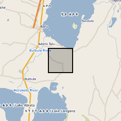
Extent
- Geographic identifier
-
ET
ISO 3166_1 alpha-2 2009 revision
- Geographic identifier
-
ETH
ISO 3166_1 alpha-3 2009 revision
- Geographic identifier
-
ETHIOPIA [id=692000]
British Geological Survey Gazetteer: Geographical hierarchy from Geosaurus 1979 creation
))
- Begin date
- 2015-05-01
- End date
- 2015-05-31
Distribution
Distribution
- Distribution format
-
- MS Excel ()
- OnLine resource
- Data
- OnLine resource
- https://doi.org/10.1029/2018GC007686
Quality
Data quality
Scope
- Hierarchy level
- Dataset
- Other
-
dataset
Conformance result
Citation
- Title
-
INSPIRE Implementing rules laying down technical arrangements for the interoperability and harmonisation of Geology
- Date (Publication)
- 2011
- Explanation
-
See the referenced specification
- Pass
- No
Conformance result
Citation
- Title
-
Commission Regulation (EU) No 1089/2010 of 23 November 2010 implementing Directive 2007/2/EC of the European Parliament and of the Council as regards interoperability of spatial data sets and services
- Date (Publication)
- 2010-12-08
- Explanation
-
See http://eur-lex.europa.eu/LexUriServ/LexUriServ.do?uri=OJ:L:2010:323:0011:0102:EN:PDF
- Pass
- No
- Statement
-
Tephra layers were sampled in May 2015. All cores had been kept sealed since they were retrieved in 1999. Every visible tephra was sampled across the entire layer, and most layers thicker than 4–5 cm were subsampled. This equates to 25 different tephra layers in ABII (five of which were subsampled) and 20 in LLIII (two of which were subsampled).
Ref. system
- Unique resource identifier
- WGS 84 / UTM zone 37N (EPSG::32637)
Metadata
Metadata
- File identifier
- 91521fe3-2c7b-72ea-e054-002128a47908 XML
- Metadata language
- English
- Hierarchy level
- Dataset
- Date stamp
- 2025-07-02
- Metadata standard name
- UK GEMINI
- Metadata standard version
-
2.3
- Dataset URI
)))
