 BGS Metadata Catalogue
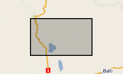
Groundwater and drought in Ethiopia
In 1998 the Department for International Development (DFID) funded the project ‘Groundwater drought early warning for vulnerable areas’ as part of the DFID Knowledge and Research (KaR) programme, a collaboration between UK partners BGS and the Overseas Development Institute (ODI), and with the Bureau of Water, Mines and Energy in Amhara Region, Ethiopia. Drawing on village surveys and stakeholder consultations across sectors, this project evolved a broader, more holistic approach to the study of drought and water supply. Rather than focus exclusively on drought and water availability, constraints on household access to and use of water were explored through the lens of water security. This, in turn, highlighted links between the household water economy (across seasons; between good and bad years) and wider livelihood strategies, particularly in relation to inter-dependencies between food and water security.
Simple
- Date (Creation)
- 2019-08-13
- Citation identifier
- http://data.bgs.ac.uk/id/dataHolding/13607507
- Point of contact
-
Organisation name Individual name Electronic mail address Role British Geological Survey
Enquiries
Distributor British Geological Survey
Enquiries
Point of contact
- Maintenance and update frequency
- Unknown
-
GEMET - INSPIRE themes, version 1.0
-
BGS Thesaurus of Geosciences
-
-
Water resources
-
Droughts
-
- dataCentre
- Keywords
-
-
NERC_DDC
-
- Access constraints
- Other restrictions
- Other constraints
- no limitations
- Other constraints
- The dataset is made freely available for access, e.g. via the Internet. Either no third party data / information is contained in the dataset or BGS has secured written permission from the owner(s) of any third party data / information contained in the dataset to make the dataset freely accessible.
- Use constraints
- Other restrictions
- Other constraints
-
The copyright of materials derived from the British Geological Survey's work is vested in the Natural Environment Research Council [NERC]. No part of this work may be reproduced or transmitted in any form or by any means, or stored in a retrieval system of any nature, without the prior permission of the copyright holder, via the BGS Intellectual Property Rights Manager. Use by customers of information provided by the BGS, is at the customer's own risk. In view of the disparate sources of information at BGS's disposal, including such material donated to BGS, that BGS accepts in good faith as being accurate, the Natural Environment Research Council (NERC) gives no warranty, expressed or implied, as to the quality or accuracy of the information supplied, or to the information's suitability for any use. NERC/BGS accepts no liability whatever in respect of loss, damage, injury or other occurence however caused.
- Other constraints
-
Available under the Open Government Licence subject to the following acknowledgement accompanying the reproduced NERC materials "Contains NERC materials ©NERC [year]"
- Language
- English
- Topic category
-
- Geoscientific information
- Geographic identifier
-
ET
ISO 3166_1 alpha-2 2009 revision
- Geographic identifier
-
ETH
ISO 3166_1 alpha-3 2009 revision
- Geographic identifier
-
ETHIOPIA [id=692000]
British Geological Survey Gazetteer: Geographical hierarchy from Geosaurus 1979 creation
))
- Begin date
- 1988-08-01
- End date
- 2000-08-31
Reference System Information
- Distribution format
-
Name Version Microsoft Excel
witheld
Microsoft Word
witheld
- Distributor contact
-
Organisation name Individual name Electronic mail address Role British Geological Survey
Enquiries
Distributor
- OnLine resource
-
Protocol Linkage Name WWW:DOWNLOAD-1.0-http--download
https://webapps.bgs.ac.uk/services/ngdc/accessions/index.html#item129475 Groundwater and drought in Ethiopia
- OnLine resource
-
Protocol Linkage Name WWW:LINK-1.0-http--link
https://nora.nerc.ac.uk/id/eprint/501048/ The struggle for water: drought, water security and rural livelihoods
- Hierarchy level
- Dataset
- Other
-
dataset
Conformance result
- Title
-
INSPIRE Implementing rules laying down technical arrangements for the interoperability and harmonisation of Geology
- Date (Publication)
- 2011
- Explanation
-
See the referenced specification
- Pass
- No
Conformance result
- Title
-
Commission Regulation (EU) No 1089/2010 of 23 November 2010 implementing Directive 2007/2/EC of the European Parliament and of the Council as regards interoperability of spatial data sets and services
- Date (Publication)
- 2010-12-08
- Explanation
-
See http://eur-lex.europa.eu/LexUriServ/LexUriServ.do?uri=OJ:L:2010:323:0011:0102:EN:PDF
- Pass
- No
- Statement
-
Fieldwork took place over 3 weeks in the South Wollo zone of Amhara. Meetings were held with a range of stakeholders at federal, regional, zonal and woreda level, as well as at the community - household level. In each community semi structured interviews were conducted with a range of individuals at water points. Some physical data were also collected for the major water source of each community. The basic chemistry of the water was tested, including pH and electrical conductivity and major ion samples for analysis in the laboratory. The methodology used to collect the samples and associated data is described in full in Calow, R.C.; MacDonald, A.M.; Nicol, A.L.; Robins, N.S.; Kebede, S.. 2006 The struggle for water: drought, water security and rural livelihoods. British Geological Survey, 52pp. (CR/02/226N) (Unpublished). http://nora.nerc.ac.uk/id/eprint/501048/
Metadata
- File identifier
- 908851b6-631a-50f5-e054-002128a47908 XML
- Metadata language
- English
- Hierarchy level
- Dataset
- Date stamp
- 2026-06-12
- Metadata standard name
- UK GEMINI
- Metadata standard version
-
2.3
- Metadata author
-
Organisation name Individual name Electronic mail address Role British Geological Survey
Point of contact
- Dataset URI
)))
