BGS Data Catalogue
River Rating Curves and Equations, Kwale County, Kenya (NERC grant NE/M008894/1)
The data sets contain the rating curves and equations, approved stage (H) discharge (Q) data for the purposed of building river rating information for three hydrometric stations: 3KD06 and KISCOL weir on Mukurumudzi River and Eshu Bridge on Ramisi River, in Kwale. See also Wara et al. 2019: https://doi.org/10.4236/jwarp.2019.114028
INSPIRE
Identification
- File identifier
- 9037c8e3-baf5-1cbc-e054-002128a47908 XML
- Resource type
- dataset
Online resource
Resource identifier
- Metadata Language
- English (en)
Encoding
- Format
-
MS Excel
Projection
Classification of data and services
- Topic category
-
- Geoscientific information
Classification of data and services
Coupled resource
Coupled resource
Classification of data and services
Coupled resource
Coupled resource
Keywords
- GEMET - INSPIRE themes, version 1.0
- BGS Thesaurus of Geosciences
-
-
NGDC Deposited Data
-
River flow
-
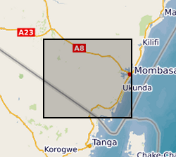
Geographic coverage
))
Temporal reference
Temporal extent
Temporal extent
- Dataset Reference Date ()
- 2019-08-07
Quality and validity
- Lineage
-
1) River flow measurements were undertaken using a Velocity Current Meter (Valeport) and an Acoustic Doppler Current Profiler (ADCP) during low, medium and high flow conditions at the three sites. 2) A Hydraulic Engineering Center-River Analysis System (HEC-RAS) model was set up for each site to simulate river surface water profiles under different flow conditions. The HEC-RAS model input included cross section and longitudinal surveys of the reaches. Engineering drawings for hydraulic structures and flow control sections were used to define model geometry. The model was calibrated and validated against measured stage-discharge data under unsteady state condition until the best agreement between measured and simulated was achieved. River rating curves and H-Q values were extracted from the calibrated and validated model to provide an accurate representation of river flow conditions.
Conformity
Conformity
Conformity
Conformity
Conformity
Conformity
- Explanation
-
See the referenced specification
Restrictions on access and use
- Access constraints
- no limitations
- Access constraints
- The dataset is made freely available for access, e.g. via the Internet. Either no third party data / information is contained in the dataset or BGS has secured written permission from the owner(s) of any third party data / information contained in the dataset to make the dataset freely accessible.
- Access constraints
-
The copyright of materials derived from the British Geological Survey's work is vested in the Natural Environment Research Council [NERC]. No part of this work may be reproduced or transmitted in any form or by any means, or stored in a retrieval system of any nature, without the prior permission of the copyright holder, via the BGS Intellectual Property Rights Manager. Use by customers of information provided by the BGS, is at the customer's own risk. In view of the disparate sources of information at BGS's disposal, including such material donated to BGS, that BGS accepts in good faith as being accurate, the Natural Environment Research Council (NERC) gives no warranty, expressed or implied, as to the quality or accuracy of the information supplied, or to the information's suitability for any use. NERC/BGS accepts no liability whatever in respect of loss, damage, injury or other occurence however caused.
- Access constraints
-
Available under the Open Government Licence subject to the following acknowledgement accompanying the reproduced NERC materials "Contains NERC materials ©NERC [year]"
Responsible organization (s)
Contact for the resource
- Organisation name
-
University of Oxford
-
not available
- Organisation name
-
University of Oxford
-
not available
- Organisation name
-
Rural Focus Ltd
-
not available
- Organisation name
-
Rural Focus Ltd
-
not available
- Organisation name
-
British Geological Survey
-
not available
- Organisation name
-
British Geological Survey
-
not available
Metadata information
Contact for the metadata
- Organisation name
-
British Geological Survey
-
enquiries@bgs.ac enquiries@bgs.ac.uk
- Metadata Date
- 2024-04-22
- Metadata Language
- English (en)