BGS Data Catalogue
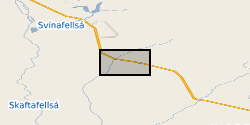
Groundwater Monitoring Data, Virkisjokull Glacier Observatory, 2012-2018
Groundwater level and groundwater temperature data measured in 9 boreholes between August 2012 and August 2018. Groundwater conductivity data measured in 1 of these boreholes from September 2012 to August 2014. Eight of the boreholes are drilled into a sandur (glacial outwash floodplain) aquifer in front of Virkisjokull glacier, SE Iceland, and are between 8.2 and 14.9 m deep. The remaining borehole is drilled into a volcanic rock aquifer between the sandur and glacier and is 5.1 m deep. Selected groundwater monitoring data are reported in Ó Dochartaigh, B. É., et al. 2019. Groundwater?- glacier?meltwater interaction in proglacial aquifers, Hydrol. Earth Syst. Sci. https://doi.org/10.5194/hess-2019-120. Further information on borehole installations and geology can be found in Ó Dochartaigh et al. 2012. Groundwater investigations at Virkisjokull, Iceland: data report 2012. British Geological Survey Open Report OR/12/088, http://nora.nerc.ac.uk/id/eprint/500570/
INSPIRE
Identification
- File identifier
- 8f0ad97e-c579-0a80-e054-002128a47908 XML
- Resource type
- dataset
Online resource
Resource identifier
- Metadata Language
- English (en)
Encoding
- Format
-
MS Excel
Projection
Classification of data and services
- Topic category
-
- Geoscientific information
Classification of data and services
Coupled resource
Coupled resource
Classification of data and services
Coupled resource
Coupled resource
Keywords
- GEMET - INSPIRE themes, version 1.0
- BGS Thesaurus of Geosciences
-
-
Flood plains
-
Temperature
-
Ground water level
-
Aquifers
-
Hydrogeology
-
Conductivity
-
data.gov.uk (non-INSPIRE)
-
Glaciers
-
Groundwater
-
Monitoring
-
Geographic coverage
))
Temporal reference
Temporal extent
Temporal extent
- Dataset Reference Date ()
- 2019-08-01
Quality and validity
- Lineage
-
Data were measured using automatic pressure-temperature loggers or an automatic pressure-temperature-conductivity logger. Measurements were recorded at 15 minute intervals between September 2012 and August 2014, and at 30 minute intervals between August 2014 and August 2018. Details are given in Ó Dochartaigh, B. É., et al. 2019. Groundwater- glacier meltwater interaction in proglacial aquifers, Hydrol. Earth Syst. Sci. https://doi.org/10.5194/hess-2019-120.
Conformity
Conformity
Conformity
Conformity
Conformity
Conformity
- Explanation
-
See the referenced specification
Restrictions on access and use
- Access constraints
- no limitations
- Access constraints
- The dataset is made freely available for access, e.g. via the Internet. Either no third party data / information is contained in the dataset or BGS has secured written permission from the owner(s) of any third party data / information contained in the dataset to make the dataset freely accessible.
- Access constraints
-
The copyright of materials derived from the British Geological Survey's work is vested in the Natural Environment Research Council [NERC]. No part of this work may be reproduced or transmitted in any form or by any means, or stored in a retrieval system of any nature, without the prior permission of the copyright holder, via the BGS Intellectual Property Rights Manager. Use by customers of information provided by the BGS, is at the customer's own risk. In view of the disparate sources of information at BGS's disposal, including such material donated to BGS, that BGS accepts in good faith as being accurate, the Natural Environment Research Council (NERC) gives no warranty, expressed or implied, as to the quality or accuracy of the information supplied, or to the information's suitability for any use. NERC/BGS accepts no liability whatever in respect of loss, damage, injury or other occurence however caused.
- Access constraints
-
Available under the Open Government Licence subject to the following acknowledgement accompanying the reproduced NERC materials "Contains NERC materials ©NERC [year]"
Responsible organization (s)
Contact for the resource
- Organisation name
-
British Geological Survey
-
gsni@economy-ni.gov.uk
- Organisation name
-
British Geological Survey
-
gsni@economy-ni.gov.uk
- Organisation name
-
British Geological Survey
-
enquiries@bgs.ac enquiries@bgs.ac.uk
- Organisation name
-
British Geological Survey
-
enquiries@bgs.ac enquiries@bgs.ac.uk
Metadata information
Contact for the metadata
- Organisation name
-
British Geological Survey
-
enquiries@bgs.ac enquiries@bgs.ac.uk
- Metadata Date
- 2024-04-17
- Metadata Language
- English (en)