BGS Data Catalogue
Earthquake hazard from 36-Cl exposure dating of elapsed time and Coulomb stress transfer (NERC grant NE/I024127/1)
Data derived from NERC grant NE/I024127/1 1) 36Cl data and supporting chemistry. This folder contains the 36Cl concentration data, data on sample locations on fault planes, major and trace element concentrations, and similar data for upper slope samples. 2) Depth versus density data for trenches in colluvium. This folder contains measurements of weights and volumes of colluvial material removed from trenches for some of the 36Cl sites. These data are used to calculate colluvial densities to inform modelling of the 36Cl data. 3) Field Site Documentation. This folder contains field data and field photographs and movies of the sample sites. It also contains a file that summarises interpretations of the data in this folder, to provide numerical values needed to support modeling the 36Cl data to recover fault slip histories. 4) Google Earth Files to locate sample sites. This folder contains kmz files for Google Earth to locate the sample sites. 5) Terrestrial LiDAR data for each 36Cl sample sites. This folder contains Terrestrial LiDAR data (from a LiDAR on a tripod).
INSPIRE
Identification
- File identifier
- 8c36909e-65a0-025f-e054-002128a47908 XML
- Resource type
- dataset
Online resource
Resource identifier
- Metadata Language
- English (en)
Encoding
Projection
Classification of data and services
- Topic category
-
- Geoscientific information
Classification of data and services
Coupled resource
Coupled resource
Classification of data and services
Coupled resource
Coupled resource
Keywords
- GEMET - INSPIRE themes, version 1.0
- BGS Thesaurus of Geosciences
-
-
NGDC Deposited Data
-
Chlorine isotopes
-
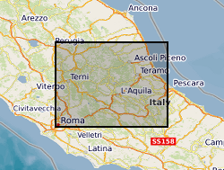
Geographic coverage
))
Temporal reference
Temporal extent
Temporal extent
- Dataset Reference Date ()
- 2019-05-13
Quality and validity
- Lineage
-
Accelerator Mass Spectrometr (AMS), Inductively Coupled Plasma Optical Emission Spectrometry (ICPOES), Terrestrial LiDAR and Fieldwork
Conformity
Conformity
Conformity
Conformity
Conformity
Conformity
- Explanation
-
See the referenced specification
Restrictions on access and use
- Access constraints
- no limitations
- Access constraints
- The dataset is made freely available for access, e.g. via the Internet. Either no third party data / information is contained in the dataset or BGS has secured written permission from the owner(s) of any third party data / information contained in the dataset to make the dataset freely accessible.
- Access constraints
-
The copyright of materials derived from the British Geological Survey's work is vested in the Natural Environment Research Council [NERC]. No part of this work may be reproduced or transmitted in any form or by any means, or stored in a retrieval system of any nature, without the prior permission of the copyright holder, via the BGS Intellectual Property Rights Manager. Use by customers of information provided by the BGS, is at the customer's own risk. In view of the disparate sources of information at BGS's disposal, including such material donated to BGS, that BGS accepts in good faith as being accurate, the Natural Environment Research Council (NERC) gives no warranty, expressed or implied, as to the quality or accuracy of the information supplied, or to the information's suitability for any use. NERC/BGS accepts no liability whatever in respect of loss, damage, injury or other occurence however caused.
- Access constraints
-
There are no restrictions on the use that may be made of the dataset, although an appropriate copyright acknowledgement must be made when any part of the dataset is reproduced. Either no third party data / information is contained in the dataset or BGS has secured written permission from the owner of any third party data / information contained in the dataset to make the dataset freely available without any use constraints - inclusion of any third party data / information will affect the copyright acknowledgement that needs to be made.
Responsible organization (s)
Contact for the resource
- Organisation name
-
Birkbeck College
-
not available
- Organisation name
-
Birkbeck College
-
not available
Responsible organization (s)
Contact for the resource
- Organisation name
-
Birkbeck College
-
not available
- Organisation name
-
Birkbeck College
-
not available
Metadata information
Contact for the metadata
- Organisation name
-
British Geological Survey
-
enquiries@bgs.ac enquiries@bgs.ac.uk
- Metadata Date
- 2024-04-19
- Metadata Language
- English (en)