BGS Data Catalogue
Long-term groundwater-level anomalies across Sub-Saharan Africa (NERC grant NE/M008932/1)
Multi-decadal time series of groundwater levels were compiled by the authors from records of observation wells initiated and maintained by government departments and research institutions in nine countries in sub-Saharan Africa. The pan-African collation of these hydrographs was initiated at the 41st Congress of the International Association of Hydrogeologists (IAH) in Marrakech (Morocco) on 14th September 2014. All records were subjected to a rigorous review by the authors during which the integrity, continuity, duration and interpretability of records were evaluated. This process included dedicated workshops in Benin, Tanzania, and Uganda, and records failing these tests were discarded from the analysis. Procedures included taking of the first time derivative to identify anomalous spikes in records commonly associated with errors of data-entry. Where multiple records in same geographic and climate zone were available (e.g. Benin, South Africa) we prioritized records remote from potential areas of intensive abstraction. Statistical clustering of records was also used in the Limpopo Basin of South Africa to identify the representativity of employed records at Modderfontein and Sterkloop.
INSPIRE
Identification
- File identifier
- 897af404-d0d9-5801-e054-002128a47908 XML
- Resource type
- dataset
Online resource
Resource identifier
- Metadata Language
- English (en)
Encoding
- Format
-
Text File
Projection
Classification of data and services
- Topic category
-
- Geoscientific information
Classification of data and services
Coupled resource
Coupled resource
Classification of data and services
Coupled resource
Coupled resource
Keywords
- GEMET - INSPIRE themes, version 1.0
- BGS Thesaurus of Geosciences
-
-
NGDC Deposited Data
-
Ground water level
-
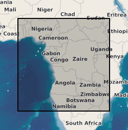
Geographic coverage
))
Temporal reference
Temporal extent
Temporal extent
- Dataset Reference Date ()
- 2019-05-21
Quality and validity
- Lineage
-
Infilling of occasional gaps of less than a week in daily groundwater-level records was achieved by linear interpolation. Because permission to enable access to absolute values of groundwater levels and precipitation at all locations in this dataset has not been granted, both datasets are provided as anomalies with respect to the long-term value for the period of observation.
Conformity
Conformity
Conformity
Conformity
Conformity
Conformity
- Explanation
-
See the referenced specification
Restrictions on access and use
- Access constraints
- no limitations
- Access constraints
- The dataset is made freely available for access, e.g. via the Internet. Either no third party data / information is contained in the dataset or BGS has secured written permission from the owner(s) of any third party data / information contained in the dataset to make the dataset freely accessible.
- Access constraints
-
The copyright of materials derived from the British Geological Survey's work is vested in the Natural Environment Research Council [NERC]. No part of this work may be reproduced or transmitted in any form or by any means, or stored in a retrieval system of any nature, without the prior permission of the copyright holder, via the BGS Intellectual Property Rights Manager. Use by customers of information provided by the BGS, is at the customer's own risk. In view of the disparate sources of information at BGS's disposal, including such material donated to BGS, that BGS accepts in good faith as being accurate, the Natural Environment Research Council (NERC) gives no warranty, expressed or implied, as to the quality or accuracy of the information supplied, or to the information's suitability for any use. NERC/BGS accepts no liability whatever in respect of loss, damage, injury or other occurence however caused.
- Access constraints
-
Available under the Open Government Licence subject to the following acknowledgement accompanying the reproduced NERC materials "Contains NERC materials ©NERC [year]"
Responsible organization (s)
Contact for the resource
- Organisation name
-
University College London
-
not available
- Organisation name
-
University College London
-
not available
Responsible organization (s)
Contact for the resource
- Organisation name
-
University College London
-
not available
- Organisation name
-
University College London
-
not available
Metadata information
Contact for the metadata
- Organisation name
-
British Geological Survey
-
enquiries@bgs.ac enquiries@bgs.ac.uk
- Metadata Date
- 2024-04-23
- Metadata Language
- English (en)