BGS Data Catalogue
Continuous GPS data for stations deployed on Corbetti and Aluto Volcano, Main Ethiopian Rift, Ethiopia (NERC grant NE/L013932/1)
The RiftVolc GPS network was comprised of a total of 10 continuously recording stations deployed on Aluto and Corbetti Volcanoes between 2012 to present. At least 9 stations were recording data simultaneously except in 2012, 2016 and 2017 where 1, 8 and 5 stations were in operation respectively. Full details on station location and operation periods are provided in the attached README file.
- Identification
- Distribution
- Quality
- Spatial rep.
- Ref. system
- Content
- Portrayal
- Metadata
- Md. constraints
- Md. maintenance
- Schema info
Identification
Data identification
Citation
- Dataset Reference Date ()
- 2019-03-11
University of Bristol
-Ophelia George
(Geophysics Laboratory and Field Manager, School of Earth Sciences
)Wills Memorial Building
,Bristol
,BS8 1RJ
,- Maintenance and update frequency
- notApplicable
- GEMET - INSPIRE themes, version 1.0
- BGS Thesaurus of Geosciences
-
-
Ground deformation
-
GPS
-
NGDC Deposited Data
-
Rift valleys
-
Geodesy
-
Rift zone
-
- Keywords ()
- Keywords
-
-
NERC_DDC
-
Legal constraints
- Limitations on Public Access
- otherRestrictions
- Other constraints
- no limitations
- Other constraints
- The dataset is made freely available for access, e.g. via the Internet. Either no third party data / information is contained in the dataset or BGS has secured written permission from the owner(s) of any third party data / information contained in the dataset to make the dataset freely accessible.
Legal constraints
- Use constraints
- otherRestrictions
- Other constraints
-
The copyright of materials derived from the British Geological Survey's work is vested in the Natural Environment Research Council [NERC]. No part of this work may be reproduced or transmitted in any form or by any means, or stored in a retrieval system of any nature, without the prior permission of the copyright holder, via the BGS Intellectual Property Rights Manager. Use by customers of information provided by the BGS, is at the customer's own risk. In view of the disparate sources of information at BGS's disposal, including such material donated to BGS, that BGS accepts in good faith as being accurate, the Natural Environment Research Council (NERC) gives no warranty, expressed or implied, as to the quality or accuracy of the information supplied, or to the information's suitability for any use. NERC/BGS accepts no liability whatever in respect of loss, damage, injury or other occurence however caused.
- Other constraints
-
Available under the Open Government Licence subject to the following acknowledgement accompanying the reproduced NERC materials "Contains NERC materials ©NERC [year]"
- Metadata Language
- English (en)
- Topic category
-
- Geoscientific information
Extent
- Extent
-
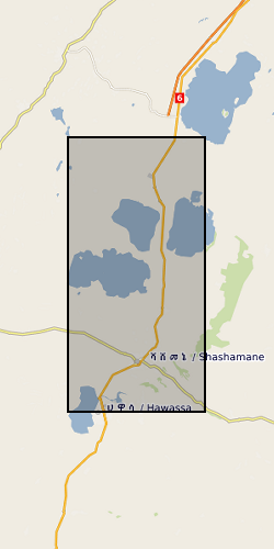
Main Ethiopian Rift [id=985019]
Citation
- Dataset Reference Date ()
- 1979
))
- Begin date
- 2012-11-19
- End date
- 2017-09-05
Distribution
Distribution
- Data format
-
-
PDF
() -
rinex
()
-
- Resource Locator
- https://www.bgs.ac.uk/services/ngdc/accessions/index.html#item127010
Quality
Data quality
Scope
- Quality Scope
- dataset
- Other
-
dataset
Report
Citation
- Dataset Reference Date ()
- 2011
- Explanation
-
See the referenced specification
- Degree
Report
Citation
- Dataset Reference Date ()
- 2010-12-08
- Explanation
-
See http://eur-lex.europa.eu/LexUriServ/LexUriServ.do?uri=OJ:L:2010:323:0011:0102:EN:PDF
- Degree
- Statement
-
The data were collected with Trimble/Leica antennas and recievers and are archived here as a series of 1-day Receiver Independent Exchange format (RINEX) version 2.11 files. These are plain ascii files formatted to contain only the information needed by standard GPS processing software (e.g. GAMIT/Globk) for deriving GPS solutions without the extraneous information stored by the receiver. The rinex files were generated from the raw GPS data using TEQC.
Ref. system
- Code
- WGS 84 (EPSG::4326)
Metadata
Metadata
- File identifier
- 864259f0-4819-2200-e054-002128a47908 XML
- Metadata Language
- English (en)
- Resource type
- dataset
- Metadata Date
- 2024-04-24
- Metadata standard name
- UK GEMINI
- Metadata standard version
-
2.3
British Geological Survey
Environmental Science Centre,Keyworth
,NOTTINGHAM
,NOTTINGHAMSHIRE
,NG12 5GG
,United Kingdom
- Dataset URI