 BGS Metadata Catalogue
Near-field TLS and SfM datasets from the 2016 central Italian Earthquake Sequence ( NERC grant NE/P018858/1)
Terrestrial laser scanning datasets (including GPS data for georeferencing), structure from motion datasets, and field photographs collected during the 2016 Central Italian Earthquake sequence. Data were collected from multiple localities to capture the co- and post- seismic near-fault deformation along the earthquake surface ruptures. See the scan_data.xlsx for individual details of each laser scan location, and readme.txt for a complete description. In each scan site folder you can find the unprocessed raw files and processed ascii files. Note, not all processed files are georeferenced.This is due to time constraints on field data collection. Georeferencing for these data can be achieved by point cloud matching to other georeferenced scans. Photos for structure from motion (SfM) datasets were collected with a Nikon camera. All original photos are provided. Field photographs taken in the aftermath of the 2016 Norcia Earthquake (30th October 2016, Mw6.6) are also provided. Relevant references are: Wilkinson, MW, KJW McCaffrey, RR Jones, GP Roberts, RE Holdsworth, LC Gregory, RJ Walters, LNJ Wedmore, H Goodall, F Iezzi (2017). Near-field fault slip of the 2016 Vettore Mw 6.6 earthquake (Central Italy) measured using low-cost GNSS. Scientific Reports 7: 4612. Walters, RJ, LC Gregory, LNJ Wedmore, TJ Craig, K McCaffrey, M Wilkinson, J Chen, Z Li, JR Elliott, H Goodall, F Iezzi, F Livio, AM Michetti, G Roberts, E Vittori (2018). Dual control of fault intersections on stop-start rupture in the 2016 Central Italy seismic sequence. Earth and Planetary Science Letters 500, 1-14. Wedmore, LNJ, LC Gregory, KJW McCaffrey, H Goodall, RJ Walters (in review). Partitioned off-fault deformation in the 2016 Norcia earthquake captured by differential terrestrial laser scanning. Submitted to Geophysical Research Letters.
Simple
- Date (Creation)
- 2019-02-05
- Citation identifier
- http://data.bgs.ac.uk/id/dataHolding/13607433
- Point of contact
-
Organisation name Individual name Electronic mail address Role University of Leeds
Laura Gregory
not available
Originator University of Leeds
Laura Gregory
not available
Principal investigator British Geological Survey
Enquiries
not available
Distributor British Geological Survey
Enquiries
not available
Point of contact
- Maintenance and update frequency
- notApplicable
-
GEMET - INSPIRE themes, version 1.0
-
BGS Thesaurus of Geosciences
-
-
Earthquakes
-
- dataCentre
- Keywords
-
-
NERC_DDC
-
- Access constraints
- Other restrictions
- Other constraints
- licenceOGL
- Use constraints
- Other restrictions
- Other constraints
-
The copyright of materials derived from the British Geological Survey's work is vested in the Natural Environment Research Council [NERC]. No part of this work may be reproduced or transmitted in any form or by any means, or stored in a retrieval system of any nature, without the prior permission of the copyright holder, via the BGS Intellectual Property Rights Manager. Use by customers of information provided by the BGS, is at the customer's own risk. In view of the disparate sources of information at BGS's disposal, including such material donated to BGS, that BGS accepts in good faith as being accurate, the Natural Environment Research Council (NERC) gives no warranty, expressed or implied, as to the quality or accuracy of the information supplied, or to the information's suitability for any use. NERC/BGS accepts no liability whatever in respect of loss, damage, injury or other occurence however caused.
- Other constraints
-
Available under the Open Government Licence subject to the following acknowledgement accompanying the reproduced NERC materials "Contains NERC materials ©NERC [year]"
- Spatial representation type
- Grid
- Language
- English
- Topic category
-
- Geoscientific information
- Geographic identifier
-
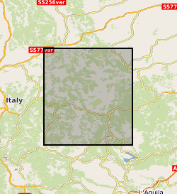
CENTRAL ITALY [id=287500]
British Geological Survey Gazetteer: Geographical hierarchy from Geosaurus 1979 creation
))
- Begin date
- 2016-08-30
- End date
- 2017-09-10
- Unique resource identifier
- WGS 84 / UTM zone 33N (EPSG::32633)
- Distribution format
-
Name Version ASCII text
witheld
RiSCAN
witheld
Microsoft Excel
witheld
Image (JPEG)
- Distributor contact
-
Organisation name Individual name Electronic mail address Role British Geological Survey
Enquiries
not available
Distributor
- OnLine resource
-
Protocol Linkage Name WWW:DOWNLOAD-1.0-http--download
https://webapps.bgs.ac.uk/services/ngdc/accessions/index.html#item126414 Data
- Hierarchy level
- Dataset
- Other
-
dataset
Conformance result
- Title
-
INSPIRE Implementing rules laying down technical arrangements for the interoperability and harmonisation of Geology
- Date (Publication)
- 2011
- Explanation
-
See the referenced specification
- Pass
- No
Conformance result
- Title
-
Commission Regulation (EU) No 1089/2010 of 23 November 2010 implementing Directive 2007/2/EC of the European Parliament and of the Council as regards interoperability of spatial data sets and services
- Date (Publication)
- 2010-12-08
- Explanation
-
See http://eur-lex.europa.eu/LexUriServ/LexUriServ.do?uri=OJ:L:2010:323:0011:0102:EN:PDF
- Pass
- No
- Statement
-
All data were collected with a Reigl VZ1000 terrestrial laser scanner. All georeferencing was achieved using a differential GPS. Horizontal Coordinates: WGS 84 / UTM zone 33N [EPSG: 32633] Vertical Coordinates: WGS84 Ellipsoid [EPSG: 7030] Unprocessed, raw files, are in Reigl proprietary format. Ascii files are tab delimited and list the X,Y,Z coordinates of the points followed by a laser return intensity value. GPS data files are provided in RINEX format in a separate folder. Photos for SfM were processed in Agisoft. The processed point cloud is also provided.
Metadata
- File identifier
- 8497fa82-a36c-0e7c-e054-002128a47908 XML
- Metadata language
- English
- Hierarchy level
- Dataset
- Date stamp
- 2026-06-24
- Metadata standard name
- UK GEMINI
- Metadata standard version
-
2.3
- Metadata author
-
Organisation name Individual name Electronic mail address Role British Geological Survey
Point of contact
- Dataset URI
)))
