BGS Data Catalogue
Marcacocha palaeoenvironmental proxy dataset (NERC grant NE/J014206/1)
Concentration and accumulation palaeoenvironmental proxy data derived from a 6.3m sedimentary core drilled at Marcacocha, a present-day wetland (formerly a small lake) located at 3355m above sea-level in the Cordillera Oriental of the Peruvian Andes. Multi-proxy analysis of the sediments at decadal to sub-decadal temporal resolution has provided detailed datasets that include sedimentology, palynology, geochemistry, plant macrofossils, diatoms and oribatid mite remains (Chepstow-Lusty et al., 2003, 2007, 2009; Sterken et al., 2006). Select data are presented here relating to the uppermost 1.9m of the sequence (ca. the last 1200 years). The data relate specifically to: Chepstow-Lusty, A., Frogley, M.R., Baker, A.S. Comparison of Sporormiella dung fungal spores and oribatid mites as indicators of large herbivore presence: evidence from the Cuzco region of Peru. J. Arch. Sci. https://doi.org/10.1016/j.jas.2018.12.006 Chepstow-Lusty, A., Bennett, K., Fjeldså, J., Kendall, A., Galiano, W., Tupayachi Herrera, A., 1998. Tracing 4000 years of environmental history in the Cuzco area, Peru, from the pollen record. Mt. Res. Dev. 18, 159–172. Chepstow-Lusty, A., Frogley, M.R., Bauer, B.S., Bush, M.B., Tupayachi Herrera, A., 2003. A late Holocene record of arid events from the Cuzco region, Peru. J. Quat. Sci. 18, 491–502. Chepstow-Lusty, A., Frogley, M.R., Bauer, B.S., Leng, M., Cundy, A., Boessenkool, K.P., Gioda, A., 2007. Evaluating socio-economic change in the Andes using oribatid mite abundances as indicators of domestic animal densities. J. Arch. Sci. 34, 1178–1186. Chepstow-Lusty, A.J., Frogley, M.R., Bauer, B., Leng, M.J., Boessenkool, K.P., Carcaillet, C., Ali, A.A., Gioda, A., 2009. Putting the rise of the Inca empire within a climatic and land management context. Clim. Past 5, 1–14. Sterken, M., Sabbe, K., Chepstow-Lusty, A., Frogley, M., Vanhoutte, K., Verleyen, E., Cundy, A., Vyverman, W., 2006. Climate and land-use changes in the Cuzco region (Cordillera Oriental, South East Peru) during the last 1200 years: a diatom based reconstruction. Arch. Hydrobiol. 165, 289–312.
INSPIRE
Identification
- File identifier
- 7e8a6e2f-36a5-094e-e054-002128a47908 XML
- Resource type
- dataset
Online resource
Resource identifier
- Metadata Language
- English (en)
Encoding
- Format
-
MS Excel
Projection
Classification of data and services
- Topic category
-
- Geoscientific information
Classification of data and services
Coupled resource
Coupled resource
Classification of data and services
Coupled resource
Coupled resource
Keywords
- GEMET - INSPIRE themes, version 1.0
- BGS Thesaurus of Geosciences
-
-
Lakes
-
Holocene
-
NGDC Deposited Data
-
Fungi
-
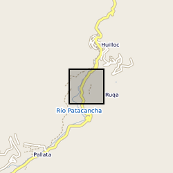
Geographic coverage
))
Temporal reference
Temporal extent
Temporal extent
- Dataset Reference Date ()
- 2018-12-18
Quality and validity
- Lineage
-
: In 1993, a series of overlapping sedimentary cores were recovered from the centre of the Marcacocha basin using a 5 cm diameter Livingstone corer. The overall composite length of the sequence was 8.25m, consisting of an upper 50cm horizon of dense peat, underlain by a series of highly organic lake muds (with occasional relatively fine-grained inorganic horizons) to a depth of 6.3m; sediments below this level consisted solely of gravels. The uppermost peats were too fibrous to core, so were sub-sampled continuously from a hand-dug pit at 4cm intervals. A chronology for the sequence was developed using a combination of seven 210-Pb determinations (applying the Constant Rate of Supply model) and six radiocarbon dates from bulk organic carbon (five conventional dates and one AMS), demonstrating that the sequence extended back continuously for the past ca. 4200 years.
Conformity
Conformity
Conformity
Conformity
Conformity
Conformity
- Explanation
-
See the referenced specification
Restrictions on access and use
- Access constraints
- no limitations
- Access constraints
- The dataset is made freely available for access, e.g. via the Internet. Either no third party data / information is contained in the dataset or BGS has secured written permission from the owner(s) of any third party data / information contained in the dataset to make the dataset freely accessible.
- Access constraints
-
The copyright of materials derived from the British Geological Survey's work is vested in the Natural Environment Research Council [NERC]. No part of this work may be reproduced or transmitted in any form or by any means, or stored in a retrieval system of any nature, without the prior permission of the copyright holder, via the BGS Intellectual Property Rights Manager. Use by customers of information provided by the BGS, is at the customer's own risk. In view of the disparate sources of information at BGS's disposal, including such material donated to BGS, that BGS accepts in good faith as being accurate, the Natural Environment Research Council (NERC) gives no warranty, expressed or implied, as to the quality or accuracy of the information supplied, or to the information's suitability for any use. NERC/BGS accepts no liability whatever in respect of loss, damage, injury or other occurence however caused.
- Access constraints
-
Available under the Open Government Licence subject to the following acknowledgement accompanying the reproduced NERC materials "Contains NERC materials ©NERC [year]"
Responsible organization (s)
Contact for the resource
- Organisation name
-
University of Sussex
-
not available
Responsible organization (s)
Contact for the resource
- Organisation name
-
University of Sussex
-
not available
Metadata information
Contact for the metadata
- Organisation name
-
British Geological Survey
-
enquiries@bgs.ac enquiries@bgs.ac.uk
- Metadata Date
- 2024-04-24
- Metadata Language
- English (en)