BGS Data Catalogue
GeoSure Basic version 8
GeoSure Basic is a single, combined GeoSure model, based on the 6 geohazard layers produced for the GeoSure dataset package. The methodology behind GeoSure Basic uses only the highest score of all the GeoSure layers, which cover: Collapsible Deposits, Compessible Ground, Landslides, Running Sand, Shrink Swell, and Dissolution. The resulting model has been re-classified to show 'Negligible - Very Low', 'Low', and 'Moderate - High' potential for natural geohazards. Complete Great Britain national coverage is available.
INSPIRE
Identification
- File identifier
- 7b158bfa-8480-7432-e054-002128a47908 XML
- Resource type
- dataset
Online resource
- Protocol
-
HTTP
Resource identifier
- Metadata Language
- English (en)
- Spatial representation type
- vector
Encoding
Projection
Classification of data and services
- Topic category
-
- Geoscientific information
Classification of data and services
Coupled resource
Coupled resource
Classification of data and services
Coupled resource
Coupled resource
Keywords
- GEMET - INSPIRE themes, version 1.0
- BGS Thesaurus of Geosciences
-
-
Natural hazards
-
data.gov.uk (non-INSPIRE)
-
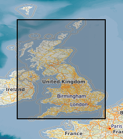
Geographic coverage
))
Temporal reference
Temporal extent
Temporal extent
- Dataset Reference Date ()
- 2018-10
Quality and validity
- Lineage
-
This dataset is derived from GeoSure Version 8. Methodology devised by the Natural Geohazards project. Latest version and earlier versions are held in project files. 'GeoSure_UserGuide_v8' available from BGS Enquiries (Open Report: OR/17/050).
Conformity
Conformity
Conformity
Conformity
Conformity
Conformity
- Explanation
-
See the referenced specification
Restrictions on access and use
- Access constraints
- license
- Access constraints
-
The copyright of materials derived from the British Geological Survey's work is vested in the Natural Environment Research Council [NERC]. No part of this work may be reproduced or transmitted in any form or by any means, or stored in a retrieval system of any nature, without the prior permission of the copyright holder, via the BGS Intellectual Property Rights Manager. Use by customers of information provided by the BGS, is at the customer's own risk. In view of the disparate sources of information at BGS's disposal, including such material donated to BGS, that BGS accepts in good faith as being accurate, the Natural Environment Research Council (NERC) gives no warranty, expressed or implied, as to the quality or accuracy of the information supplied, or to the information's suitability for any use. NERC/BGS accepts no liability whatever in respect of loss, damage, injury or other occurence however caused.
- Access constraints
-
The dataset is made available to external clients under BGS Digital Data Licence terms and conditions. Revert to the IPR Section (iprdigital@bgs.ac.uk) if further advice is required with regard to permitted usage. iprdigital@bgs.ac The dataset is made available to external clients under BGS Digital Data Licence terms and conditions. Revert to the IPR Section (iprdigital@bgs.ac.uk) if further advice is required with regard to permitted usage.
Responsible organization (s)
Contact for the resource
- Organisation name
-
British Geological Survey
-
enquiries@bgs.ac enquiries@bgs.ac.uk
- Organisation name
-
British Geological Survey
-
enquiries@bgs.ac enquiries@bgs.ac.uk
Responsible organization (s)
Contact for the resource
- Organisation name
-
British Geological Survey
-
enquiries@bgs.ac enquiries@bgs.ac.uk
- Organisation name
-
British Geological Survey
-
enquiries@bgs.ac enquiries@bgs.ac.uk
Metadata information
Contact for the metadata
- Organisation name
-
British Geological Survey
-
enquiries@bgs.ac enquiries@bgs.ac.uk
- Metadata Date
- 2024-04-24
- Metadata Language
- English (en)