BGS Data Catalogue
The mid-Palaeozoic biotic crisis: setting the trajectory of tetrapod evolution. Coquetdale, Coldstream and Whitrope Burn, Northern England and the Scottish Borders. (NERC grant NE/J020729/1)
The data set consists of rock samples collected from Coquetdale, Coldstream and Whitrope Burn from 2013-2014; milled material is included. There is an Excel spreadsheet of sample numbers with location, sample height on log, d13C data and %C. There are scans of field logs from Coquetdale, Coldstream and Whitrope Burn, and Illustrator drawn logs from Coldstream which include samples collected at a later date. Scans of thin sections are also included. (thin sections to be kept at Leicester for the time being – still being worked on for papers.) Each locality folder has an Excel spreadsheet detailing samples, sample height, %C and bulk and specific d13C values. These data were used to interpret the environment in which early tetrapods have been found in the early Carboniferous. These data supported the MPhil thesis 'In an alternating marine and non-marine depositional setting, where and how are early Carboniferous tetrapods preserved?' by Sherwin, 2018, and one publication including data from Whitrope Burn - Richards et al., 2018, ( https://doi.org/10.1017/S1755691018000166).
INSPIRE
Identification
- File identifier
- 780696a7-833a-4939-e054-002128a47908 XML
- Resource type
- dataset
Online resource
Resource identifier
- Metadata Language
- English (en)
Encoding
- Format
-
jpg
- Format
-
MS Word
- Format
-
PDF
- Format
-
MS Excel
Projection
Classification of data and services
- Topic category
-
- Geoscientific information
Classification of data and services
Coupled resource
Coupled resource
Classification of data and services
Coupled resource
Coupled resource
Keywords
- GEMET - INSPIRE themes, version 1.0
- BGS Thesaurus of Geosciences
-
-
NGDC Deposited Data
-
Carbon isotopes
-
Carboniferous
-
Palaeoenvironment
-
Stable isotopes
-
Micropalaeontology
-
Sedimentary geology
-
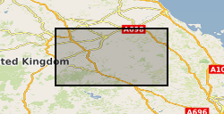
Geographic coverage
))
Temporal reference
Temporal extent
Temporal extent
- Dataset Reference Date ()
- 2018-10-02
Quality and validity
- Lineage
-
Samples were collected from the field and location of each noted. Thin sections were made of many of the samples. Small amounts of many samples were crushed, milled and assessed for C and S content on a LECO machine. Suitable samples were then analysed for d13C values. Fossils were identified in some laminae.
Conformity
Conformity
Conformity
Conformity
Conformity
Conformity
- Explanation
-
See the referenced specification
Restrictions on access and use
- Access constraints
- no limitations
- Access constraints
- The dataset is made freely available for access, e.g. via the Internet. Either no third party data / information is contained in the dataset or BGS has secured written permission from the owner(s) of any third party data / information contained in the dataset to make the dataset freely accessible.
- Access constraints
-
The copyright of materials derived from the British Geological Survey's work is vested in the Natural Environment Research Council [NERC]. No part of this work may be reproduced or transmitted in any form or by any means, or stored in a retrieval system of any nature, without the prior permission of the copyright holder, via the BGS Intellectual Property Rights Manager. Use by customers of information provided by the BGS, is at the customer's own risk. In view of the disparate sources of information at BGS's disposal, including such material donated to BGS, that BGS accepts in good faith as being accurate, the Natural Environment Research Council (NERC) gives no warranty, expressed or implied, as to the quality or accuracy of the information supplied, or to the information's suitability for any use. NERC/BGS accepts no liability whatever in respect of loss, damage, injury or other occurence however caused.
- Access constraints
-
Available under the Open Government Licence subject to the following acknowledgement accompanying the reproduced NERC materials "Contains NERC materials ©NERC [year]"
Responsible organization (s)
Contact for the resource
- Organisation name
-
University of Leicester
-
not available
- Organisation name
-
University of Leicester
-
not available
Responsible organization (s)
Contact for the resource
- Organisation name
-
University of Leicester
-
not available
- Organisation name
-
University of Leicester
-
not available
Metadata information
Contact for the metadata
- Organisation name
-
British Geological Survey
-
enquiries@bgs.ac enquiries@bgs.ac.uk
- Metadata Date
- 2024-04-23
- Metadata Language
- English (en)