 BGS Metadata Catalogue
Gro for GooD Water Quality Monitoring, Kwale County, Kenya (NERC grant NE/M008892/1)
The file contain groundwater level/depth (WL), Groundwater and Surface Water Quality data (EC (micro-siemens per centimetre or µS/cm), Temperature (°C) and pH) for 49 points under fortnightly monitoring relevant to Gro for GooD research project in Kwale County, Kenya. Blank - Data not available. Gro for GooD: Groundwater Risk Management for Growth and Development
INSPIRE
Identification
- File identifier
- 7639b85b-bb1d-197e-e054-002128a47908 XML
- Title
-
Gro for GooD Water Quality Monitoring, Kwale County, Kenya (NERC grant NE/M008892/1)
- Hierarchy level
- Dataset
Online resource
Resource identifier
- Metadata language
- English
- Spatial representation type
- Text, table
Encoding
- Format
-
MS Excel
Projection
Classification of data and services
- Topic category
-
- Geoscientific information
Keywords
-
GEMET - INSPIRE themes, version 1.0
-
BGS Thesaurus of Geosciences
-
-
Groundwater
-
Water quality
-
NGDC Deposited Data
-
Water
-
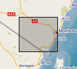
Geographic coverage
))
Temporal reference
Temporal extent
- Begin
- 2016-01-23
- End
- 2018-08-23
Temporal extent
- Date (Creation)
- 2018-09-11
Quality and validity
- Lineage
-
The collection of the data is done fortnightly using Heron Dipper instrument (Water Level), and Hanna meter instrument for groundwater and surface water quality (pH, EC and Temperature). Before the Hanna meter is used for water quality testing, the instrument is first calibrated for pH using pH7 (HI 7007) and pH4 (HI7004) solutions and for Electrical Conductivity, EC using conductivity solution (HI70031) to ensure accuracy of the measured parameters. For groundwater level, the Heron Dipper is lowered into the well and the groundwater level (table) measured with reference to ground level.
Conformity
Conformity
Conformity
- Title
-
INSPIRE Implementing rules laying down technical arrangements for the interoperability and harmonisation of Geology
- Title
-
Commission Regulation (EU) No 1089/2010 of 23 November 2010 implementing Directive 2007/2/EC of the European Parliament and of the Council as regards interoperability of spatial data sets and services
Restrictions on access and use
- Access constraints
- no limitations
- Access constraints
- The dataset is made freely available for access, e.g. via the Internet. Either no third party data / information is contained in the dataset or BGS has secured written permission from the owner(s) of any third party data / information contained in the dataset to make the dataset freely accessible.
- Access constraints
-
The copyright of materials derived from the British Geological Survey's work is vested in the Natural Environment Research Council [NERC]. No part of this work may be reproduced or transmitted in any form or by any means, or stored in a retrieval system of any nature, without the prior permission of the copyright holder, via the BGS Intellectual Property Rights Manager. Use by customers of information provided by the BGS, is at the customer's own risk. In view of the disparate sources of information at BGS's disposal, including such material donated to BGS, that BGS accepts in good faith as being accurate, the Natural Environment Research Council (NERC) gives no warranty, expressed or implied, as to the quality or accuracy of the information supplied, or to the information's suitability for any use. NERC/BGS accepts no liability whatever in respect of loss, damage, injury or other occurence however caused.
- Access constraints
-
Available under the Open Government Licence subject to the following acknowledgement accompanying the reproduced NERC materials "Contains NERC materials ©NERC [year]"
Responsible organization (s)
Contact for the resource
- Organisation name
-
University of Oxford
-
not available
- Organisation name
-
University of Oxford
-
not available
- Organisation name
-
Rural Focus Ltd
-
not available
- Organisation name
-
Universitat Politècnica de Catalunya
-
not available
- Organisation name
-
Universitat Politècnica de Catalunya
-
not available
- Organisation name
-
University of Oxford
-
not available
- Organisation name
-
University of Oxford
-
not available
- Organisation name
-
British Geological Survey
-
not available
- Organisation name
-
British Geological Survey
-
not available
Metadata information
Contact for the metadata
- Organisation name
-
British Geological Survey
- Date stamp
- 2025-06-29
- Metadata language
- English
)))
