BGS Data Catalogue
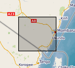
Gro for GooD ERT (Electrical Resistivity Tomography) Data, Kwale County, Kenya (NERC grant NE/M008894/1)
Results of Electrical Resistivity Tomography (ERT) conducted in Kwale County, Kenya December 2015 and June 2016 by University of Nairobi and Water Resources Management Authority as part of the Gro for GooD project ( https://upgro.org/consortium/gro-for-good/) to characterize the aquifers in the study area. There were eight transects of length 1.2 to 6km, running W-E and NNE-SSW parallel to coastline. ERT data was analysed using RES2D inversion software. Gro for GooD - Groundwater Risk Management for Growth and Development
INSPIRE
Identification
- File identifier
- 75be7240-aede-6c34-e054-002128a47908 XML
- Resource type
- dataset
Online resource
Resource identifier
- Metadata Language
- English (en)
- Spatial representation type
- textTable
Encoding
- Format
-
.dat
- Format
-
.bmp
- Format
-
.rar
Projection
Classification of data and services
- Topic category
-
- Geoscientific information
Classification of data and services
Coupled resource
Coupled resource
Classification of data and services
Coupled resource
Coupled resource
Keywords
- GEMET - INSPIRE themes, version 1.0
- BGS Thesaurus of Geosciences
-
-
Geology
-
Hydrogeology
-
NGDC Deposited Data
-
Geophysics
-
Tomography
-
Geographic coverage
))
Temporal reference
Temporal extent
Temporal extent
- Dataset Reference Date ()
- 2018-08-20
Quality and validity
- Lineage
-
2-D electrical imaging/tomography survey equipment was used (Telford, 1990, Griffiths and Barker 1993). For history of ERT see Parasin, 1962. Field set of the tomography system used here included ABEM SAS 1000 Terrameter, LUND ES464 switchbox (electronic switching unit), four multi-core cables each with 21 current take out points at constant spacing of 10 metres interval, battery, communications cables, electrode jumpers, electrodes, laptop and data transfer cables. This dedicated equipment measures both ?V and I and presents a calculated apparent resistivity. The profile length was 800m and the investigated depth was 149m bgl. Roll-along technique was used. After completion of measurements, the cable was moved past one end of the line by two cables. Measurements which involved electrodes on one part of the cable which did not overlap the original end of the survey line were repeated.
Conformity
Conformity
Conformity
Conformity
Conformity
Conformity
- Explanation
-
See the referenced specification
Restrictions on access and use
- Access constraints
- licenceOGL
- Access constraints
- Available under the Open Government Licence subject to the following acknowledgement accompanying the reproduced NERC materials "Contains NERC materials ©NERC [year]"
- Access constraints
-
The copyright of materials derived from the British Geological Survey's work is vested in the Natural Environment Research Council [NERC]. No part of this work may be reproduced or transmitted in any form or by any means, or stored in a retrieval system of any nature, without the prior permission of the copyright holder, via the BGS Intellectual Property Rights Manager. Use by customers of information provided by the BGS, is at the customer's own risk. In view of the disparate sources of information at BGS's disposal, including such material donated to BGS, that BGS accepts in good faith as being accurate, the Natural Environment Research Council (NERC) gives no warranty, expressed or implied, as to the quality or accuracy of the information supplied, or to the information's suitability for any use. NERC/BGS accepts no liability whatever in respect of loss, damage, injury or other occurence however caused.
- Access constraints
-
Available under the Open Government Licence subject to the following acknowledgement accompanying the reproduced NERC materials "Contains NERC materials ©NERC [year]"
Responsible organization (s)
Contact for the resource
- Organisation name
-
University of Oxford
-
not available
- Organisation name
-
University of Oxford
-
not available
- Organisation name
-
Rural Focus Ltd
-
not available
- Organisation name
-
Rural Focus Ltd
-
not available
- Organisation name
-
Water Resources Management Authority
-
not available
- Organisation name
-
University of Nairobi
-
not available
- Organisation name
-
University of Nairobi
-
not available
Metadata information
Contact for the metadata
- Organisation name
-
British Geological Survey
-
enquiries@bgs.ac enquiries@bgs.ac.uk
- Metadata Date
- 2024-04-19
- Metadata Language
- English (en)