 BGS Metadata Catalogue
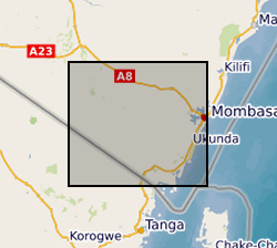
Gro for GooD VES (Vertical Electrical Soundings) Data, Kwale County, Kenya (NERC grant NE/M008894/1)
Results of Vertical Electrical Soundings (VES) study conducted in Kwale County, Kenya in July and August 2017 by University of Nairobi and Water Resources Management Authority as part of the Gro for GooD project ( https://upgro.org/consortium/gro-for-good/) to determine the existence of deeper aquifers.
Simple
- Date (Creation)
- 2018-08-20
- Citation identifier
- http://data.bgs.ac.uk/id/dataHolding/13607375
- Point of contact
-
Organisation name Individual name Electronic mail address Role University of Oxford
Dr R A Hope
not available
Principal investigator University of Oxford
Nancy Gladstone
not available
Point of contact Rural Focus Ltd
Calvince Wara
not available
Originator Rural Focus Ltd
Mike Thomas
not available
Originator Water Resources Management Authority
David Shokut
not available
Originator University of Nairobi
Dan Olago
not available
Originator University of Nairobi
Julius Odida
not available
Originator British Geological Survey
Enquiries
not available
Distributor British Geological Survey
Enquiries
not available
Point of contact
- Maintenance and update frequency
- notApplicable
-
GEMET - INSPIRE themes, version 1.0
-
BGS Thesaurus of Geosciences
-
-
Geology
-
Geophysics
-
Hydrogeology
-
- dataCentre
- Keywords
-
-
NERC_DDC
-
- Access constraints
- Other restrictions
- Other constraints
- licenceOGL
- Use constraints
- Other restrictions
- Other constraints
-
The copyright of materials derived from the British Geological Survey's work is vested in the Natural Environment Research Council [NERC]. No part of this work may be reproduced or transmitted in any form or by any means, or stored in a retrieval system of any nature, without the prior permission of the copyright holder, via the BGS Intellectual Property Rights Manager. Use by customers of information provided by the BGS, is at the customer's own risk. In view of the disparate sources of information at BGS's disposal, including such material donated to BGS, that BGS accepts in good faith as being accurate, the Natural Environment Research Council (NERC) gives no warranty, expressed or implied, as to the quality or accuracy of the information supplied, or to the information's suitability for any use. NERC/BGS accepts no liability whatever in respect of loss, damage, injury or other occurence however caused.
- Other constraints
-
Available under the Open Government Licence subject to the following acknowledgement accompanying the reproduced NERC materials "Contains NERC materials ©NERC [year]"
- Spatial representation type
- Vector
- Language
- English
- Topic category
-
- Geoscientific information
- Geographic identifier
-
KE
ISO 3166_1 alpha-2 2009 revision
- Geographic identifier
-
KEN
ISO 3166_1 alpha-3 2009 revision
- Geographic identifier
-
KENYA [id=687000]
British Geological Survey Gazetteer: Geographical hierarchy from Geosaurus 1979 creation
))
- Begin date
- 2017-07-01
- End date
- 2017-08-31
- Unique resource identifier
- WGS 84 / UTM zone 37S (EPSG::32737)
- Distribution format
-
Name Version Microsoft Excel
witheld
- Distributor contact
-
Organisation name Individual name Electronic mail address Role British Geological Survey
Enquiries
not available
Distributor
- OnLine resource
-
Protocol Linkage Name WWW:DOWNLOAD-1.0-http--download
https://webapps.bgs.ac.uk/services/ngdc/accessions/index.html#item114529 Data
- OnLine resource
-
Protocol Linkage Name http://reshare.ukdataservice.ac.uk/853667/
- Hierarchy level
- Dataset
- Other
-
dataset
Conformance result
- Title
-
INSPIRE Implementing rules laying down technical arrangements for the interoperability and harmonisation of Geology
- Date (Publication)
- 2011
- Explanation
-
See the referenced specification
- Pass
- No
Conformance result
- Title
-
Commission Regulation (EU) No 1089/2010 of 23 November 2010 implementing Directive 2007/2/EC of the European Parliament and of the Council as regards interoperability of spatial data sets and services
- Date (Publication)
- 2010-12-08
- Explanation
-
See http://eur-lex.europa.eu/LexUriServ/LexUriServ.do?uri=OJ:L:2010:323:0011:0102:EN:PDF
- Pass
- No
- Statement
-
Direct Current (DC) electrical resistivity method is commonly used to delineate aquifer composition, groundwater, bed-rock, fresh and salt intrusion (Robinson and Coruh, 1988; Burger, 1992; Telford et al. 1990; method detailed in Lowrie, 2007). VES was conducted in SSW-NNE direction parallel to the geological strike in the coastal area using ABEM SAS 1000 terrameter. Maximum current electrode separation was 1,000m. The array type was Schlumberger. Readings were repeated to get the value with the least standard deviation to increase data quality. Sites were identified in all the major geological formations and the survey conducted transverse to geological strikes. A total of thirty five (35) points were probed in a N-S orientation with current electrode separation of 500m. Potential was boosted at 32m, 80m and 250m during data acquisition to increase uniformity.
Metadata
- File identifier
- 75bca52e-3198-3d4a-e054-002128a47908 XML
- Metadata language
- English
- Hierarchy level
- Dataset
- Date stamp
- 2026-07-11
- Metadata standard name
- UK GEMINI
- Metadata standard version
-
2.3
- Metadata author
-
Organisation name Individual name Electronic mail address Role British Geological Survey
Point of contact
- Dataset URI
)))
