 BGS Metadata Catalogue
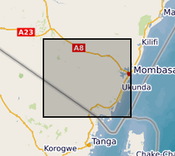
Geology field notes with coordinates in Kwale County, Kenya (NERC grant NE/M008894/1)
Geological observations during field walks, with coordinates, photographs and descriptions of rocks/geological materials and features at the various stops.
Simple
- Date (Creation)
- 2018-09-20
- Citation identifier
- http://data.bgs.ac.uk/id/dataHolding/13607374
- Point of contact
-
Organisation name Individual name Electronic mail address Role University of Oxford
Dr R A Hope
not available
Principal investigator University of Oxford
Nancy Gladstone
not available
Point of contact University of Nairobi
Dan Olago
not available
Originator British Geological Survey
Enquiries
not available
Distributor British Geological Survey
Enquiries
not available
Point of contact
- Maintenance and update frequency
- notApplicable
-
GEMET - INSPIRE themes, version 1.0
-
BGS Thesaurus of Geosciences
-
-
Geology
-
- dataCentre
- Keywords
-
-
NERC_DDC
-
- Access constraints
- Other restrictions
- Other constraints
- licenceOGL
- Use constraints
- Other restrictions
- Other constraints
-
The copyright of materials derived from the British Geological Survey's work is vested in the Natural Environment Research Council [NERC]. No part of this work may be reproduced or transmitted in any form or by any means, or stored in a retrieval system of any nature, without the prior permission of the copyright holder, via the BGS Intellectual Property Rights Manager. Use by customers of information provided by the BGS, is at the customer's own risk. In view of the disparate sources of information at BGS's disposal, including such material donated to BGS, that BGS accepts in good faith as being accurate, the Natural Environment Research Council (NERC) gives no warranty, expressed or implied, as to the quality or accuracy of the information supplied, or to the information's suitability for any use. NERC/BGS accepts no liability whatever in respect of loss, damage, injury or other occurence however caused.
- Other constraints
-
Available under the Open Government Licence subject to the following acknowledgement accompanying the reproduced NERC materials "Contains NERC materials ©NERC [year]"
- Language
- English
- Topic category
-
- Geoscientific information
- Geographic identifier
-
KE
ISO 3166_1 alpha-2 2009 revision
- Geographic identifier
-
KEN
ISO 3166_1 alpha-3 2009 revision
- Geographic identifier
-
KENYA [id=687000]
British Geological Survey Gazetteer: Geographical hierarchy from Geosaurus 1979 creation
))
- Begin date
- 2016-12-13
- End date
- 2017-07-31
- Supplemental Information
-
The authors gratefully acknowledge the support of Kenya’s Water Resource Authority (formerly WRMA), the Kwale Country Government, Base Titanium Ltd., Kwale International Sugar Company Ltd., Rural Focus Ltd., and University of Nairobi who assisted in or enabled the surveys in one way or another. This research was funded by the UK Government via NERC, ESRC and DFID as part of the Gro for GooD project (UPGro Consortium Grant: NE/M008894/1).
- Unique resource identifier
- WGS 84 / UTM zone 37S (EPSG::32737)
- Distribution format
-
Name Version Microsoft Excel
witheld
- Distributor contact
-
Organisation name Individual name Electronic mail address Role British Geological Survey
Enquiries
not available
Distributor
- OnLine resource
-
Protocol Linkage Name WWW:DOWNLOAD-1.0-http--download
https://webapps.bgs.ac.uk/services/ngdc/accessions/index.html#item114551 Data
- OnLine resource
-
Protocol Linkage Name http://reshare.ukdataservice.ac.uk/853667/
- Hierarchy level
- Dataset
- Other
-
dataset
Conformance result
- Title
-
INSPIRE Implementing rules laying down technical arrangements for the interoperability and harmonisation of Geology
- Date (Publication)
- 2011
- Explanation
-
See the referenced specification
- Pass
- No
Conformance result
- Title
-
Commission Regulation (EU) No 1089/2010 of 23 November 2010 implementing Directive 2007/2/EC of the European Parliament and of the Council as regards interoperability of spatial data sets and services
- Date (Publication)
- 2010-12-08
- Explanation
-
See http://eur-lex.europa.eu/LexUriServ/LexUriServ.do?uri=OJ:L:2010:323:0011:0102:EN:PDF
- Pass
- No
- Statement
-
Geological field survey was undertaken to groundtruth geological information contained in the Caswell (1953) report and map but was constrained to our project study area only. A four wheel drive vehicle was used to traverse the roads in the area and stops were made to make more detailed study of geological exposures (which were very few) and materials brought up from on-going excavations for wells, pit latrines or boreholes. Photos were taken and rock/soil samples were collected for petrographic analyses in the laboratory.
Metadata
- File identifier
- 75acd9b3-f053-0210-e054-002128a47908 XML
- Metadata language
- English
- Hierarchy level
- Dataset
- Date stamp
- 2026-07-11
- Metadata standard name
- UK GEMINI
- Metadata standard version
-
2.3
- Metadata author
-
Organisation name Individual name Electronic mail address Role British Geological Survey
Point of contact
- Dataset URI
)))
