 BGS Metadata Catalogue
Amatrice Sequence International (in agreement with the Network Name assigned in IRIS) (NERC grant NE/P016626/1)
The data collection consists of 25 3-component broadband seismic station at 100sps (approx. 45mb per station, per day) located in the epicentral area of the 26th August 2016, M=6.0 Amatrice earthquake. The sequence evolved with strong mainshocks for over 6 months reaching a maximum magnitude of M=6.4 that struck Norcia town on October 30th, 2016. In line with SEIS-UK guidelines data was archived with the IRIS data management facility ( https://ds.iris.edu/ds/nodes/dmc/) under the FDSN network code YR and using the network name “Amatrice Sequence International”. The project has the digital identifier https://doi.org/10.7914/SN/YR_2016.
Simple
- Date (Creation)
- 2018-08-17
- Citation identifier
- http://data.bgs.ac.uk/id/dataHolding/13607366
- Point of contact
-
Organisation name Individual name Electronic mail address Role British Geological Survey
Enquiries
Distributor British Geological Survey
Enquiries
Point of contact British Geological Survey
Enquiries
Principal investigator
- Maintenance and update frequency
- notApplicable
-
GEMET - INSPIRE themes, version 1.0
-
BGS Thesaurus of Geosciences
-
-
Earthquakes
-
- dataCentre
- Keywords
-
-
NERC_DDC
-
- Access constraints
- Other restrictions
- Other constraints
- no limitations
- Other constraints
- The dataset is made freely available for access, e.g. via the Internet. Either no third party data / information is contained in the dataset or BGS has secured written permission from the owner(s) of any third party data / information contained in the dataset to make the dataset freely accessible.
- Use constraints
- Other restrictions
- Other constraints
-
The copyright of materials derived from the British Geological Survey's work is vested in the Natural Environment Research Council [NERC]. No part of this work may be reproduced or transmitted in any form or by any means, or stored in a retrieval system of any nature, without the prior permission of the copyright holder, via the BGS Intellectual Property Rights Manager. Use by customers of information provided by the BGS, is at the customer's own risk. In view of the disparate sources of information at BGS's disposal, including such material donated to BGS, that BGS accepts in good faith as being accurate, the Natural Environment Research Council (NERC) gives no warranty, expressed or implied, as to the quality or accuracy of the information supplied, or to the information's suitability for any use. NERC/BGS accepts no liability whatever in respect of loss, damage, injury or other occurence however caused.
- Other constraints
-
There are no restrictions on the use that may be made of the dataset, although an appropriate copyright acknowledgement must be made when any part of the dataset is reproduced. Either no third party data / information is contained in the dataset or BGS has secured written permission from the owner of any third party data / information contained in the dataset to make the dataset freely available without any use constraints - inclusion of any third party data / information will affect the copyright acknowledgement that needs to be made.
- Spatial representation type
- Text, table
- Language
- English
- Topic category
-
- Geoscientific information
- Geographic identifier
-
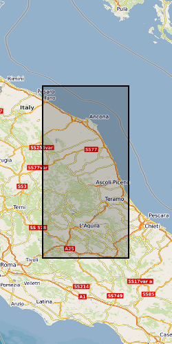
CENTRAL ITALY [id=287500]
British Geological Survey Gazetteer: Geographical hierarchy from Geosaurus 1979 creation
))
- Begin date
- 2016-08-28
- End date
- 2017-08-28
Reference System Information
- Distribution format
-
Name Version miniSEED
witheld
- Distributor contact
-
Organisation name Individual name Electronic mail address Role British Geological Survey
Enquiries
Distributor
- OnLine resource
-
Protocol Linkage Name WWW:LINK-1.0-http--link
http://www.fdsn.org/networks/detail/YR_2016/
- OnLine resource
-
Protocol Linkage Name http://ds.iris.edu/mda/YR/?starttime=2016-01-01T00:00:00&endtime=2017-12-31T23:59:59
- OnLine resource
-
Protocol Linkage Name WWW:LINK-1.0-http--related
https://doi.org/10.7914/SN/YR_2016 Citation Information - Digital Object Identifier (DOI)
- Hierarchy level
- Dataset
- Other
-
dataset
Conformance result
- Title
-
INSPIRE Implementing rules laying down technical arrangements for the interoperability and harmonisation of Geology
- Date (Publication)
- 2011
- Explanation
-
See the referenced specification
- Pass
- No
Conformance result
- Title
-
Commission Regulation (EU) No 1089/2010 of 23 November 2010 implementing Directive 2007/2/EC of the European Parliament and of the Council as regards interoperability of spatial data sets and services
- Date (Publication)
- 2010-12-08
- Explanation
-
See http://eur-lex.europa.eu/LexUriServ/LexUriServ.do?uri=OJ:L:2010:323:0011:0102:EN:PDF
- Pass
- No
- Statement
-
The 1-yr continuous waveforms recorded at our stations were downloaded during 4 visits of BGS scientists and field engineers with most stations performing well without long-term gaps. The data collected have been formatted appropriately by BGS personnel and archived following the facility loan guidelines.
Metadata
- File identifier
- 739e18ff-8bfa-63c8-e054-002128a47908 XML
- Metadata language
- English
- Hierarchy level
- Dataset
- Date stamp
- 2026-05-24
- Metadata standard name
- UK GEMINI
- Metadata standard version
-
2.3
- Metadata author
-
Organisation name Individual name Electronic mail address Role British Geological Survey
Point of contact
- Dataset URI
)))
