BGS Data Catalogue
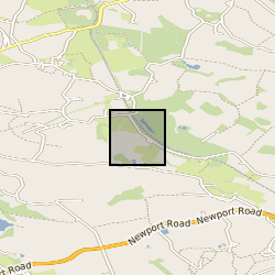
BIFoR site of Mill Haft, Staffordshire, UK. Temperature from Fiber Optics Distributed Temperature Sensor (DTS). Soil moisture from Active DTS technique and from FDR point probes (NERC grant NE/P003486/1)
The data comprise of temperatures (degC) from a fibre optic distributed temperature sensor and soil moisture in the form of volumetric water content (VWC), expressed in m3/m3. The measurements were performed in a vegetated hillslope in Staffordshire, UK, in the context of the NERC funded project DiHPS: A Distributed Heat Pulse Sensor Network for subsurface heat and water fluxes. The site was equipped with: 15xVWC point probes (5TM, Decagon Devices) installed at 5 locations along the hillslope. At each location, 3x5TM probes were inserted in the soil at depths of 0.10m, 0.25m, 0.40m from the soil surface 1,512m of fibre optic cable for Active DTS measurements. The fibre was buried in the soil in three overlapped loops of 504m each at 0.10m, 0.25m, 0.40m. The measurements from the 5TM were used to infer a site specific empirical relation to obtain soil moisture from Active-DTS measurements, following the approach from Sayde et al., WRR, 2010 ( https://www.researchgate.net/publication/241060722_Feasibility_of_soil_moisture_monitoring_with_heated_fiber_optics)
INSPIRE
Identification
- File identifier
- 6f8869de-bac6-40c9-e054-002128a47908 XML
- Resource type
- dataset
Online resource
Resource identifier
- Metadata Language
- English (en)
Encoding
- Format
-
MS Excel
Projection
Classification of data and services
- Topic category
-
- Geoscientific information
Classification of data and services
Coupled resource
Coupled resource
Classification of data and services
Coupled resource
Coupled resource
Keywords
- GEMET - INSPIRE themes, version 1.0
- BGS Thesaurus of Geosciences
-
-
Soil properties
-
Soil water
-
NGDC Deposited Data
-
Water content
-
Optical fibres
-
Geographic coverage
))
Temporal reference
Temporal extent
Temporal extent
- Dataset Reference Date ()
- 2018-05-15
Quality and validity
- Lineage
-
Soil temperature (DTS): DTS continuously measuring every 30s and 0.25m spatial sampling over the entire 1,512m of buried fibre optic cable. VWC (A-DTS): A-DTS tests were performed by heating in sequence the cable at 0.40m for 930s, then the cable at 0.25m and finally at 0.10m. Applied power rate was 5W/m. Each A-DTS test was automatically repeated 4 times per day (starting at 02:00, 08:00, 14:00, 20:00). DTS temperatures during each of the heating cycles were time-integrated to produce cumulative temperature values at each 0.25m spatial sample along the fibre optic Cumulative temperatures were converted into VWC by means of a site specific empirical relationship carried out during the first A-DTS tests performed in 2015-2016. A detailed description of the installation, DTS data, and calibration of the system is contained in Ciocca et. al, 2018 (in preparation)
Conformity
Conformity
Conformity
Conformity
Conformity
Conformity
- Explanation
-
See the referenced specification
Restrictions on access and use
- Access constraints
- no limitations
- Access constraints
- The dataset is made freely available for access, e.g. via the Internet. Either no third party data / information is contained in the dataset or BGS has secured written permission from the owner(s) of any third party data / information contained in the dataset to make the dataset freely accessible.
- Access constraints
-
The copyright of materials derived from the British Geological Survey's work is vested in the Natural Environment Research Council [NERC]. No part of this work may be reproduced or transmitted in any form or by any means, or stored in a retrieval system of any nature, without the prior permission of the copyright holder, via the BGS Intellectual Property Rights Manager. Use by customers of information provided by the BGS, is at the customer's own risk. In view of the disparate sources of information at BGS's disposal, including such material donated to BGS, that BGS accepts in good faith as being accurate, the Natural Environment Research Council (NERC) gives no warranty, expressed or implied, as to the quality or accuracy of the information supplied, or to the information's suitability for any use. NERC/BGS accepts no liability whatever in respect of loss, damage, injury or other occurence however caused.
- Access constraints
-
Available under the Open Government Licence subject to the following acknowledgement accompanying the reproduced NERC materials "Contains NERC materials ©NERC [year]"
Responsible organization (s)
Contact for the resource
- Organisation name
-
University of Birmingham
-
not available
- Organisation name
-
Silixa Ltd
-
not available
Responsible organization (s)
Contact for the resource
- Organisation name
-
University of Birmingham
-
not available
- Organisation name
-
Silixa Ltd
-
not available
Metadata information
Contact for the metadata
- Organisation name
-
British Geological Survey
-
enquiries@bgs.ac enquiries@bgs.ac.uk
- Metadata Date
- 2024-04-25
- Metadata Language
- English (en)