 BGS Metadata Catalogue
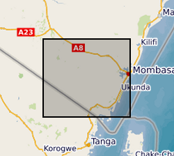
Gro for Good Groundwater MicrobialRisk, 2015-2017, Kwale County, Kenya (NERC grant NE/M008894/1)
Results of microbial water quality conducted in Kwale County, Kenya from 2015 to 2017 by University of Oxford and Universitat Politecnica de Catalunya as part of the Gro for GooD project ( https://upgro.org/consortium/gro-for-good/). Water samples from 101 locations (including 31 open wells, 27 deep boreholes, 21 shallow boreholes with handpumps, 15 covered dug wells with handpumps, and 10 surface water sites. This data set contains results for microbial risk parameters including Escherichia coli, thermotolerant coliforms (TTCs) and tryptophan-like fluorescence (TLF). Most samples also have accompanying data on pH, conductivity, water temperature and turbidity. Duplicate and replicate samples are included and indicated by 'Dup' or 'Rep'. Duplicates samples were collected from the same water points within minutes of each other and laboratory replicates were different aliquots from a single sample. Risk classifications of E. coli and TTC data are based on the World Health Organisation's microbial water quality risk grading scheme. Manufacturer recommended sampling protocols were used. The sampled water points were in regular use and boreholes were flushed with either an electric pump or hand-pumping prior to sample collection. Samples from the open wells were drawn with buckets and rope, which were designated for each site and were rinsed prior to sampling to minimise secondary contamination. Daily field and laboratory blank samples were analysed to confirm no secondary contamination or cross-contamination between sites. For the tryptophan-like fluorescence (TLF) measurement, approximately three litres of unfiltered water were pumped or poured into a stainless-steel container (kept in a black box to prevent ambient light from interfering). The container was cleaned with ethanol and triple-rinsed with sample water prior to each measurement. Measurement was conducted for approximately 3 minutes and the median result was used. The probe and its sensor window were kept clean. Air bubble formation on the sensor window was avoided. For the bacteria sampling, sterile purpose-made bags were used for sample collection and immediately stored in a cooler box with ice-packs. They were transported and processed to begin incubation within two to five hours. Gro for GooD: Groundwater Risk Management for Growth and Development
Simple
- Date (Creation)
- 2018-06-05
- Citation identifier
- http://data.bgs.ac.uk/id/dataHolding/13607339
- Point of contact
-
Organisation name Individual name Electronic mail address Role University of Oxford
Dr R A Hope
not available
Principal investigator University of Oxford
Nancy Gladstone
not available
Point of contact Universitat Politècnica de Catalunya
Núria Ferrer
not available
Originator Universitat Politècnica de Catalunya
Albert Folch
not available
Originator Universitat Politècnica de Catalunya
Xavier Sánchez-Vila
not available
Originator University of Oxford
Saskia Nowicki
not available
Originator British Geological Survey
Enquiries
not available
Distributor British Geological Survey
Enquiries
not available
Point of contact
- Maintenance and update frequency
- notApplicable
-
GEMET - INSPIRE themes, version 1.0
-
BGS Thesaurus of Geosciences
-
-
Bacteria
-
Water
-
Groundwater
-
- dataCentre
- Keywords
-
-
NERC_DDC
-
- Access constraints
- Other restrictions
- Other constraints
- no limitations
- Other constraints
- The dataset is made freely available for access, e.g. via the Internet. Either no third party data / information is contained in the dataset or BGS has secured written permission from the owner(s) of any third party data / information contained in the dataset to make the dataset freely accessible.
- Use constraints
- Other restrictions
- Other constraints
-
The copyright of materials derived from the British Geological Survey's work is vested in the Natural Environment Research Council [NERC]. No part of this work may be reproduced or transmitted in any form or by any means, or stored in a retrieval system of any nature, without the prior permission of the copyright holder, via the BGS Intellectual Property Rights Manager. Use by customers of information provided by the BGS, is at the customer's own risk. In view of the disparate sources of information at BGS's disposal, including such material donated to BGS, that BGS accepts in good faith as being accurate, the Natural Environment Research Council (NERC) gives no warranty, expressed or implied, as to the quality or accuracy of the information supplied, or to the information's suitability for any use. NERC/BGS accepts no liability whatever in respect of loss, damage, injury or other occurence however caused.
- Other constraints
-
Available under the Open Government Licence subject to the following acknowledgement accompanying the reproduced NERC materials "Contains NERC materials ©NERC [year]"
- Language
- English
- Topic category
-
- Geoscientific information
- Geographic identifier
-
KE
ISO 3166_1 alpha-2 2009 revision
- Geographic identifier
-
KEN
ISO 3166_1 alpha-3 2009 revision
- Geographic identifier
-
KENYA [id=687000]
British Geological Survey Gazetteer: Geographical hierarchy from Geosaurus 1979 creation
))
- Begin date
- 2015-09-01
- End date
- 2017-03-31
- Unique resource identifier
- Arc 1960 / UTM zone 37S (EPSG::21037)
- Distribution format
-
Name Version Microsoft Excel
witheld
- Distributor contact
-
Organisation name Individual name Electronic mail address Role British Geological Survey
Enquiries
not available
Distributor
- OnLine resource
-
Protocol Linkage Name WWW:DOWNLOAD-1.0-http--download
https://webapps.bgs.ac.uk/services/ngdc/accessions/index.html#item110749 Data
- OnLine resource
-
Protocol Linkage Name http://reshare.ukdataservice.ac.uk/853667/
- Hierarchy level
- Dataset
- Other
-
dataset
Conformance result
- Title
-
INSPIRE Implementing rules laying down technical arrangements for the interoperability and harmonisation of Geology
- Date (Publication)
- 2011
- Explanation
-
See the referenced specification
- Pass
- No
Conformance result
- Title
-
Commission Regulation (EU) No 1089/2010 of 23 November 2010 implementing Directive 2007/2/EC of the European Parliament and of the Council as regards interoperability of spatial data sets and services
- Date (Publication)
- 2010-12-08
- Explanation
-
See http://eur-lex.europa.eu/LexUriServ/LexUriServ.do?uri=OJ:L:2010:323:0011:0102:EN:PDF
- Pass
- No
- Statement
-
E.coli was assessed by (1) compartmental bag tests (CBTs) (Aquagenx - North Carolina, USA) and (2) membrane filtration with m-ColiBlue24 broth (Hach - Colorado, USA). TTCs were assessed using membrane filtration with laurel sulphate broth (DelAgua - Surrey, UK). TLF was assessed in-situ using a portable LED UV-based UviLux fluorimeter (Chelsea Technologies Group - Surrey, UK). TLF data was corrected for probe sensitivity using calibration equations determined with laboratory grade L-tryptophan standards (Acros Organics, USA) at 30°C. pH, conductivity and water temperature were measured using combo meter (Hanna Instruments HI-98129 or HI-98130) or professional series YSI multi-meter. Turbidity was measured with a microprocessor-based turbidity meter (ELE International - range 0 to 1000 NTU). Meter calibrations were confirmed bi-weekly during sampling campaigns.
Metadata
- File identifier
- 6efcaf67-996f-6c28-e054-002128a47908 XML
- Metadata language
- English
- Hierarchy level
- Dataset
- Date stamp
- 2026-07-11
- Metadata standard name
- UK GEMINI
- Metadata standard version
-
2.3
- Metadata author
-
Organisation name Individual name Electronic mail address Role British Geological Survey
Point of contact
- Dataset URI
)))
