 BGS Metadata Catalogue
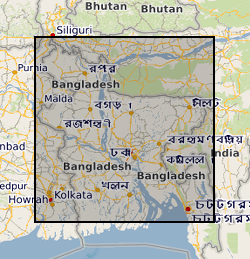
Bangladesh river bathymetry and seismic surveys (NERC grant NE/I023228/1)
This dataset contains data from a river multibeam and seismic survey which took place in 2013 and 2014 at scour sites within the Brahmaputra river basin in Bangladesh. The survey was carried out as part of a joint project between the Universities of Birmingham, Southampton and Exeter. "The sedimentology of fluvial megascours" was a scientific research project funded by NERC. The purpose was to collect the data necessary to validate the first generic numerical model of scour zone stratigraphy that will be widely applicable to a broad range of large rivers. River bed bathymetry data were collected using a multibeam echosounder. Sub bottom seismic profiling data were collected using a surface tow boomer and chirp system. Technical details of the survey are contained in the cruise report of the survey which comprises part of the metadata. Some of the data has been accepted for a publication in the journal 'Sedimentology' which will be published in 2018 with the title 'The Sedimentology of channel confluences'.
Simple
- Date (Creation)
- 2018-05-01
- Citation identifier
- http://data.bgs.ac.uk/id/dataHolding/13607327
- Point of contact
-
Organisation name Individual name Electronic mail address Role University of Birmingham
Professor Greg Sambrook Smith
not available
Point of contact University of Birmingham
Professor Greg Sambrook Smith
not available
Principal investigator
- Maintenance and update frequency
- notApplicable
-
GEMET - INSPIRE themes, version 1.0
-
BGS Thesaurus of Geosciences
-
-
Rivers
-
Seismic data
-
Sedimentary geology
-
Bathymetry
-
- dataCentre
- Keywords
-
-
NERC_DDC
-
- Access constraints
- Other restrictions
- Other constraints
- no limitations
- Other constraints
- The dataset is made freely available for access, e.g. via the Internet. Either no third party data / information is contained in the dataset or BGS has secured written permission from the owner(s) of any third party data / information contained in the dataset to make the dataset freely accessible.
- Use constraints
- Other restrictions
- Other constraints
-
The copyright of materials derived from the British Geological Survey's work is vested in the Natural Environment Research Council [NERC]. No part of this work may be reproduced or transmitted in any form or by any means, or stored in a retrieval system of any nature, without the prior permission of the copyright holder, via the BGS Intellectual Property Rights Manager. Use by customers of information provided by the BGS, is at the customer's own risk. In view of the disparate sources of information at BGS's disposal, including such material donated to BGS, that BGS accepts in good faith as being accurate, the Natural Environment Research Council (NERC) gives no warranty, expressed or implied, as to the quality or accuracy of the information supplied, or to the information's suitability for any use. NERC/BGS accepts no liability whatever in respect of loss, damage, injury or other occurence however caused.
- Other constraints
-
Available under the Open Government Licence subject to the following acknowledgement accompanying the reproduced NERC materials "Contains NERC materials ©NERC [year]"
- Language
- English
- Topic category
-
- Geoscientific information
- Geographic identifier
-
BANGLADESH [id=498000]
British Geological Survey Gazetteer: Geographical hierarchy from Geosaurus 1979 creation
- Geographic identifier
-
BD
ISO 3166_1 alpha-2 2009 revision
- Geographic identifier
-
BGD
ISO 3166_1 alpha-3 2009 revision
))
- Begin date
- 2013-06-13
- End date
- 2013-10-04
- Unique resource identifier
- WGS 84 / UTM zone 46N (EPSG::32646)
- Distribution format
-
Name Version SEG-Y
witheld
Text file (TXT)
witheld
- OnLine resource
-
Protocol Linkage Name WWW:DOWNLOAD-1.0-http--download
https://webapps.bgs.ac.uk/services/ngdc/accessions/index.html#item110050 Data
- OnLine resource
-
Protocol Linkage Name WWW:LINK-1.0-http--related
https://www2.bgs.ac.uk/nationalgeosciencedatacentre/citedData/catalogue/21394db3-89db-4dd3-bec7-f25913edc919.html
- Hierarchy level
- Dataset
- Other
-
dataset
Conformance result
- Title
-
INSPIRE Implementing rules laying down technical arrangements for the interoperability and harmonisation of Geology
- Date (Publication)
- 2011
- Explanation
-
See the referenced specification
- Pass
- No
Conformance result
- Title
-
Commission Regulation (EU) No 1089/2010 of 23 November 2010 implementing Directive 2007/2/EC of the European Parliament and of the Council as regards interoperability of spatial data sets and services
- Date (Publication)
- 2010-12-08
- Explanation
-
See http://eur-lex.europa.eu/LexUriServ/LexUriServ.do?uri=OJ:L:2010:323:0011:0102:EN:PDF
- Pass
- No
- Statement
-
Boomer Sub-Bottom Profiler Seismic reflection profiles were acquired using the University of Southampton’s Boomer sub-bottom profiler. Consisting of an Applied Acoustics AA200 plate mounted on a small, lightweight catamaran, the system is powered by an Applied Acoustics CSP300 Capacitor Discharge box capable of duty cycles up to 2 PPS at a maximum power output of 300 J. The Boomer provides a highly repeatable, broad bandwidth, impulsive seismic source with frequencies ranging between 0.4 kHz and 4.0 kHz, peaking at c. 1.5 kHz. During surveying, the catamaran was towed c. 15 m astern of the MV Kokilmoni, immediately behind the launch boat (see Fig. 1a). Use of the launch made for easier deployment/retrieval (lower sided than MV Kokilmoni), and acted to shield the catamaran from propeller wash during surveying. Data was recorded using an 11-element mini-streamer (c. 3 m long active section) towed off a 0.5 m long boom on the port stern quarter. Lateral offset between source and receiver was c. 5 m, while the inline offset was varied during the early part of the survey to optimize imaging (settling on c. 20 m behind the vessel from 16/06/2013). Raw analogue data was digitized using a CODA Octopus DA2000, and stored to disk as unprocessed SEG-Y files with navigation from the catamaran mounted GPS antenna. Chirp Sub-Bottom Profiler To complement the lower-frequency, higher-penetration Boomer profiles, seismic reflection data were also acquired using the University of Southampton’s higher-frequency, lower-penetration Chirp sub-bottom profiler. Consisting of a modified GeoAcoustics digital GeoPulse and 7-element mini-streamer (1.0 m long active section), this system produces a swept-frequency (1.5 – 13.0 kHz), tunable, highly repeatable (99.9%) source waveform 32.74 ms in length. Data was recorded using a CODA Octopus acquisition system (version 5.4) as unprocessed SEG-Y files. During acquisition, the Chirp catamaran was towed in a similar manner to the Boomer catamaran (see, Fig. 1b); c. 5 m astern of the launch boat, c. 20 m astern of the MV Kokilmoni. The streamer was towed directly behind the catamaran, using an extension cable to provide source-receiver offsets of order 5 m. With the difficulty of deploying the heavy Chirp catamaran without a winch/A-frame, it was felt the risk of mounting the GPS antenna directly on the catamaran was too great. Therefore, positioning for Chirp data is relative to the GPS antenna mounted on the launch boat and therefore requires layback correction (c. 10 m). Multi-Beam Bathymetry Multi-beam bathymetry was acquired using a Reson SeaBat 8125 High-Resolution Focused Multi-Beam Echosounder. Operating at 455 kHz, the 8125 transducer emits 240 individual beams that are 0.5° x 1.0° in size at the nadir and 1.0° x 1.0° in size at the outer beams. The 8125 utilizes high-frequency beam forming to produce excellent near field imagery, and is therefore especially well suited to shallow water depths; maximum of 120 m and optimum imaging at 60 m and less. The sonar head was mounted on a specifically designed and constructed over-the-side pole, mounted on the forward starboard quarter of the vessel. The 6 m-long pole positioned the head just beneath the maximum keel depth of the vessel (c. 2.0 m below the water line). Positional information was provided by-way of two GPS antennae mounted on the bridge roof (supplied with DGPS correction strings via Omnistar subscription) and a PosMV Inertial Motion Reference Unit (IMU) located in the dining room. The location of each component was measured in prior to the start of the survey, using the PosMV as the 0,0,0 reference location.
Metadata
- File identifier
- 6d03a207-09e5-2c27-e054-002128a47908 XML
- Metadata language
- English
- Hierarchy level
- Dataset
- Date stamp
- 2026-07-11
- Metadata standard name
- UK GEMINI
- Metadata standard version
-
2.3
- Metadata author
-
Organisation name Individual name Electronic mail address Role British Geological Survey
Point of contact
- Dataset URI
)))
