 BGS Metadata Catalogue
RATE Lo-RISE Marine Workstream (NERC Grant NE/L000202/1)
Data collected as part of the NERC funded Radioactivity and the Environment (RATE), Long-lived Radionuclides in the Surface Environment (Lo-RISE), research consortium.This data comes from the marine workstream group based at the Scottish Universities Environmental Research Centre (SUERC) and the Scottish Association for Marine Science (SAMS). The data consists of radionuclide measurements of environmental and biological samples including radiocarbon, caesium (137), americium (241) and plutonium (238, 239, 240).The data has been published in the following publications: Tierney et al., 2018. Modelling Marine Trophic Transfer of Radiocarbon (14C) from a Nuclear Facility. Ecosystem Modelling and Software 102, 138-154. Tierney et al., 2017. Nuclear Reprocessing-Related Radiocarbon (14C) Uptake into UK Marine Mammals. Marine Pollution Bulletin 124, 43-50. Muir et al., 2017. Ecosystem Uptake and Transfer of Sellafield-Derived Radiocarbon (14C). Part 1: The Irish Sea. Marine Pollution Bulletin 114, 792-804. Tierney et al., 2017. Ecosystem Uptake and Transfer of Sellafield-Derived Radiocarbon (14C). Part 2: The West of Scotland. Marine Pollution Bulletin 115, 57-66 Tierney et al., 2016. Accumulation of Sellafield-derived 14C in Irish Sea and West of Scotland Intertidal Shells and Sediments. Journal of Environmental Radioactivity 151, 321-327.
Simple
- Date (Creation)
- 2018-04-26
- Citation identifier
- http://data.bgs.ac.uk/id/dataHolding/13607318
- Point of contact
-
Organisation name Individual name Electronic mail address Role University of Strathclyde
Dr Kieran Tierney
not available
Originator Scottish Universities Environmental Research Centre (SUERC)
Professor Gordon Cook
not available
Principal investigator British Geological Survey
Enquiries
not available
Distributor British Geological Survey
Enquiries
not available
Point of contact
- Maintenance and update frequency
- notApplicable
-
GEMET - INSPIRE themes, version 1.0
-
BGS Thesaurus of Geosciences
-
-
Americium
-
Radioactive isotopes
-
Sediments
-
Carbon isotopes
-
Plutonium
-
Biota
-
Caesium
-
- dataCentre
- Keywords
-
-
NERC_DDC
-
- Access constraints
- Other restrictions
- Other constraints
- no limitations
- Other constraints
- The dataset is made freely available for access, e.g. via the Internet. Either no third party data / information is contained in the dataset or BGS has secured written permission from the owner(s) of any third party data / information contained in the dataset to make the dataset freely accessible.
- Use constraints
- Other restrictions
- Other constraints
-
The copyright of materials derived from the British Geological Survey's work is vested in the Natural Environment Research Council [NERC]. No part of this work may be reproduced or transmitted in any form or by any means, or stored in a retrieval system of any nature, without the prior permission of the copyright holder, via the BGS Intellectual Property Rights Manager. Use by customers of information provided by the BGS, is at the customer's own risk. In view of the disparate sources of information at BGS's disposal, including such material donated to BGS, that BGS accepts in good faith as being accurate, the Natural Environment Research Council (NERC) gives no warranty, expressed or implied, as to the quality or accuracy of the information supplied, or to the information's suitability for any use. NERC/BGS accepts no liability whatever in respect of loss, damage, injury or other occurence however caused.
- Other constraints
-
Available under the Open Government Licence subject to the following acknowledgement accompanying the reproduced NERC materials "Contains NERC materials ©NERC [year]"
- Language
- English
- Topic category
-
- Geoscientific information
- Geographic identifier
-
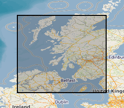
Firth Of Lorn [id=1290531]
British Geological Survey Gazetteer: OS gazetteer 2002 revision
- Geographic identifier
-
IRELAND OFFSHORE [id=98583]
British Geological Survey Gazetteer: Geographical hierarchy from Geosaurus 1979 creation
- Geographic identifier
-
IRISH SEA [id=2001430]
British Geological Survey Gazetteer: Gazetteer of sea areas 2010 revision
- Geographic identifier
-
NORTH CHANNEL [id=174500]
British Geological Survey Gazetteer: Geographical hierarchy from Geosaurus 1979 creation
- Geographic identifier
-
UK CONTINENTAL SHELF [id=121701]
British Geological Survey Gazetteer: Geographical hierarchy from Geosaurus 1979 creation
))
- Begin date
- 2013-11-04
- End date
- 2017-04-03
Reference System Information
- Distribution format
-
Name Version Microsoft Excel
witheld
- Distributor contact
-
Organisation name Individual name Electronic mail address Role British Geological Survey
Enquiries
not available
Distributor
- OnLine resource
-
Protocol Linkage Name WWW:DOWNLOAD-1.0-http--download
https://webapps.bgs.ac.uk/services/ngdc/accessions/index.html#item109749 Data
- Hierarchy level
- Dataset
- Other
-
dataset
Conformance result
- Title
-
INSPIRE Implementing rules laying down technical arrangements for the interoperability and harmonisation of Geology
- Date (Publication)
- 2011
- Explanation
-
See the referenced specification
- Pass
- No
Conformance result
- Title
-
Commission Regulation (EU) No 1089/2010 of 23 November 2010 implementing Directive 2007/2/EC of the European Parliament and of the Council as regards interoperability of spatial data sets and services
- Date (Publication)
- 2010-12-08
- Explanation
-
See http://eur-lex.europa.eu/LexUriServ/LexUriServ.do?uri=OJ:L:2010:323:0011:0102:EN:PDF
- Pass
- No
- Statement
-
Marine samples were collected offshore from RV Prince Madog and RV Calanus via benthic trawling, Van Veen grab, gravity core, mega-corer, plankton nets, and water filtration. Intertidal samples collected by hand. Data was generated via accelerator mass spectrometry and gamma spectroscopy.
Metadata
- File identifier
- 6b495698-1e09-33d4-e054-002128a47908 XML
- Metadata language
- English
- Hierarchy level
- Dataset
- Date stamp
- 2026-06-24
- Metadata standard name
- UK GEMINI
- Metadata standard version
-
2.3
- Metadata author
-
Organisation name Individual name Electronic mail address Role British Geological Survey
Point of contact
- Dataset URI
)))
