BGS Data Catalogue
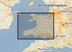
Groundwater vulnerability data for Wales
The Environment Agency and Natural Resources Wales have updated its groundwater vulnerability map to reflect improvements in data mapping, modelling capability and understanding of the factors affecting vulnerability. Two new maps are available which show the vulnerability of groundwater to a pollutant discharged at ground level. The potential impact of groundwater pollution is considered using the aquifer designation status which provides an indication of the scale and importance of groundwater for potable water supply and/or in supporting baseflow to rivers, lakes and wetlands. This dataset for Wales has shared intellectual property (IP) between Natural Resources Wales and British Geological Survey.
- Identification
- Distribution
- Quality
- Spatial rep.
- Ref. system
- Content
- Portrayal
- Metadata
- Md. constraints
- Md. maintenance
- Schema info
Identification
Data identification
Citation
- Date (Creation)
- 2017-12
- Citation identifier
- http://data.bgs.ac.uk/id/dataHolding/13607287
0115 936 3276
0115 936 3276
- Maintenance and update frequency
- As needed
-
GEMET - INSPIRE themes, version 1.0
-
BGS Thesaurus of Geosciences
-
-
data.gov.uk (non-INSPIRE)
-
Groundwater
-
Pollution
-
Aquifers
-
Ground water pollution
-
Water supply
-
- dataCentre
- Keywords
-
-
NERC_DDC
-
Legal constraints
- Access constraints
- Other restrictions
- Other constraints
- license
Legal constraints
- Use constraints
- Other restrictions
- Other constraints
-
The copyright of materials derived from the British Geological Survey's work is vested in the Natural Environment Research Council [NERC]. No part of this work may be reproduced or transmitted in any form or by any means, or stored in a retrieval system of any nature, without the prior permission of the copyright holder, via the BGS Intellectual Property Rights Manager. Use by customers of information provided by the BGS, is at the customer's own risk. In view of the disparate sources of information at BGS's disposal, including such material donated to BGS, that BGS accepts in good faith as being accurate, the Natural Environment Research Council (NERC) gives no warranty, expressed or implied, as to the quality or accuracy of the information supplied, or to the information's suitability for any use. NERC/BGS accepts no liability whatever in respect of loss, damage, injury or other occurence however caused.
- Other constraints
-
The dataset is made available to external clients under BGS Digital Data Licence terms and conditions. Revert to the IPR Section ( iprdigital@bgs.ac.uk ) if further advice is required with regard to permitted usage.
- Spatial representation type
- Vector
- Denominator
- 50000
- Language
- English
- Topic category
-
- Geoscientific information
Extent
- Geographic identifier
-
WALES [id=170000]
British Geological Survey Gazetteer: Geographical hierarchy from Geosaurus 1979
- Geographic identifier
-
WLS
ISO 3166_1 alpha-3 2009
))
- End date
- 2017-12 Before
- Supplemental Information
-
The dataset is comprised of three layers: Groundwater Vulnerability data, Wales (GWV_Wales), Local information, Wales (GWV_Local_Info_Wales), Soluble rock risk, Wales (GWV_Soluble_Rock_Risk_Wales)
Distribution
Distribution
- Distribution format
-
0115 936 3276
- OnLine resource
- BGS Datasets - Groundwater vulnerability data
Quality
Data quality
Scope
- Hierarchy level
- Dataset
- Other
-
dataset
Conformance result
Citation
- Date (Publication)
- 2011
- Explanation
-
See the referenced specification
- Pass
- No
Conformance result
Citation
- Date (Publication)
- 2010-12-08
- Explanation
-
See http://eur-lex.europa.eu/LexUriServ/LexUriServ.do?uri=OJ:L:2010:323:0011:0102:EN:PDF
- Pass
- No
- Statement
-
The Groundwater vulnerability dataset has been developed primarily by the Environment Agency and Natural Resources Wales to show vulnerability of groundwater to pollutant discharged at ground level. It has been based on the hydrological, geological, hydrogeological and soil properties within a 1km square grid, and includes data from the British Geological Survey, Centre for Ecology and Hydrology and National Soil Research Institute.
Ref. system
- Unique resource identifier
- OSGB 1936 / British National Grid (EPSG::27700)
Metadata
Metadata
- File identifier
- 67d59900-bf54-0b33-e054-002128a47908 XML
- Metadata language
- English
- Hierarchy level
- Dataset
- Date stamp
- 2024-05-01T08:48:13.538224Z
- Metadata standard name
- UK GEMINI
- Metadata standard version
-
2.3
- Dataset URI