BGS Data Catalogue
Monitoring Magmatism and Intrusion from the Bardabunga Volcano, Iceland (NERC grant NE/M017427/1)
The dataset contains 3-component seismic data from seismometers deployed for one year Sept 204-August 2015 following the dyke intrusion from Bardarbunga which led to a 6 month long eruption at Holuhraun. The data is in miniseed format, archived at SEIS-UK and IRIS. The locations of all the microearthquakes we have identified from this data are published in Supplementary Information of Ágústsdóttir et al. (2016) [approx. 31,000 events from the Bardarbunga dyke], in Greenfield et al. [approx. 70,000 events from the Askja-Herðubreið area], and in Hudson et al. (2017), where they are publicly available for download. Ágústsdóttir, T., Woods, J., Greenfield, T., Green, R. G., White, R. S., Winder, T., Brandsdóttir, B., Steinthórsson, S. & Soosalu, H. (2016). Strike-slip faulting during the 2014 Bárðarbunga-Holuhraun dike Intrusion, central Iceland. Geophysical Research Letters, plus Supplementary Information, 43, 1495-1503, doi: 10.1002/2015GL067423 Greenfield, T., White, R. S., Winder, T. Ágústsdóttir, T. Seismicity of the Askja and Bárðarbunga volcanic systems of Iceland, 2009-2015, Journal of Volcanology and Geothermal Research, submitted 2017. Hudson, T. S., White, R. S., Greenfield, T., Ágústsdóttir, T., Brisbourne, A. & Green, R. G. (2017). Deep crustal melt plumbing of Bárðarbunga volcano, Iceland, Geophysical Research Letters, 44, doi: 10.1002/2017GL074749
INSPIRE
Identification
- File identifier
- 66cf8b09-0aa9-38d6-e054-002128a47908 XML
- Resource type
- dataset
Online resource
Resource identifier
- Metadata Language
- English (en)
Encoding
- Format
-
MiniSEED
Projection
- code
- WGS 84 (EPSG::4326)
Classification of data and services
- Topic category
-
- Geoscientific information
Classification of data and services
Coupled resource
Coupled resource
Classification of data and services
Coupled resource
Coupled resource
Keywords
- GEMET - INSPIRE themes, version 1.0
- BGS Thesaurus of Geosciences
-
-
Seismic data
-
Seismic epicentre
-
NGDC Deposited Data
-
Dykes
-
Volcanic eruption
-
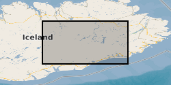
Geographic coverage
))
Temporal reference
Temporal extent
Temporal extent
- Dataset Reference Date ()
- 2018-01-05
Quality and validity
- Lineage
-
The seismic data was recorded continuously at 100 sps with continuous GPS. Almost permanent daylight in summer (this is near the Arctic circle), together with the use of large truck batteries (typically 3 x 115 Amp-hrs) and multiple solar panels on each site (typically 80 watts), provided sufficient power supply through both the summer and winter months to keep the seismometers operating continuously. The prevalence of basaltic rocks means that compasses are unreliable indicators of true north, so we used GPS to orient the seismometers. Data has been converted from Guralp GCF format to miniseed.
Conformity
Conformity
Conformity
Conformity
Conformity
Conformity
- Explanation
-
See the referenced specification
Restrictions on access and use
- Access constraints
- no limitations
- Access constraints
- The dataset is made freely available for access, e.g. via the Internet. Either no third party data / information is contained in the dataset or BGS has secured written permission from the owner(s) of any third party data / information contained in the dataset to make the dataset freely accessible.
- Access constraints
-
The copyright of materials derived from the British Geological Survey's work is vested in the Natural Environment Research Council [NERC]. No part of this work may be reproduced or transmitted in any form or by any means, or stored in a retrieval system of any nature, without the prior permission of the copyright holder, via the BGS Intellectual Property Rights Manager. Use by customers of information provided by the BGS, is at the customer's own risk. In view of the disparate sources of information at BGS's disposal, including such material donated to BGS, that BGS accepts in good faith as being accurate, the Natural Environment Research Council (NERC) gives no warranty, expressed or implied, as to the quality or accuracy of the information supplied, or to the information's suitability for any use. NERC/BGS accepts no liability whatever in respect of loss, damage, injury or other occurence however caused.
- Access constraints
-
Available under the Open Government Licence subject to the following acknowledgement accompanying the reproduced NERC materials "Contains NERC materials ©NERC [year]"
Responsible organization (s)
Contact for the resource
- Organisation name
-
University of Cambridge
-
rwhite@esc.cam rwhite@esc.cam.ac.uk
Responsible organization (s)
Contact for the resource
- Organisation name
-
University of Cambridge
-
rwhite@esc.cam rwhite@esc.cam.ac.uk
Metadata information
Contact for the metadata
- Organisation name
-
British Geological Survey
-
enquiries@bgs.ac enquiries@bgs.ac.uk
- Metadata Date
- 2024-04-24
- Metadata Language
- English (en)