 BGS Metadata Catalogue
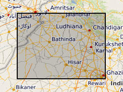
Geomorphic map (NERC grant NE/I022434/1)
Geomorphological map of the Sutlej and Yamuna fans, northwestern India. Grant abstract: India is the largest agricultural user of groundwater in the world. The last 40 years has seen a revolutionary shift from large-scale surface water management to widespread groundwater abstraction, particularly in the northwestern states of Punjab, Haryana and Rajasthan. As a result of this, northwestern India is now a hotspot of groundwater depletion, with 'the largest rate of groundwater loss in any comparable-sized region on Earth' (Tiwari et al., 2009). This unsustainable use of groundwater becomes even more challenging when set increasing demands from a burgeoning population and industrialisation, together with potential but poorly understood effects of climate-driven changes in the water cycle. There are a number of innovative socio-economic strategies that can address this issue, including enhanced recharge and subsurface water storage, but their implementation and success depend on solid regional understanding of the geology and hydrogeology of the aquifer systems, and of the patterns and rates of groundwater flow and recharge. What we know about regional groundwater resources comes largely from either low-resolution studies based on satellite data, or from local investigations; there has been no large-scale, cross-state integrated study of the groundwater system. Groundwater in northwestern India is thought to be largely hosted within buried, sandy former river channels, which extend from the Himalayas toward the southwest and are separated by fine-grained muds. Only a few channels are visible at the surface; most are buried and their existence must be inferred. Our approach is founded on the premise that we must first understand the geology and geometry of the aquifer system before we can hope to estimate the way it will respond to a complex set of future stresses. This means that we must be able to describe the locations, sizes, and characteristics of these channels as well as their age and three-dimensional pattern. Once these characteristics are determined, we can forecast the likely future behaviour of the system. In this proposal, we will provide, for the first time, a regional assessment of the aquifer system in northwestern India, along with models for its evolution under changes in the water cycle and in the way in which groundwater is used. Our project will combine expertise in sedimentology, stratigraphy, sediment routing and basin evolution, hydrology, and isotope geochemistry to understand the geological framework of the aquifer system, the ages of the groundwaters within it, and the ways in which groundwater levels are likely to evolve over the next 50 years. The outcomes of the proposal will include (1) a comprehensive data base that covers the northwestern Indian aquifer system, (2) much better understanding of regional sources, ages, and flow rates of groundwater, and (3) a suite of predictions for how the groundwater system will respond to a range of different future scenarios.
Simple
- Date (Creation)
- 2018-02-09
- Citation identifier
- http://data.bgs.ac.uk/id/dataHolding/13607262
- Point of contact
-
Organisation name Individual name Electronic mail address Role University of Durham
Professor Alexander Densmore
not available
Point of contact
- Maintenance and update frequency
- notApplicable
-
GEMET - INSPIRE themes, version 1.0
-
BGS Thesaurus of Geosciences
-
-
Geomorphic maps
-
Alluvial fans
-
Geomorphology
-
River system
-
- dataCentre
- Keywords
-
-
NERC_DDC
-
- Access constraints
- Other restrictions
- Other constraints
- no limitations
- Other constraints
- The dataset is made freely available for access, e.g. via the Internet. Either no third party data / information is contained in the dataset or BGS has secured written permission from the owner(s) of any third party data / information contained in the dataset to make the dataset freely accessible.
- Use constraints
- Other restrictions
- Other constraints
-
The copyright of materials derived from the British Geological Survey's work is vested in the Natural Environment Research Council [NERC]. No part of this work may be reproduced or transmitted in any form or by any means, or stored in a retrieval system of any nature, without the prior permission of the copyright holder, via the BGS Intellectual Property Rights Manager. Use by customers of information provided by the BGS, is at the customer's own risk. In view of the disparate sources of information at BGS's disposal, including such material donated to BGS, that BGS accepts in good faith as being accurate, the Natural Environment Research Council (NERC) gives no warranty, expressed or implied, as to the quality or accuracy of the information supplied, or to the information's suitability for any use. NERC/BGS accepts no liability whatever in respect of loss, damage, injury or other occurence however caused.
- Other constraints
-
Available under the Open Government Licence subject to the following acknowledgement accompanying the reproduced NERC materials "Contains NERC materials ©NERC [year]"
- Spatial representation type
- Grid
- Language
- English
- Topic category
-
- Geoscientific information
- Geographic identifier
-
IN
ISO 3166_1 alpha-2 2009 revision
- Geographic identifier
-
IND
ISO 3166_1 alpha-3 2009 revision
- Geographic identifier
-
INDIA [id=470000]
British Geological Survey Gazetteer: Geographical hierarchy from Geosaurus 1979 creation
))
- Begin date
- 2012-08-24
- End date
- 2017-02-23
- Unique resource identifier
- WGS 84 (EPSG::4326)
- Distribution format
-
Name Version PDF
witheld
- OnLine resource
-
Protocol Linkage Name WWW:DOWNLOAD-1.0-http--download
https://webapps.bgs.ac.uk/services/ngdc/accessions/index.html#item107249 Data
- Hierarchy level
- Dataset
- Other
-
dataset
Conformance result
- Title
-
INSPIRE Implementing rules laying down technical arrangements for the interoperability and harmonisation of Geology
- Date (Publication)
- 2011
- Explanation
-
See the referenced specification
- Pass
- No
Conformance result
- Title
-
Commission Regulation (EU) No 1089/2010 of 23 November 2010 implementing Directive 2007/2/EC of the European Parliament and of the Council as regards interoperability of spatial data sets and services
- Date (Publication)
- 2010-12-08
- Explanation
-
See http://eur-lex.europa.eu/LexUriServ/LexUriServ.do?uri=OJ:L:2010:323:0011:0102:EN:PDF
- Pass
- No
- Statement
-
Mapping on publicly-available SRTM (Shuttle Radar Topography Mission) topographic data and Landsat 5/6/7 satellite imagery.
Metadata
- File identifier
- 65de7d0f-a233-18c0-e054-002128a47908 XML
- Metadata language
- English
- Hierarchy level
- Dataset
- Date stamp
- 2026-07-11
- Metadata standard name
- UK GEMINI
- Metadata standard version
-
2.3
- Metadata author
-
Organisation name Individual name Electronic mail address Role British Geological Survey
Point of contact
- Dataset URI
)))
