 BGS Metadata Catalogue
Reduced-complexity aquifer model (NERC grant NE/I022434/1)
Matlab m-file code to generate a probabilistic model of aquifer-body occurrence in the subsurface of the Indo-Gangetic foreland basin, northwestern India. The accompanying ArcGIS ASCII matrix files give aquifer-body percentages in successive 10 m depth slices for use within the model. File xxx_01.txt is for depths 0-10 m, file xxx_02.txt for depths 10-20 m, etc.
Simple
- Date (Creation)
- 2018-02-09
- Citation identifier
- http://data.bgs.ac.uk/id/dataHolding/13607260
- Point of contact
-
Organisation name Individual name Electronic mail address Role University of Durham
Professor Alexander Densmore
not available
Originator University of Durham
Professor Alexander Densmore
not available
Principal investigator British Geological Survey
Enquiries
not available
Distributor British Geological Survey
Enquiries
not available
Point of contact
- Maintenance and update frequency
- notApplicable
-
GEMET - INSPIRE themes, version 1.0
-
BGS Thesaurus of Geosciences
-
-
Alluvial fans
-
Aquifers
-
- dataCentre
- Keywords
-
-
NERC_DDC
-
- Access constraints
- Other restrictions
- Other constraints
- no limitations
- Other constraints
- The dataset is made freely available for access, e.g. via the Internet. Either no third party data / information is contained in the dataset or BGS has secured written permission from the owner(s) of any third party data / information contained in the dataset to make the dataset freely accessible.
- Use constraints
- Other restrictions
- Other constraints
-
The copyright of materials derived from the British Geological Survey's work is vested in the Natural Environment Research Council [NERC]. No part of this work may be reproduced or transmitted in any form or by any means, or stored in a retrieval system of any nature, without the prior permission of the copyright holder, via the BGS Intellectual Property Rights Manager. Use by customers of information provided by the BGS, is at the customer's own risk. In view of the disparate sources of information at BGS's disposal, including such material donated to BGS, that BGS accepts in good faith as being accurate, the Natural Environment Research Council (NERC) gives no warranty, expressed or implied, as to the quality or accuracy of the information supplied, or to the information's suitability for any use. NERC/BGS accepts no liability whatever in respect of loss, damage, injury or other occurence however caused.
- Other constraints
-
Available under the Open Government Licence subject to the following acknowledgement accompanying the reproduced NERC materials "Contains NERC materials ©NERC [year]"
- Language
- English
- Topic category
-
- Geoscientific information
- Geographic identifier
-
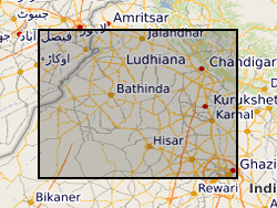
IN
ISO 3166_1 alpha-2 2009 revision
- Geographic identifier
-
IND
ISO 3166_1 alpha-3 2009 revision
- Geographic identifier
-
INDIA [id=470000]
British Geological Survey Gazetteer: Geographical hierarchy from Geosaurus 1979 creation
))
- Begin date
- 2012-08-24
- End date
- 2017-02-23
- Unique resource identifier
- WGS 84 (EPSG::4326)
- Distribution format
-
Name Version Text file (TXT)
witheld
- Distributor contact
-
Organisation name Individual name Electronic mail address Role British Geological Survey
Enquiries
not available
Distributor
- OnLine resource
-
Protocol Linkage Name WWW:DOWNLOAD-1.0-http--download
https://webapps.bgs.ac.uk/services/ngdc/accessions/index.html#item107251 Data
- Hierarchy level
- Dataset
- Other
-
dataset
Conformance result
- Title
-
INSPIRE Implementing rules laying down technical arrangements for the interoperability and harmonisation of Geology
- Date (Publication)
- 2011
- Explanation
-
See the referenced specification
- Pass
- No
Conformance result
- Title
-
Commission Regulation (EU) No 1089/2010 of 23 November 2010 implementing Directive 2007/2/EC of the European Parliament and of the Council as regards interoperability of spatial data sets and services
- Date (Publication)
- 2010-12-08
- Explanation
-
See http://eur-lex.europa.eu/LexUriServ/LexUriServ.do?uri=OJ:L:2010:323:0011:0102:EN:PDF
- Pass
- No
- Statement
-
Aquifer-body percentages were extracted from aquifer-thickness logs belonging to the Central Groundwater Board, Government of India. The m-file code was written as part of the project.
Metadata
- File identifier
- 65de0f7b-f8be-0f2b-e054-002128a47908 XML
- Metadata language
- English
- Hierarchy level
- Dataset
- Date stamp
- 2026-07-11
- Metadata standard name
- UK GEMINI
- Metadata standard version
-
2.3
- Metadata author
-
Organisation name Individual name Electronic mail address Role British Geological Survey
Point of contact
- Dataset URI
)))
