 BGS Metadata Catalogue
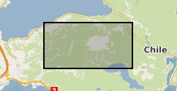
Calbuco airborne LiDAR and aerial photo survey (NERC grant NE/N007263/1)
Helicopter borne LiDAR and aerial photo survey of lahar pathways deposited during the April 2015 Volcan Calbuco eruption. Terrestrial Laser Scanning data for July 2015.
Simple
- Date (Creation)
- 2018-02-08
- Citation identifier
- http://data.bgs.ac.uk/id/dataHolding/13607258
- Point of contact
-
Organisation name Individual name Electronic mail address Role University of Newcastle
Professor Andrew Russell
not available
Point of contact
- Maintenance and update frequency
- notApplicable
-
GEMET - INSPIRE themes, version 1.0
-
BGS Thesaurus of Geosciences
-
-
Aerial photographs
-
LiDAR
-
- dataCentre
- Keywords
-
-
NERC_DDC
-
- Access constraints
- Other restrictions
- Other constraints
- no limitations
- Other constraints
- The dataset is made freely available for access, e.g. via the Internet. Either no third party data / information is contained in the dataset or BGS has secured written permission from the owner(s) of any third party data / information contained in the dataset to make the dataset freely accessible.
- Use constraints
- Other restrictions
- Other constraints
-
The copyright of materials derived from the British Geological Survey's work is vested in the Natural Environment Research Council [NERC]. No part of this work may be reproduced or transmitted in any form or by any means, or stored in a retrieval system of any nature, without the prior permission of the copyright holder, via the BGS Intellectual Property Rights Manager. Use by customers of information provided by the BGS, is at the customer's own risk. In view of the disparate sources of information at BGS's disposal, including such material donated to BGS, that BGS accepts in good faith as being accurate, the Natural Environment Research Council (NERC) gives no warranty, expressed or implied, as to the quality or accuracy of the information supplied, or to the information's suitability for any use. NERC/BGS accepts no liability whatever in respect of loss, damage, injury or other occurence however caused.
- Other constraints
-
Available under the Open Government Licence subject to the following acknowledgement accompanying the reproduced NERC materials "Contains NERC materials ©NERC [year]"
- Language
- English
- Topic category
-
- Geoscientific information
))
- Begin date
- 2016-04-01
- End date
- 2016-04-01
- Unique resource identifier
- WGS 84 / UTM zone 18S (EPSG::32718)
- Distribution format
-
Name Version
- OnLine resource
-
Protocol Linkage Name WWW:DOWNLOAD-1.0-http--download
https://webapps.bgs.ac.uk/services/ngdc/accessions/index.html#item107269 Data
- Hierarchy level
- Dataset
- Other
-
dataset
Conformance result
- Title
-
INSPIRE Implementing rules laying down technical arrangements for the interoperability and harmonisation of Geology
- Date (Publication)
- 2011
- Explanation
-
See the referenced specification
- Pass
- No
Conformance result
- Title
-
Commission Regulation (EU) No 1089/2010 of 23 November 2010 implementing Directive 2007/2/EC of the European Parliament and of the Council as regards interoperability of spatial data sets and services
- Date (Publication)
- 2010-12-08
- Explanation
-
See http://eur-lex.europa.eu/LexUriServ/LexUriServ.do?uri=OJ:L:2010:323:0011:0102:EN:PDF
- Pass
- No
- Statement
-
The principal component of the CECs Airborne Mapping System (CAMS) is an airborne laser scanner RIEGL LMS-Q240-60 with a wave length of 904 nm and a scan angle of 60 degrees which allows the measurement of distances within a maximum range of 500 m and a vertical accuracy of 20 cm. For the georeferencing of the laser measurements, the system is equipped with an Inertial Measurement Unit (IMU), IMAR iNAV-MS AIRSURV, and a dual-frequency GPS receiver Javad Legacy with a JNS AvAnt antenna. The system is completed by an SLR camera Canon EOS5D and -depending on the mission- a thermal infrared Forward-looking imaging system camera. At the Villarrica survey, the system was mounted on a helicopter. Reference: Rivera, A., and 7 others. 2014. Recent changes in total ice volume on Volcan Villarrica, Southern Chile. Nat Hazards DOI 10.1007/s11069-014-1306-1.
Metadata
- File identifier
- 6551799d-8b4c-089c-e054-002128a47908 XML
- Metadata language
- English
- Hierarchy level
- Dataset
- Date stamp
- 2026-07-11
- Metadata standard name
- UK GEMINI
- Metadata standard version
-
2.3
- Metadata author
-
Organisation name Individual name Electronic mail address Role British Geological Survey
Point of contact
- Dataset URI
)))
