BGS Metadata Catalogue
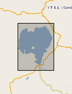
Lake Tana Seistec Boomer Data (NERC Grant NER/B/S/2002/00540)
This is Seistec Boomer data acquired on Lake Tana. If not familiar with this variant of standard Boomer, it has a line-in-cone.
INSPIRE
Identification
- File identifier
- 64001d13-098f-1e26-e054-002128a47908 XML
- Hierarchy level
- Dataset
Online resource
Resource identifier
- Metadata language
- English
Encoding
- Format
-
sgy
Projection
- code
- WGS 84 (EPSG::4326)
Classification of data and services
- Topic category
-
- Geoscientific information
Keywords
-
GEMET - INSPIRE themes, version 1.0
-
BGS Thesaurus of Geosciences
-
-
NGDC Deposited Data
-
Seismic surveys
-
Geographic coverage
))
Temporal reference
Temporal extent
- Begin
- 2004-11-11
- End
- 2004-11-14
Temporal extent
- Date (Creation)
- 2018-01-18
Quality and validity
- Lineage
-
The seismic survey was conducted using a surface-towed IKB Seistec boomer acquisition system, comprising a standard boomer plate combined with a line-in-cone hydrophone receiver arrangement, which is designed to reduce acoustic noise in a shallow water environment (Simpkin and Davis 1993). The system was powered by a 4 kV capacitor discharging power supply unit, and towed on the survey vessel’s aft quarter, in the relatively undisturbed water between the bow wave and the wake. A 200microsecond broadband pulse was produced at the boomer source, at an energy level of 180J and a repetition interval of 500ms. Survey speed was maintained at between 4 and 6kts with GPS positioning yielding location information typically to within 3-8m. Data were recorded in standard SEG-Y format with a record length of 150 ms and sampling interval of 16 micros.
Conformity
Conformity
Conformity
Restrictions on access and use
- Access constraints
- no limitations
- Access constraints
- The dataset is made freely available for access, e.g. via the Internet. Either no third party data / information is contained in the dataset or BGS has secured written permission from the owner(s) of any third party data / information contained in the dataset to make the dataset freely accessible.
- Access constraints
-
The copyright of materials derived from the British Geological Survey's work is vested in the Natural Environment Research Council [NERC]. No part of this work may be reproduced or transmitted in any form or by any means, or stored in a retrieval system of any nature, without the prior permission of the copyright holder, via the BGS Intellectual Property Rights Manager. Use by customers of information provided by the BGS, is at the customer's own risk. In view of the disparate sources of information at BGS's disposal, including such material donated to BGS, that BGS accepts in good faith as being accurate, the Natural Environment Research Council (NERC) gives no warranty, expressed or implied, as to the quality or accuracy of the information supplied, or to the information's suitability for any use. NERC/BGS accepts no liability whatever in respect of loss, damage, injury or other occurence however caused.
- Access constraints
-
Available under the Open Government Licence subject to the following acknowledgement accompanying the reproduced NERC materials "Contains NERC materials ©NERC [year]"
Responsible organization (s)
Contact for the resource
- Organisation name
-
Bangor University
-
not available
Metadata information
Contact for the metadata
- Organisation name
-
British Geological Survey
- Date stamp
- 2024-05-06
- Metadata language
- English