BGS Data Catalogue
Data associated with: Characterising the post-seismic behaviour of damaged slopes - Nepal 2015 (NERC grant NE/N007689/1)
1. Rainfall (0.2 mm tipping bucket), accelerometer (OEM) and extensometer (string potentiometer) data from 10 instruments deployed across ground cracks in Sindhupalchok, Nepal in the aftermath of the 2015 earthquake. Data is provided in *.csv format, to include for each instrument: date, rainfall, extension(raw/min/max/mean/std), x(raw/min/max/mean/std), y(raw/min/max/mean/std), z(raw/min/max/mean/std). 2. Shapefiles of landslide mapping in the Upper Bhote Kosi valley, Sindhupalchok, Nepal, Including immediately post-earthquake (pre-monsoon), and post-2015 monsoon.
- Identification
- Distribution
- Quality
- Spatial rep.
- Ref. system
- Content
- Portrayal
- Metadata
- Md. constraints
- Md. maintenance
- Schema info
Identification
Data identification
Citation
- Dataset Reference Date ()
- 2017-11-30
- Maintenance and update frequency
- notApplicable
- GEMET - INSPIRE themes, version 1.0
- BGS Thesaurus of Geosciences
-
-
NGDC Deposited Data
-
Earthquake effects
-
Earthquakes
-
Public risk
-
Landslides
-
Monitoring
-
- Keywords ()
- Keywords
-
-
NERC_DDC
-
Legal constraints
- Limitations on Public Access
- otherRestrictions
- Other constraints
- no limitations
- Other constraints
- The dataset is made freely available for access, e.g. via the Internet. Either no third party data / information is contained in the dataset or BGS has secured written permission from the owner(s) of any third party data / information contained in the dataset to make the dataset freely accessible.
Legal constraints
- Use constraints
- otherRestrictions
- Other constraints
-
The copyright of materials derived from the British Geological Survey's work is vested in the Natural Environment Research Council [NERC]. No part of this work may be reproduced or transmitted in any form or by any means, or stored in a retrieval system of any nature, without the prior permission of the copyright holder, via the BGS Intellectual Property Rights Manager. Use by customers of information provided by the BGS, is at the customer's own risk. In view of the disparate sources of information at BGS's disposal, including such material donated to BGS, that BGS accepts in good faith as being accurate, the Natural Environment Research Council (NERC) gives no warranty, expressed or implied, as to the quality or accuracy of the information supplied, or to the information's suitability for any use. NERC/BGS accepts no liability whatever in respect of loss, damage, injury or other occurence however caused.
- Other constraints
-
Available under the Open Government Licence subject to the following acknowledgement accompanying the reproduced NERC materials "Contains NERC materials ©NERC [year]"
- Metadata Language
- English (en)
- Topic category
-
- Geoscientific information
Extent
- Extent
-
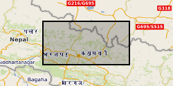
NEPAL [id=497000]
Citation
- Dataset Reference Date ()
- 1979
- Extent
-
NP
Citation
- Dataset Reference Date ()
- 2009
- Extent
-
NPL
Citation
- Dataset Reference Date ()
- 2009
))
- Begin date
- 2015-08-01
- End date
- 2017-06-01
- Additional information
-
Data was collected in collaboration in NSET Nepal, and members of Listikot VDC Nepal.
Distribution
Distribution
- Data format
-
-
Portable Network Graphics file (.png)
() -
Comma-separated values (.csv)
()
-
- Resource Locator
- https://hobolink.com/p/b1cfa78c991048d9d9c32541201a9545
- Resource Locator
- https://hobolink.com/p/f7ac275492f82abe43b95f0ce81e1573
- Resource Locator
- https://hobolink.com/p/1b9d1a705a006779b6ec0dcf175efa69
- Resource Locator
- https://hobolink.com/p/e3d38ede70cbe5aefa72258eb296e9e4
- Resource Locator
- https://hobolink.com/p/eb01f45315062bbeb06c6aec8a3cd1af
- Resource Locator
- https://hobolink.com/p/1c8e464875f77880fef24ccf35b53e96
- Resource Locator
- https://hobolink.com/p/f4d14e8c43bbecfa06a29dbc3bb0b293
- Resource Locator
- https://hobolink.com/p/528deabef249e1885fac7448daf9c637
- Resource Locator
- https://hobolink.com/p/0183a0c04096b5d1f52874681c9a6f7c
- Resource Locator
- http://www.bgs.ac.uk/services/ngdc/accessions/index.html#item104789
Quality
Data quality
Scope
- Quality Scope
- dataset
- Other
-
dataset
Report
Citation
- Dataset Reference Date ()
- 2011
- Explanation
-
See the referenced specification
- Degree
Report
Citation
- Dataset Reference Date ()
- 2010-12-08
- Explanation
-
See http://eur-lex.europa.eu/LexUriServ/LexUriServ.do?uri=OJ:L:2010:323:0011:0102:EN:PDF
- Degree
- Statement
-
A bespoke instrument cluster was developed to include tipping bucket rain gauge, string extensometer, and OEM accelerometer. These allowed constant (1 s interval) monitoring of the controls (rainfall, seismicity) on landslide movement (extension), to be captured and reported via a live web-enabled set of 10 data loggers. Data was recorded and derivative produced using Onset Hobo RX3000s. Instruments were variously located on ridgeline cracking, landslide head scarps, tension cracks and over areas of ground deformation induced . by the 2015 Nepal earthquake sequence. A more detailed method is reported in Rosser et al (in review) Post-earthquake deformation of seismically damaged slopes. The method to collect the landslide mapping data (2, above) is described in: Williams et al. ( https://www.nat-hazards-earth-syst-sci-discuss.net/nhess-2017-273/)
Ref. system
Spatial Reference System
Metadata
Metadata
- File identifier
- 602163ba-e899-3e73-e054-002128a47908 XML
- Metadata Language
- English (en)
- Resource type
- dataset
- Metadata Date
- 2024-04-25
- Metadata standard name
- UK GEMINI
- Metadata standard version
-
2.3
British Geological Survey
Environmental Science Centre,Keyworth
,NOTTINGHAM
,NOTTINGHAMSHIRE
,NG12 5GG
,United Kingdom
- Dataset URI