BGS Data Catalogue
Gro for GooD Land Cover Land Use Data 1990 & 2015, Kwale County, Kenya (NERC grant NE/M008894/1)
This data set contains land cover/land use data for the year 1990 and 2015 obtained through processing of Landsat images of US Geological Survey. These data sets were obtained through a supervised classification carried out with Landsat 8 image for 2015; Landsat 4 and 5 were used for land use classification of 1990. Gro for GooD: Groundwater Risk Management for Growth and Development
INSPIRE
Identification
- File identifier
- 5f9acdbd-6d3a-3dd7-e054-002128a47908 XML
- Resource type
- dataset
Online resource
Resource identifier
- Metadata Language
- English (en)
- Spatial representation type
- textTable
Encoding
- Format
-
archive files (.7z)
Projection
Classification of data and services
- Topic category
-
- Geoscientific information
Classification of data and services
Coupled resource
Coupled resource
Classification of data and services
Coupled resource
Coupled resource
Keywords
- GEMET - INSPIRE themes, version 1.0
- BGS Thesaurus of Geosciences
-
-
NGDC Deposited Data
-
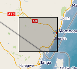
Geographic coverage
))
Temporal reference
Temporal extent
Temporal extent
- Dataset Reference Date ()
- 2017-11-17
Quality and validity
- Lineage
-
Imagery used in the analysis was downloaded from the Earth Explorer USGS image database (Landsat Imagery Archive). A number of images for the 1990 land cover were combined i.e. 1992, 1991, 1995 and small section of 1997. This was done for cloud removal purposes alongside cloud cover removal algorithms applied for areas with less than 50% cloud cover. Cloud cover was not a major problem for 2015 images. Landsat 166063 was used for the classification for the years mentioned above. Image pre-processing procedures; cloud cover removal using the assessment cloud cover algorithm mosaicking of different images as cloud removal tools was applied. The images were set to WGS84 UTM zone 37s. [See Landuse landcover methodology.txt file within the zip data set for further details]
Conformity
Conformity
Conformity
Conformity
Conformity
Conformity
- Explanation
-
See the referenced specification
Restrictions on access and use
- Access constraints
- no limitations
- Access constraints
- The dataset is made freely available for access, e.g. via the Internet. Either no third party data / information is contained in the dataset or BGS has secured written permission from the owner(s) of any third party data / information contained in the dataset to make the dataset freely accessible.
- Access constraints
-
The copyright of materials derived from the British Geological Survey's work is vested in the Natural Environment Research Council [NERC]. No part of this work may be reproduced or transmitted in any form or by any means, or stored in a retrieval system of any nature, without the prior permission of the copyright holder, via the BGS Intellectual Property Rights Manager. Use by customers of information provided by the BGS, is at the customer's own risk. In view of the disparate sources of information at BGS's disposal, including such material donated to BGS, that BGS accepts in good faith as being accurate, the Natural Environment Research Council (NERC) gives no warranty, expressed or implied, as to the quality or accuracy of the information supplied, or to the information's suitability for any use. NERC/BGS accepts no liability whatever in respect of loss, damage, injury or other occurence however caused.
- Access constraints
-
Available under the Open Government Licence subject to the following acknowledgement accompanying the reproduced NERC materials "Contains NERC materials ©NERC [year]"
Responsible organization (s)
Contact for the resource
- Organisation name
-
University of Oxford
-
not available
- Organisation name
-
University of Oxford
-
not available
- Organisation name
-
Rural Focus Ltd
-
not available
- Organisation name
-
Jomo Kenyatta University of Agriculture and Technology
-
not available
Metadata information
Contact for the metadata
- Organisation name
-
British Geological Survey
-
enquiries@bgs.ac enquiries@bgs.ac.uk
- Metadata Date
- 2024-04-25
- Metadata Language
- English (en)