BGS Data Catalogue
Tarmac Marine Geophysical Records from Aggregate Industry Surveys (1989 - 2004)
Scanned geophysical records, reports and track charts from Tarmac (previously Lafarge Tarmac) aggregate industry marine surveys 1989 to 2004. The geophysical records include boomer seismic and side scan sonar data of varying quality. All records from 44 boxes of paper records have been scanned at BGS and are delivered online along with any additional digital file such as reports or data files. The data are stored as part of the National Geoscience Data Centre (NGDC) and the Marine Environmental Data and Information Network (MEDIN) Data Archive Centre (DAC) for Geology and Geophysics.
INSPIRE
Identification
- File identifier
- 5d015a7e-2838-1eda-e054-002128a47908 XML
- Resource type
- dataset
Online resource
Resource identifier
- Metadata Language
- English (en)
- Spatial representation type
- grid
Encoding
- Format
-
pdf
- Format
-
JP2
Classification of data and services
- Topic category
-
- Geoscientific information
Classification of data and services
Coupled resource
Coupled resource
Classification of data and services
Coupled resource
Coupled resource
Keywords
- GEMET - INSPIRE themes, version 1.0
- BGS Thesaurus of Geosciences
-
-
Geology
-
UK Location (INSPIRE)
-
Bathymetry
-
Geological mapping
-
Sea floor
-
MEDIN
-
Marine geology
-
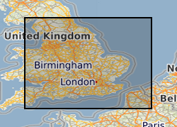
Geographic coverage
))
Temporal reference
Temporal extent
Temporal extent
- Dataset Reference Date ()
- 1989
Quality and validity
- Lineage
-
Data were collected by Tarmac. Deposited by Andrew Bellamy. Records were scanned at BGS
Conformity
Conformity
Conformity
Conformity
Conformity
Conformity
- Explanation
-
See the referenced specification
Restrictions on access and use
- Access constraints
- licenceOGL
- Access constraints
- Available under the Open Government Licence subject to the following acknowledgement accompanying the reproduced NERC materials "Contains NERC materials ©NERC [year]"
- Access constraints
-
The copyright of materials derived from the British Geological Survey's work is vested in the Natural Environment Research Council [NERC]. No part of this work may be reproduced or transmitted in any form or by any means, or stored in a retrieval system of any nature, without the prior permission of the copyright holder, via the BGS Intellectual Property Rights Manager. Use by customers of information provided by the BGS, is at the customer's own risk. In view of the disparate sources of information at BGS's disposal, including such material donated to BGS, that BGS accepts in good faith as being accurate, the Natural Environment Research Council (NERC) gives no warranty, expressed or implied, as to the quality or accuracy of the information supplied, or to the information's suitability for any use. NERC/BGS accepts no liability whatever in respect of loss, damage, injury or other occurence however caused.
- Access constraints
-
Available under the Open Government Licence subject to the following acknowledgement accompanying the reproduced NERC materials "Contains NERC materials ©NERC [year]"
Responsible organization (s)
Contact for the resource
- Organisation name
-
British Geological Survey
-
enquiries@bgs.ac enquiries@bgs.ac.uk
- Organisation name
-
British Geological Survey
-
enquiries@bgs.ac enquiries@bgs.ac.uk
- Organisation name
-
British Geological Survey
-
not available
- Organisation name
-
British Geological Survey
-
not available
Metadata information
Contact for the metadata
- Organisation name
-
British Geological Survey
-
enquiries@bgs.ac enquiries@bgs.ac.uk
- Metadata Date
- 2024-04-24
- Metadata Language
- English (en)