BGS Data Catalogue
Cambodia Arsenic-Prone Groundwaters (NERC grant NE/J023833/1)
The dataset comprise hydrogeochemical, isotopic and environmental geophysics data from surface waters and groundwater and sediments from scientific boreholes drilled into arsenic-prone aquifers in the Mekong River Basin. The data is divided into 5 categories: Geophysical data Hydrogeochemical data Isotopic data Sedimentary data Outreach and Dissemination Publications to date - open access linkages The data pertain to samples obtained from northern Kandal province just south of Phnom Penh in Cambodia. The data were collected over the period 2013-2016. The hydrogeochemical data were obtained by one of more of (i) in situ analytical techniques; or (ii) instrumental geochemical techniques, notably IC, ICP-AES, ICP-MS and GC-MS in the Manchester Analytical Geochemistry Unit, University of Manchester following methods as described in Richards et al. (2015, 2017). The geophysical data were obtained as described in Uhlemann et al. (2017). The data were obtained as part of a project funded by NERC Standard Research Grant NE/J023833/1 the major purpose of which was to determine the extent to which surface derived organics may be driving arsenic mobilisation in shallow circum-Himalayan aquifers, an exemplar of which is norther Kandal Province's largely Holocene aquifers to which these data refer. The data were obtained and interpreted by the University of Manchester except as follows: environmental geophysics data were obtained and interpreted by Oliver Kuras and Sebastian Uhlemann of the British Geological Survey GTOM team; tritium data were generated by Jurgen Sultenfuss of the University of Bremen; oxygen and hydrogen isotope data by SUERC, East Kilbride and carbon-14 data by the NERC Radiocarbon Laboratory at East Kilbride.
INSPIRE
Identification
- File identifier
- 5bce9651-6360-3c81-e054-002128a47908 XML
- Resource type
- dataset
Online resource
Resource identifier
- Metadata Language
- English (en)
Encoding
- Format
-
Image (JPG)
- Format
-
Zipped files (ZIP)
- Format
-
MS Word Document (DOC/X)
- Format
-
Spreadsheets (XLSX)
Projection
- code
- WGS 84 (EPSG::4326)
Classification of data and services
- Topic category
-
- Geoscientific information
Classification of data and services
Coupled resource
Coupled resource
Classification of data and services
Coupled resource
Coupled resource
Keywords
- GEMET - INSPIRE themes, version 1.0
- BGS Thesaurus of Geosciences
-
-
Geochemistry
-
Geophysics
-
Arsenic
-
Hydrogeology
-
Water chemistry
-
NGDC Deposited Data
-
Groundwater
-
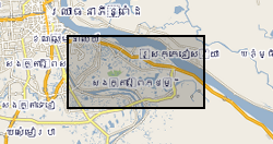
Geographic coverage
))
Temporal reference
Temporal extent
Temporal extent
- Dataset Reference Date ()
- 2017-08-31
Quality and validity
- Lineage
-
The hydrogeochemical data were obtained by one of more of (i) in situ analytical techniques; or (ii) instrumental geochemical techniques, notably IC, ICP-AES, ICP-MS and GC-MS in the Manchester Analytical Geochemistry Unit, University of Manchester following methods as described in Richards et al. (2015, 2017). The geophysical data were obtained as described in Uhlemann et al. (2017). Further methodology as detailed in the file NE-J023833-1 Project Data Comments and Metadata.
Conformity
Conformity
Conformity
Conformity
Conformity
Conformity
- Explanation
-
See the referenced specification
Restrictions on access and use
- Access constraints
- no limitations
- Access constraints
- The dataset is made freely available for access, e.g. via the Internet. Either no third party data / information is contained in the dataset or BGS has secured written permission from the owner(s) of any third party data / information contained in the dataset to make the dataset freely accessible.
- Access constraints
-
The copyright of materials derived from the British Geological Survey's work is vested in the Natural Environment Research Council [NERC]. No part of this work may be reproduced or transmitted in any form or by any means, or stored in a retrieval system of any nature, without the prior permission of the copyright holder, via the BGS Intellectual Property Rights Manager. Use by customers of information provided by the BGS, is at the customer's own risk. In view of the disparate sources of information at BGS's disposal, including such material donated to BGS, that BGS accepts in good faith as being accurate, the Natural Environment Research Council (NERC) gives no warranty, expressed or implied, as to the quality or accuracy of the information supplied, or to the information's suitability for any use. NERC/BGS accepts no liability whatever in respect of loss, damage, injury or other occurence however caused.
- Access constraints
-
Available under the Open Government Licence subject to the following acknowledgement accompanying the reproduced NERC materials "Contains NERC materials ©NERC [year]"
Responsible organization (s)
Contact for the resource
- Organisation name
-
University of Manchester
-
not available
- Organisation name
-
University of Manchester
-
not available
Responsible organization (s)
Contact for the resource
- Organisation name
-
University of Manchester
-
not available
- Organisation name
-
University of Manchester
-
not available
Metadata information
Contact for the metadata
- Organisation name
-
British Geological Survey
-
enquiries@bgs.ac enquiries@bgs.ac.uk
- Metadata Date
- 2024-04-22
- Metadata Language
- English (en)