 BGS Metadata Catalogue
Bowland Shale dataset: field and sample photographs, sample descriptions, microphotographs, x-ray fluorescence, LECO elemental analysis, x-ray diffraction and RockEval pyrolysis from Hind Clough, MHD4 and Cominco S9 (NERC grant NE/L002493/1)
The data were produced by Joe Emmings, NERC-funded PhD student at the University of Leicester and British Geological Survey, between 2014 and 2017. Authors of these data: Joe Emmings a, b; Sarah Davies a; Christopher Vane b; Melanie Leng b, c; Vicky Moss-Hayes b; Michael Stephenson b a School of Geography, Geology and the Environment, University of Leicester, University Road, Leicester, LE1 7RH, UK. b British Geological Survey, Keyworth, Nottingham, NG12 5GG, UK. c School of Biosciences, Centre for Environmental Geochemistry, University of Nottingham, Sutton Bonington Campus, Leicestershire LE12 5RD, UK. Data include: 1) A range of photographs from the outcrop Hind Clough and boreholes MHD4 and Cominco S9, sample photographs, thin section scans, microphotographs (transmitted light and scanning electron microscopy) and hand specimen descriptions; 2) The results of 100 analyses from the outcrop Hind Clough and boreholes MHD4 and Cominco S9; x-ray fluorescence major and trace element concentrations, RockEval pyrolysis measurements, x-ray diffraction traces and LECO elemental C and S data. These data were interpreted together with 20 drill-core samples previously acquired from Hind Clough ('HC01' prefix). See http://dx.doi.org/10.5285/c39a32b2-1a30-4426-8389-2fae21ec60ad for further information regarding this drill-core dataset. Acknowledgements: This study was funded by NERC grant NE/L002493/1, a part of the Central England Training Alliance (CENTA). This study also received CASE funding from the BGS. Nick Riley (Carboniferous Ltd) is thanked for sharing his expertise, particularly regarding the field identification of marine faunas. Charlotte Watts is thanked for providing field assistance. Nick Marsh, Tom Knott and Cheryl Haidon are thanked for providing expertise and assistance during inorganic geochemical and mineralogical analyses.
Simple
- Date (Creation)
- 2017-10-06
- Citation identifier
- http://data.bgs.ac.uk/id/dataHolding/13607205
- Point of contact
-
Organisation name Individual name Electronic mail address Role University of Leicester
Joe Emmings
not available
Point of contact
- Maintenance and update frequency
- notApplicable
-
GEMET - INSPIRE themes, version 1.0
-
BGS Thesaurus of Geosciences
-
-
Geochemistry
-
Sedimentary geology
-
Shale
-
- dataCentre
- Keywords
-
-
NERC_DDC
-
- Access constraints
- Other restrictions
- Other constraints
- no limitations
- Other constraints
- The dataset is made freely available for access, e.g. via the Internet. Either no third party data / information is contained in the dataset or BGS has secured written permission from the owner(s) of any third party data / information contained in the dataset to make the dataset freely accessible.
- Use constraints
- Other restrictions
- Other constraints
-
The copyright of materials derived from the British Geological Survey's work is vested in the Natural Environment Research Council [NERC]. No part of this work may be reproduced or transmitted in any form or by any means, or stored in a retrieval system of any nature, without the prior permission of the copyright holder, via the BGS Intellectual Property Rights Manager. Use by customers of information provided by the BGS, is at the customer's own risk. In view of the disparate sources of information at BGS's disposal, including such material donated to BGS, that BGS accepts in good faith as being accurate, the Natural Environment Research Council (NERC) gives no warranty, expressed or implied, as to the quality or accuracy of the information supplied, or to the information's suitability for any use. NERC/BGS accepts no liability whatever in respect of loss, damage, injury or other occurence however caused.
- Other constraints
-
Available under the Open Government Licence subject to the following acknowledgement accompanying the reproduced NERC materials "Contains NERC materials ©NERC [year]"
- Language
- English
- Topic category
-
- Geoscientific information
- Geographic identifier
-
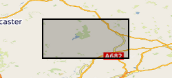
LANCASHIRE [id=154200]
British Geological Survey Gazetteer: Geographical hierarchy from Geosaurus 1979 creation
))
- Begin date
- 2015-02-27
- End date
- 2017-05-13
- Unique resource identifier
- OSGB 1936 / British National Grid (EPSG::27700)
- Distribution format
-
Name Version Image (JPEG)
Image (BMP)
.uxd
witheld
Microsoft Excel
witheld
Text file (TXT)
witheld
Image (TIFF)
- OnLine resource
-
Protocol Linkage Name WWW:DOWNLOAD-1.0-http--download
https://webapps.bgs.ac.uk/services/ngdc/accessions/index.html#item79769 Data
- OnLine resource
-
Protocol Linkage Name WWW:LINK-1.0-http--related
https://doi.org/10.5285/9ceadcad-a93c-4bab-8ca1-07b0de2c5ed0 Citation Information - Digital Object Identifier (DOI)
- Hierarchy level
- Dataset
- Other
-
dataset
Conformance result
- Title
-
INSPIRE Implementing rules laying down technical arrangements for the interoperability and harmonisation of Geology
- Date (Publication)
- 2011
- Explanation
-
See the referenced specification
- Pass
- No
Conformance result
- Title
-
Commission Regulation (EU) No 1089/2010 of 23 November 2010 implementing Directive 2007/2/EC of the European Parliament and of the Council as regards interoperability of spatial data sets and services
- Date (Publication)
- 2010-12-08
- Explanation
-
See http://eur-lex.europa.eu/LexUriServ/LexUriServ.do?uri=OJ:L:2010:323:0011:0102:EN:PDF
- Pass
- No
- Statement
-
Three positions in the Craven Basin were selected for analysis; outcrop Hind Clough (grid ref: 364430 453210, British National Grid projection) and boreholes Marl Hill 4 (MHD4) (grid ref: 367426 446752) and Cominco S9 (grid ref: 386010 463500). The stratigraphic framework was based on recognition of ammonoid biozones, enabling correlation. True thicknesses at Hind Clough were estimated using the dip and strike of bedding with an Abney level. 341 samples were collected using hammer and chisel from Hind Clough ('HC02' prefix in dataset), and MHD4 and Cominco S9 core sampled at the British Geological Survey. Samples were cleaned, dry/ wet cut and some surfaces polished depending on sample quality, photographed and described prior to selection of subsamples. 100 homogenised powdered subsamples weighing approximately 10 g were selected for Rock-Eval pyrolysis, XRF and LECO elemental analysis. 74 samples were analysed for mineralogy (phase identification) using XRD. Samples were milled using an agate planetary mill and air-dried at 35 degrees C prior to pyrolysis. 90 ultrathin (20 µm) uncovered and uncoated sections were described using scans and transmitted light, and a subset analysed under scanning electron microscope. These data were interpreted together with 20 drill-core samples previously acquired from Hind Clough (‘HC01’ prefix). See http://dx.doi.org/10.5285/c39a32b2-1a30-4426-8389-2fae21ec60ad for further information regarding this drill-core dataset. 1.1. Organic Analysis Pyrolysis was conducted on finely powdered samples (60 mg subsamples) in a Rock-Eval 6TM apparatus (Vinci Technologies) at the British Geological Survey. Repeat measurements (n=3 to n=4) provide estimates for precision (two sample standard deviations) of less than ± 10 % for S1 and S2 parameters. Accuracy for total organic carbon (TOC) is reported at ± 7 %. 1.2. Elemental Analysis Total carbon (TC) and total sulphur (TS) were determined by analysis using a LECO CS 230 elemental analyser (30 mg subsamples). Accuracy is estimated at ± 5 % for C and ± 15% for S. Typical sample precision is estimated using two standard deviations at ± 3 % for C and ± 8 % for S. XRF data were acquired with a PANalytical Axios Advanced X-Ray Fluorescence spectrometer. Major element concentration was determined on fused beads using default PANalytical SuperQ conditions and trace element concentration was determined on 32 mm diameter pressed powder briquettes. Accuracy is estimated as ± 5 % for major elements and ± 5 % for trace elements. Similarly, precision (sample standard deviation) is typically up to ± 5 % (but commonly ± 1 %) for major elements and of ± 10 % (but commonly ± 5 %) for trace elements. These estimates are based on appropriate reference materials (repeat analyses). The majority of elements were detected in concentrations at least 10 times greater than the lower limit of detection. 1.3. Mineralogical Analysis Whole-rock powder XRD data were collected on a Bruker D8 Advance Powder Diffractometer equipped with a LynxEye Position Sensitive Detector with a Bragg Brentano, flat plate θ-θ geometry using CuKα radiation. Whole-rock data were acquired at a step size of 0.01° 2θ and step time of 0.5 seconds with a scan range from 0° to 135° 2θ. Scanning electron microscopy (SEM) was conducted on uncoated 'ultathin' sections using an S-3600N Hitachi microscope with Oxford INCA 350 EDS used for elemental mapping.
Metadata
- File identifier
- 5a3c4255-bf86-1107-e054-002128a47908 XML
- Metadata language
- English
- Hierarchy level
- Dataset
- Date stamp
- 2026-07-11
- Metadata standard name
- UK GEMINI
- Metadata standard version
-
2.3
- Metadata author
-
Organisation name Individual name Electronic mail address Role British Geological Survey
Point of contact
- Dataset URI
)))
