BGS Data Catalogue
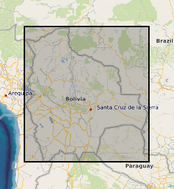
River channel centreline positions for the Rio Beni, Bolivia (NERC grant NE/H009108/1)
Each contains two columns of data representing the UTM coordinates of the centre line of the Rio Beni in Bolivia. These coordinates were derived by digitising Landsat imagery and aerial photographs (1960 only). The number in the file name after "banks_c" corresponds to the year. Numbers in column 1: UTM Zone 19S Easting Numbers in column 2: UTM Zone 19S Northing
INSPIRE
Identification
- File identifier
- 5768b6c6-f5a9-74a6-e054-002128a47908 XML
- Resource type
- dataset
Online resource
Resource identifier
- Metadata Language
- English (en)
Encoding
Projection
Classification of data and services
- Topic category
-
- Geoscientific information
Classification of data and services
Coupled resource
Coupled resource
Classification of data and services
Coupled resource
Coupled resource
Keywords
- GEMET - INSPIRE themes, version 1.0
- BGS Thesaurus of Geosciences
-
-
River channels
-
NGDC Deposited Data
-
Flood plains
-
Water flooding
-
Geographic coverage
))
Temporal reference
Temporal extent
Temporal extent
- Dataset Reference Date ()
- 2017-08-22
Quality and validity
- Lineage
-
Data consist of UTM coordinates representing the centreline of the Rio Beni, Bolivia. Data were obtained by digitising Landsat images in Arc GIS. Methods are described in detail in: Schwendel et al. (2015), Earth Surface Processes and Landforms, vol 40, p 2026-2040.
Conformity
Conformity
Conformity
Conformity
Conformity
Conformity
- Explanation
-
See the referenced specification
Restrictions on access and use
- Access constraints
- no limitations
- Access constraints
- The dataset is made freely available for access, e.g. via the Internet. Either no third party data / information is contained in the dataset or BGS has secured written permission from the owner(s) of any third party data / information contained in the dataset to make the dataset freely accessible.
- Access constraints
-
The copyright of materials derived from the British Geological Survey's work is vested in the Natural Environment Research Council [NERC]. No part of this work may be reproduced or transmitted in any form or by any means, or stored in a retrieval system of any nature, without the prior permission of the copyright holder, via the BGS Intellectual Property Rights Manager. Use by customers of information provided by the BGS, is at the customer's own risk. In view of the disparate sources of information at BGS's disposal, including such material donated to BGS, that BGS accepts in good faith as being accurate, the Natural Environment Research Council (NERC) gives no warranty, expressed or implied, as to the quality or accuracy of the information supplied, or to the information's suitability for any use. NERC/BGS accepts no liability whatever in respect of loss, damage, injury or other occurence however caused.
- Access constraints
-
The dataset is made available to external clients under BGS Digital Data Licence terms and conditions. Revert to the IPR Section (iprdigital@bgs.ac.uk) if further advice is required with regard to permitted usage. iprdigital@bgs.ac The dataset is made available to external clients under BGS Digital Data Licence terms and conditions. Revert to the IPR Section (iprdigital@bgs.ac.uk) if further advice is required with regard to permitted usage.
Responsible organization (s)
Contact for the resource
- Organisation name
-
University of Exeter
-
not available
- Organisation name
-
University of Exeter
-
not available
- Organisation name
-
University of Hull
-
not available
- Organisation name
-
British Geological Survey
-
not available
- Organisation name
-
British Geological Survey
-
not available
Metadata information
Contact for the metadata
- Organisation name
-
British Geological Survey
-
enquiries@bgs.ac enquiries@bgs.ac.uk
- Metadata Date
- 2024-04-22
- Metadata Language
- English (en)