 BGS Metadata Catalogue
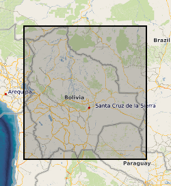
River channel bank height data for the Rio Beni, Bolivia (NERC grant NE/H009108/1)
Each file contains four columns of data representing: column 1: UTM Zone 19S Easting coordinate for survey location along the Rio Beni, Bolivia. column 2: UTM Zone 19S Northing coordinate for survey location along the Rio Beni, Bolivia. column 3: Measurment range from observer to bank in m column 4: Bank height in m (the difference between bank top and low flow water level) UTM coordinates were measured using a Trimble Global Position System with OmniSTAR HP correction Measurement range and bank height were measured using a GPS supported laser range finder (Impulse 200 LR< Laser Technology inc) Survey 1 was carried out between 15th and 19th September 2011, when the flow discharge within the Beni was in the range 453-530 cumecs Survey 2 was carried out between 20th and 23rd September 2011, when the flow discharge within the Beni was in the range 762-892 cumecs
Simple
- Date (Creation)
- 2017-08-22
- Citation identifier
- http://data.bgs.ac.uk/id/dataHolding/13607187
- Point of contact
-
Organisation name Individual name Electronic mail address Role University of Exeter
Andrew Nicholas
not available
Originator University of Exeter
Andrew Nicholas
not available
Principal investigator University of Hull
Dr Arved Schwendel
not available
Originator British Geological Survey
Enquiries
not available
Distributor British Geological Survey
Enquiries
not available
Point of contact
- Maintenance and update frequency
- notApplicable
-
GEMET - INSPIRE themes, version 1.0
-
BGS Thesaurus of Geosciences
-
-
Flood plains
-
River channels
-
Water flooding
-
- dataCentre
- Keywords
-
-
NERC_DDC
-
- Access constraints
- Other restrictions
- Other constraints
- no limitations
- Other constraints
- The dataset is made freely available for access, e.g. via the Internet. Either no third party data / information is contained in the dataset or BGS has secured written permission from the owner(s) of any third party data / information contained in the dataset to make the dataset freely accessible.
- Use constraints
- Other restrictions
- Other constraints
-
The copyright of materials derived from the British Geological Survey's work is vested in the Natural Environment Research Council [NERC]. No part of this work may be reproduced or transmitted in any form or by any means, or stored in a retrieval system of any nature, without the prior permission of the copyright holder, via the BGS Intellectual Property Rights Manager. Use by customers of information provided by the BGS, is at the customer's own risk. In view of the disparate sources of information at BGS's disposal, including such material donated to BGS, that BGS accepts in good faith as being accurate, the Natural Environment Research Council (NERC) gives no warranty, expressed or implied, as to the quality or accuracy of the information supplied, or to the information's suitability for any use. NERC/BGS accepts no liability whatever in respect of loss, damage, injury or other occurence however caused.
- Other constraints
-
Either: (i) the dataset is made freely available, e.g. via the Internet, for a restricted category of use (e.g. educational use only); or (ii) the dataset has not been formally approved by BGS for access and use by external clients under licence, but its use may be permitted under alternative formal arrangements; or (iii) the dataset contains 3rd party data or information obtained by BGS under terms and conditions that must be consulted in order to determine the permitted usage of the dataset. Refer to the BGS staff member responsible for the creation of the dataset if further advice is required. He / she should be familiar with the composition of the dataset, particularly with regard to 3rd party IPR contained in it, and any resultant use restrictions. This staff member should revert to the IPR Section ( ipr@bgs.ac.uk) for advice, should the position not be clear.
- Language
- English
- Topic category
-
- Geoscientific information
- Geographic identifier
-
BO
ISO 3166_1 alpha-2 2009 revision
- Geographic identifier
-
BOL
ISO 3166_1 alpha-3 2009 revision
- Geographic identifier
-
BOLIVIA [id=867000]
British Geological Survey Gazetteer: Geographical hierarchy from Geosaurus 1979 creation
))
- Begin date
- 2011-01-01
- End date
- 2011-12-31
- Unique resource identifier
- WGS 84 / UTM zone 19S (EPSG::32719)
- Distribution format
-
Name Version Microsoft Excel (CSV)
witheld
Text file (TXT)
witheld
- Distributor contact
-
Organisation name Individual name Electronic mail address Role British Geological Survey
Enquiries
not available
Distributor
- OnLine resource
-
Protocol Linkage Name WWW:DOWNLOAD-1.0-http--download
https://webapps.bgs.ac.uk/services/ngdc/accessions/index.html#item78469 Data
- Hierarchy level
- Dataset
- Other
-
dataset
Conformance result
- Title
-
INSPIRE Implementing rules laying down technical arrangements for the interoperability and harmonisation of Geology
- Date (Publication)
- 2011
- Explanation
-
See the referenced specification
- Pass
- No
Conformance result
- Title
-
Commission Regulation (EU) No 1089/2010 of 23 November 2010 implementing Directive 2007/2/EC of the European Parliament and of the Council as regards interoperability of spatial data sets and services
- Date (Publication)
- 2010-12-08
- Explanation
-
See http://eur-lex.europa.eu/LexUriServ/LexUriServ.do?uri=OJ:L:2010:323:0011:0102:EN:PDF
- Pass
- No
- Statement
-
Data consist of measurements of river bank height relative to the low flow water surface. Data were collected using a Trimble Global Position System with OmniSTAR HP correction, combined with a laser range finder (Impulse 200 LR< Laser Technology inc). Measurements were taken from a boat moving downstream (survey 1) and upstream (survey 2) along the Rio Beni, Bolivia.
Metadata
- File identifier
- 5758cbba-271d-70ce-e054-002128a47908 XML
- Metadata language
- English
- Hierarchy level
- Dataset
- Date stamp
- 2026-07-11
- Metadata standard name
- UK GEMINI
- Metadata standard version
-
2.3
- Metadata author
-
Organisation name Individual name Electronic mail address Role British Geological Survey
Point of contact
- Dataset URI
)))
