 BGS Metadata Catalogue
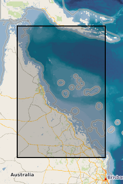
Exploring the hidden shallows: inner-shelf reef growth and future trajectories of reef geomorphic change (NERC grant NE/J023329/1)
Four datasets for NERC grant NE/J023329/1, Paluma Shoals reef complex, Halifax Bay, central Great Barrier Reef, Australia. DATASET 1: Single Beam acoustic survey data. This dataset comprises the single beam acoustic data that was collected from transects across the Paluma Shoals reef complex, Halifax Bay, central Great Barrier Reef, Australia. The dataset comprises of depth measurements (m) and the latitudinal and longitudinal coordinates of 58,255 point samples across the study area. The dataset was used to construct Figure 1C in Morgan, K. M., Perry, C. T., Smithers, S. G., Johnson, J. A., & Daniell, J. J. (2016). Evidence of extensive reef development and high coral cover in nearshore environments: implications for understanding coral adaptation in turbid settings. Scientific Reports, 6. DATASET 2: Paluma Shoals core data (sedimentology and palaeoecology This dataset includes all collected sedimentary and coral palaeoecological data collected from cores from across the Paluma Shoals Reef Complex, Halifax Bay, central Great Barrier Reef, Australia. This includes 1) a list of the cores recovered, their geographic location and their depths; 2) data on the mud and carbonate content of the sediment matrix from each core; 3) grainsize data from each core; 4) data from thin section analysis from each delineated facies in cores; and 5) downcore data on coral constituent abundance. DATASET 3: Core radiocarbon dates This dataset comprises the radiocarbon dates obtained from coral samples from cores collected across the Paluma Shoals Reef Complex, Halifax Bay, central Great Barrier Reef, Australia. Dates are from the NERC Radiocarbon dating lab (SUERC) in East Kilbride. DATASET 4: Benthic video imagery This dataset comprises screen grab images collected along towed transects across the Paluma Shoals reef complex, Halifax Bay, central Great Barrier Reef, Australia. Each image has the relevant lat, long coordinates printed on the top right hand corner. The sites names (folders) relate to the sites described in the following paper: Morgan KM, Perry CT, Smithers SG, Daniell JJ and Johnson JA (2016) Extensive reef development within the “mesophotic” nearshore Great Barrier Reef: Evidence for intra-regional variations in coral resilience. Scientific Reports 6:29616. DOI: 10.1038/srep29616
Simple
- Date (Creation)
- 2017-03-29
- Citation identifier
- http://data.bgs.ac.uk/id/dataHolding/13607167
- Point of contact
-
Organisation name Individual name Electronic mail address Role University of Exeter
Professor Chris Perry
not available
Point of contact
- Maintenance and update frequency
- notApplicable
-
GEMET - INSPIRE themes, version 1.0
-
BGS Thesaurus of Geosciences
-
-
Barrier reefs
-
Coral
-
Sedimentary geology
-
Turbidity
-
Carbon dating
-
Coral reefs
-
Acoustics
-
Drill core
-
Palaeoecology
-
- dataCentre
- Keywords
-
-
NERC_DDC
-
- Access constraints
- Other restrictions
- Other constraints
- restricted
- Use constraints
- Other restrictions
- Other constraints
-
The copyright of materials derived from the British Geological Survey's work is vested in the Natural Environment Research Council [NERC]. No part of this work may be reproduced or transmitted in any form or by any means, or stored in a retrieval system of any nature, without the prior permission of the copyright holder, via the BGS Intellectual Property Rights Manager. Use by customers of information provided by the BGS, is at the customer's own risk. In view of the disparate sources of information at BGS's disposal, including such material donated to BGS, that BGS accepts in good faith as being accurate, the Natural Environment Research Council (NERC) gives no warranty, expressed or implied, as to the quality or accuracy of the information supplied, or to the information's suitability for any use. NERC/BGS accepts no liability whatever in respect of loss, damage, injury or other occurence however caused.
- Other constraints
-
Either: (i) the dataset is made freely available, e.g. via the Internet, for a restricted category of use (e.g. educational use only); or (ii) the dataset has not been formally approved by BGS for access and use by external clients under licence, but its use may be permitted under alternative formal arrangements; or (iii) the dataset contains 3rd party data or information obtained by BGS under terms and conditions that must be consulted in order to determine the permitted usage of the dataset. Refer to the BGS staff member responsible for the creation of the dataset if further advice is required. He / she should be familiar with the composition of the dataset, particularly with regard to 3rd party IPR contained in it, and any resultant use restrictions. This staff member should revert to the IPR Section ( ipr@bgs.ac.uk) for advice, should the position not be clear.
- Language
- English
- Topic category
-
- Geoscientific information
- Geographic identifier
-
GREAT BARRIER REEF [id=579000]
British Geological Survey Gazetteer: Geographical hierarchy from Geosaurus 1979 creation
))
- Begin date
- 2014-07-01
- End date
- 2014-07-31
- Begin date
- 2013-06-01
- End date
- 2013-07-31
- Unique resource identifier
- WGS 84 / UTM zone 55S (EPSG::32755)
- Distribution format
-
Name Version
- OnLine resource
-
Protocol Linkage Name WWW:DOWNLOAD-1.0-http--download
https://webapps.bgs.ac.uk/services/ngdc/accessions/index.html#item76769 Data
- OnLine resource
-
Protocol Linkage Name WWW:DOWNLOAD-1.0-http--download
https://webapps.bgs.ac.uk/services/ngdc/accessions/index.html#item75354 Data
- Hierarchy level
- Dataset
- Other
-
dataset
Conformance result
- Title
-
INSPIRE Implementing rules laying down technical arrangements for the interoperability and harmonisation of Geology
- Date (Publication)
- 2011
- Explanation
-
See the referenced specification
- Pass
- No
Conformance result
- Title
-
Commission Regulation (EU) No 1089/2010 of 23 November 2010 implementing Directive 2007/2/EC of the European Parliament and of the Council as regards interoperability of spatial data sets and services
- Date (Publication)
- 2010-12-08
- Explanation
-
See http://eur-lex.europa.eu/LexUriServ/LexUriServ.do?uri=OJ:L:2010:323:0011:0102:EN:PDF
- Pass
- No
- Statement
-
Single Beam acoustic survey data were collected in July 2013 and July 2014 over an area of ~15.5 km2 using a single-beam echo sounder (Ceeducer Ceestar 200 kHz), coupled with a Real-Time Kinematic Global Positioning System (RTK-GPS). Data were acquired along a suite of closely spaced (every ~100 m) north-south parallel lines across the location of known shoals (observed in Landsat imagery), and a series of ~500 m spaced shore-perpendicular lines to provide broader context for the shoals. Depth values were corrected for tidal variations throughout surveying in CarisTM HIPS and reduced to lowest astronomical tide (LAT) datum using tide gauge data at the Port of Townsville. Core data (sedimentology and palaeoecology),the cores from which the data were collected were recovered in July 2013 and July 2014. These data are based on the analysis of sediment samples recovered on a downcore basis (the depths from which each sample derive are listed in the attached Excel spreadsheet). This data was used as the basis for the following published study: Johnson JA, Perry CT, Smithers SG, Morgan KM, Johnson KG (2017, in press) Depth-controlled patterns in vertical coral community development within the turbid nearshore waters of the Great Barrier Reef: baselines for assessing ecological change. Coral Reefs Core radiocarbon dates, the cores from which the data were collected were recovered in July 2013 and July 2014. This data was used as the basis for the following published study: Morgan KM, Perry CT, Smithers SG, Johnson JA, Gulliver P (2016) Transitions in coral reef accretion rates linked to intrinsic ecological shifts on turbid-zone nearshore reefs. Geology 44: 995-998. Benthic video imagery, these images were collected in July 2013 and July 2014 using a hand-held frame-mounted underwater video camera (SeaViewer with Sea-Track™ GPS overlay). The camera was towed ~1 m above the seafloor along multiple 300 m transect lines. Still frames (~1 m2) were extracted from the video at automated 8 sec intervals (n = 4420) and a digital 9-point grid overlay was added.
Metadata
- File identifier
- 528ce7b1-cb31-0514-e054-002128a47908 XML
- Metadata language
- English
- Hierarchy level
- Dataset
- Date stamp
- 2026-06-25
- Metadata standard name
- UK GEMINI
- Metadata standard version
-
2.3
- Metadata author
-
Organisation name Individual name Electronic mail address Role British Geological Survey
Point of contact
- Dataset URI
)))
