BGS Data Catalogue
GeoSure Extra: Debris Flow Susceptibility Model for Great Britain (Version 6.0)
The Debris Flow Susceptibility Model for Great Britain version 6.0 (DFSM_GB_v6.0) provides information on the likelihood of debris flows occurring at a given location based on a combination of digital geological, hydrogeological and topographic data. It is a raster dataset at 50m resolution, showing susceptibility for debris flows on a scale A (lowest likelihood) to E (highest likelihood). The methodology develops an additional dimension to the BGS GeoSure Landslides surface layer (Dashwood et al., 2014) and is designed for users interested specifically in debris flow susceptibility. The identification of debris flow hazards can assist regional planners; rapidly identifying areas with potential problems and aid local government offices in making development plans by helping to define land suited to different uses. Other users of these data may include developers, homeowners, asset owners, solicitors, loss adjusters, the insurance industry, architects and surveyors. The DFSM (Debris Flow Susceptibility Model) GB v6.0 was completed in March 2017.
INSPIRE
Identification
- File identifier
- 5173f4df-f8ca-5cdb-e054-002128a47908 XML
- Resource type
- dataset
Online resource
Resource identifier
- Metadata Language
- English (en)
Encoding
Projection
Classification of data and services
- Topic category
-
- Geoscientific information
Classification of data and services
Coupled resource
Coupled resource
Classification of data and services
Coupled resource
Coupled resource
Keywords
- GEMET - INSPIRE themes, version 1.0
- BGS Thesaurus of Geosciences
-
-
Natural hazards
-
Landslides
-
data.gov.uk (non-INSPIRE)
-
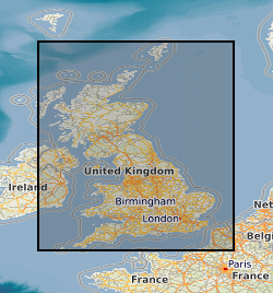
Geographic coverage
))
Temporal reference
Temporal extent
Temporal extent
- Dataset Reference Date ()
- 2017-03
Quality and validity
- Lineage
-
The Debris Flow Model for Great Briatin version 6.0 has been produced using NEXTMap 50m DTM, BGS Soil- Parent Material v6 data, Geological Controls on Infiltration V7 dataset (based on BGS superficial and Bedrock permeability V7 data). A number of GIS processes have been applied to these data and combined to produce the model. These have been extensively documented in the datasets accompanying ‘Methodology’ report.
- Denominator
- 50000
Conformity
Conformity
Conformity
Conformity
Conformity
Conformity
- Explanation
-
See the referenced specification
Restrictions on access and use
- Access constraints
- license
- Access constraints
-
The copyright of materials derived from the British Geological Survey's work is vested in the Natural Environment Research Council [NERC]. No part of this work may be reproduced or transmitted in any form or by any means, or stored in a retrieval system of any nature, without the prior permission of the copyright holder, via the BGS Intellectual Property Rights Manager. Use by customers of information provided by the BGS, is at the customer's own risk. In view of the disparate sources of information at BGS's disposal, including such material donated to BGS, that BGS accepts in good faith as being accurate, the Natural Environment Research Council (NERC) gives no warranty, expressed or implied, as to the quality or accuracy of the information supplied, or to the information's suitability for any use. NERC/BGS accepts no liability whatever in respect of loss, damage, injury or other occurence however caused.
- Access constraints
-
The dataset is made available to external clients under BGS Digital Data Licence terms and conditions. Revert to the IPR Section (iprdigital@bgs.ac.uk) if further advice is required with regard to permitted usage. iprdigital@bgs.ac The dataset is made available to external clients under BGS Digital Data Licence terms and conditions. Revert to the IPR Section (iprdigital@bgs.ac.uk) if further advice is required with regard to permitted usage.
Responsible organization (s)
Contact for the resource
- Organisation name
-
British Geological Survey
-
enquiries@bgs.ac enquiries@bgs.ac.uk
- Organisation name
-
British Geological Survey
-
enquiries@bgs.ac enquiries@bgs.ac.uk
Responsible organization (s)
Contact for the resource
- Organisation name
-
British Geological Survey
-
enquiries@bgs.ac enquiries@bgs.ac.uk
- Organisation name
-
British Geological Survey
-
enquiries@bgs.ac enquiries@bgs.ac.uk
Metadata information
Contact for the metadata
- Organisation name
-
British Geological Survey
-
enquiries@bgs.ac enquiries@bgs.ac.uk
- Metadata Date
- 2024-04-18
- Metadata Language
- English (en)