 BGS Metadata Catalogue
National (Great Britain) Recharge Model climate change runs - 11 regional climate models
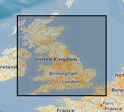
The data are the gridded recharge values obtained from the BGS distributed recharge model (ZOODRM) driven by 11 Ensembles of the HaDCM3 Regional Climate Model (RCM) taken from the Future Flow and Groundwater Level data set ( http://www.ceh.ac.uk/our-science/projects/future-flows-and-groundwater-levels). The model covers the mainland areas of England, Scotland and Wales. The 11 ensembles are run from January 1950 to December 2099. The dataset themselves are the gridded (2 km by 2 km) outputs from the recharge model averaged over four time horizons: historical, 20s, 50s, and 80s, for each of the 11 ensembles. The results can be used to assess the impact of climate change on potential recharge (soil drainage) for catchments in mainland England, Scotland and Wales.
Simple
- Date (Creation)
- 2017-03-31
- Citation identifier
- http://data.bgs.ac.uk/id/dataHolding/13607147
- Point of contact
-
Organisation name Individual name Electronic mail address Role British Geological Survey
Enquiries
Distributor British Geological Survey
Enquiries
Point of contact
- Maintenance and update frequency
- As needed
-
GEMET - INSPIRE themes, version 1.0
-
BGS Thesaurus of Geosciences
-
-
Climate change
-
Ground water recharge
-
Models
-
- dataCentre
- Keywords
-
-
NERC_DDC
-
- Access constraints
- Other restrictions
- Other constraints
- no limitations
- Other constraints
- The dataset is made freely available for access, e.g. via the Internet. Either no third party data / information is contained in the dataset or BGS has secured written permission from the owner(s) of any third party data / information contained in the dataset to make the dataset freely accessible.
- Use constraints
- Other restrictions
- Other constraints
-
The copyright of materials derived from the British Geological Survey's work is vested in the Natural Environment Research Council [NERC]. No part of this work may be reproduced or transmitted in any form or by any means, or stored in a retrieval system of any nature, without the prior permission of the copyright holder, via the BGS Intellectual Property Rights Manager. Use by customers of information provided by the BGS, is at the customer's own risk. In view of the disparate sources of information at BGS's disposal, including such material donated to BGS, that BGS accepts in good faith as being accurate, the Natural Environment Research Council (NERC) gives no warranty, expressed or implied, as to the quality or accuracy of the information supplied, or to the information's suitability for any use. NERC/BGS accepts no liability whatever in respect of loss, damage, injury or other occurence however caused.
- Other constraints
-
Available under the Open Government Licence subject to the following acknowledgement accompanying the reproduced NERC materials "Contains NERC materials ©NERC [year]"
- Language
- English
- Topic category
-
- Geoscientific information
- Geographic identifier
-
GBN
ISO 3166_2 2009 revision
- Geographic identifier
-
GREAT BRITAIN [id=139600]
British Geological Survey Gazetteer: Geographical hierarchy from Geosaurus 1979 creation
))
- Begin date
- 1950-01-01
- End date
- 2099-12-31
- Supplemental Information
-
Jointly funded by the Environment Agency and BGS
- Unique resource identifier
- OSGB 1936 / British National Grid (EPSG::27700)
- Distribution format
-
Name Version ActionScript Communication (ASC)
witheld
- Distributor contact
-
Organisation name Individual name Electronic mail address Role British Geological Survey
Enquiries
Distributor
- OnLine resource
-
Protocol Linkage Name WWW:DOWNLOAD-1.0-http--download
https://webapps.bgs.ac.uk/services/ngdc/accessions/index.html#item112352 National (UK) Recharge Model Climate Change runs - 11 ensembles
- Hierarchy level
- Dataset
- Other
-
dataset
Conformance result
- Title
-
INSPIRE Implementing rules laying down technical arrangements for the interoperability and harmonisation of Geology
- Date (Publication)
- 2011
- Explanation
-
See the referenced specification
- Pass
- No
Conformance result
- Title
-
Commission Regulation (EU) No 1089/2010 of 23 November 2010 implementing Directive 2007/2/EC of the European Parliament and of the Council as regards interoperability of spatial data sets and services
- Date (Publication)
- 2010-12-08
- Explanation
-
See http://eur-lex.europa.eu/LexUriServ/LexUriServ.do?uri=OJ:L:2010:323:0011:0102:EN:PDF
- Pass
- No
- Statement
-
The recharge model ZOODRM (nora.nerc.ac.uk/12633/) was run using rainfall and Potential Evaporation derived from the Future Flow and Groundwater Level Dataset ( http://www.ceh.ac.uk/our-science/projects/future-flows-and-groundwater-levels). The model was run from 1/1/1950 to 31/12/2099 and potential recharge produced on a gridded basis (2km by 2km) for each of the 11 RCMs. Other input data includes land use, soil type, DEM (topography) and geology. The recharge model outputs are calculated on a daily basis and then amalgamated to average values over four time horizons defined as: historical (1950 – 2009), 20s (2010 – 2039), 50s (2040 – 2069), 80s (2070 – 2099)
Metadata
- File identifier
- 4f1384fa-f3a4-3fcf-e054-002128a47908 XML
- Metadata language
- English
- Hierarchy level
- Dataset
- Date stamp
- 2026-07-10
- Metadata standard name
- UK GEMINI
- Metadata standard version
-
2.3
- Metadata author
-
Organisation name Individual name Electronic mail address Role British Geological Survey
Point of contact
- Dataset URI
)))
