 BGS Metadata Catalogue
UK in-situ stress field orientation from borehole breakouts and drilling induced tensile fractures identified using borehole imaging
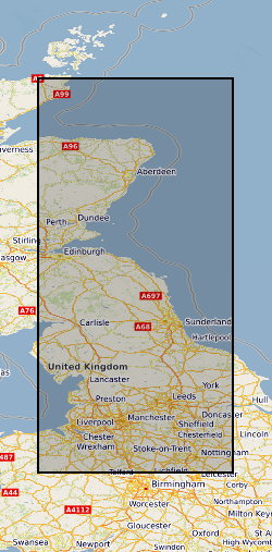
This datasets contains 323 observations of borehole breakouts across and drilling induced tensile fractures from borehole imaging used to re-characterise the UK stress field orientation in 2016. This was published in the Journal of Marine and Petroleum Geology and is openly available using doi:10.1016/j.marpetgeo.2016.02.012 The observations relate to 39 wells from Central England, Northern England and Northern Scotland and are provided with links to screen grabs of the images for clarity. The basic well metadata is supplied along with a description of the dataset. The Images were generated in the IMAGE DISPLAY module of the Landmark RECALL software and are supplied on an “as shown” basis. Descriptions of the tools and the techniques used are listed in the accompanying paper: KINGDON, A., FELLGETT, M. W. & WILLIAMS, J. D. O. 2016. Use of borehole imaging to improve understanding of the in-situ stress orientation of Central and Northern England and its implications for unconventional hydrocarbon resources. Marine and Petroleum Geology, 73, 1-20.
Simple
- Date (Creation)
- 2016-03-01
- Citation identifier
- http://data.bgs.ac.uk/id/dataHolding/13607137
- Point of contact
-
Organisation name Individual name Electronic mail address Role British Geological Survey
Enquiries
Distributor British Geological Survey
Enquiries
Point of contact
- Maintenance and update frequency
- Not planned
-
GEMET - INSPIRE themes, version 1.0
-
BGS Thesaurus of Geosciences
-
-
Drilling
-
Stress field
-
Boreholes
-
Borehole imaging
-
Fractured rock
-
Tensile strength
-
- dataCentre
- Keywords
-
-
NERC_DDC
-
- Access constraints
- Other restrictions
- Other constraints
- no limitations
- Other constraints
- The dataset is made freely available for access, e.g. via the Internet. Either no third party data / information is contained in the dataset or BGS has secured written permission from the owner(s) of any third party data / information contained in the dataset to make the dataset freely accessible.
- Use constraints
- Other restrictions
- Other constraints
-
The copyright of materials derived from the British Geological Survey's work is vested in the Natural Environment Research Council [NERC]. No part of this work may be reproduced or transmitted in any form or by any means, or stored in a retrieval system of any nature, without the prior permission of the copyright holder, via the BGS Intellectual Property Rights Manager. Use by customers of information provided by the BGS, is at the customer's own risk. In view of the disparate sources of information at BGS's disposal, including such material donated to BGS, that BGS accepts in good faith as being accurate, the Natural Environment Research Council (NERC) gives no warranty, expressed or implied, as to the quality or accuracy of the information supplied, or to the information's suitability for any use. NERC/BGS accepts no liability whatever in respect of loss, damage, injury or other occurence however caused.
- Other constraints
-
The dataset is made available to external clients under BGS Digital Data Licence terms and conditions. Revert to the IPR Section ( iprdigital@bgs.ac.uk) if further advice is required with regard to permitted usage.
- Language
- English
- Topic category
-
- Geoscientific information
- Geographic identifier
-
CENTRAL ENGLAND [id=157000]
British Geological Survey Gazetteer: Geographical hierarchy from Geosaurus 1979 creation
- Geographic identifier
-
NORTHERN ENGLAND [id=151000]
British Geological Survey Gazetteer: Geographical hierarchy from Geosaurus 1979 creation
- Geographic identifier
-
SCOTLAND [id=140000]
British Geological Survey Gazetteer: Geographical hierarchy from Geosaurus 1979 creation
- Geographic identifier
-
SCT
ISO 3166_1 alpha-3 2009 revision
))
- Begin date
- 2015-01-04
- End date
- 2015-07-07
- Unique resource identifier
- OSGB 1936 / British National Grid (EPSG::27700)
- Distribution format
-
Name Version
- Distributor contact
-
Organisation name Individual name Electronic mail address Role British Geological Survey
Enquiries
Distributor
- OnLine resource
-
Protocol Linkage Name WWW:LINK-1.0-http--related
https://doi.org/10.1016/j.marpetgeo.2016.02.012 Use of borehole imaging to improve understanding of the in-situ stress orientation of Central and Northern England and its implications for unconventional hydrocarbon resources
- OnLine resource
-
Protocol Linkage Name WWW:LINK-1.0-http--related
https://doi.org/10.5285/cb9c22d8-53f1-489f-b4d3-5d008d2a7841 Citation Information - Digital Object Identifier (DOI)
- Hierarchy level
- Dataset
- Other
-
dataset
Conformance result
- Title
-
INSPIRE Implementing rules laying down technical arrangements for the interoperability and harmonisation of Geology
- Date (Publication)
- 2011
- Explanation
-
See the referenced specification
- Pass
- No
Conformance result
- Title
-
Commission Regulation (EU) No 1089/2010 of 23 November 2010 implementing Directive 2007/2/EC of the European Parliament and of the Council as regards interoperability of spatial data sets and services
- Date (Publication)
- 2010-12-08
- Explanation
-
See http://eur-lex.europa.eu/LexUriServ/LexUriServ.do?uri=OJ:L:2010:323:0011:0102:EN:PDF
- Pass
- No
- Statement
-
The images were derived from raw: Las, Lis and Dlis files. They were processed using the Landmark Recall Software. The breakouts and drilling induced tensile fractures were interpreted by Mark Fellgett and Andy Kingdon using the IMAGE DISPLAY module of the RECALL software.
Metadata
- File identifier
- 4c8fcf89-bcce-0858-e054-002128a47908 XML
- Metadata language
- English
- Hierarchy level
- Dataset
- Date stamp
- 2026-07-10
- Metadata standard name
- UK GEMINI
- Metadata standard version
-
2.3
- Metadata author
-
Organisation name Individual name Electronic mail address Role British Geological Survey
Point of contact
- Dataset URI
)))
