BGS Data Catalogue
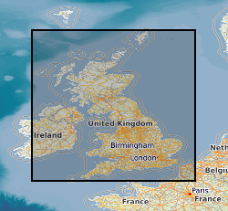
Mining hazard (not including coal) 1km hex grid version 7
The 1km Hex Mining Hazard (Not Including Coal) v7 dataset shows areas of known underground mining (Not Including Coal), identified with an indication of the level of hazard associated for each site. The presence of former underground workings, particularly where shallow, may collapse and cause surface settlement which is used to identify potential hazard at each site. The rating is based on a Low (limited mining known to have occurred) to High (underground mining is known to have occurred) scale. The dataset covers areas of known underground working in Great Britain. The coverage is not comprehensive as areas with no evidence of underground working are unclassified. Underground extraction of minerals and rocks has taken place in Great Britain for more than 5000 years. This dataset draws together a range of diverse information; the geology, the primary constraint on distribution; additional information sourced from published literature and knowledge from BGS experts. Derived from the original MiningHazardNotIncludingCoalGB_v7 dataset, this layer generalises these data into a Hex grid format, with an effective hexagonal grid resolution of 2.6km coverage area (side length of 1km). The dataset was created to provide a comprehensive overview of Great Britain's long and complicated mining legacy. It provides essential information for planners and developers working in areas where former underground mine workings may have occurred. Also for anyone involved in the ownership or management of property, including developers, householders and local government.
INSPIRE
Identification
- File identifier
- 4b3ac01e-f994-5f51-e054-002128a47908 XML
- Resource type
- dataset
Online resource
- Protocol
-
HTTP
Resource identifier
- Metadata Language
- English (en)
Encoding
Projection
Classification of data and services
- Topic category
-
- Geoscientific information
Classification of data and services
Coupled resource
Coupled resource
Classification of data and services
Coupled resource
Coupled resource
Keywords
- GEMET - INSPIRE themes, version 1.0
- BGS Thesaurus of Geosciences
-
-
Geohazards
-
Mining
-
Underground mining
-
data.gov.uk (non-INSPIRE)
-
Geographic coverage
))
Temporal reference
Temporal extent
Temporal extent
- Dataset Reference Date ()
- 2017-02
Quality and validity
- Lineage
-
This dataset is directly derived from the MiningHazardNotIncludingCoalGB_v7 dataset, which in turn was derived from a diverse range of material. It was constructed using GIS software via seven individual data layers each of which was created either from DiGMapGB-50k Bedrock data, information from literature and local and expert knowledge. The data is compiled into a series of individual data layers which undergo a series of GIS data processes before being combined and edited into a single final data layer. Information is then checked by geologists with detailed local knowledge.
- Denominator
- 50000
Conformity
Conformity
Conformity
Conformity
Conformity
Conformity
- Explanation
-
See the referenced specification
Restrictions on access and use
- Access constraints
- license
- Access constraints
-
The copyright of materials derived from the British Geological Survey's work is vested in the Natural Environment Research Council [NERC]. No part of this work may be reproduced or transmitted in any form or by any means, or stored in a retrieval system of any nature, without the prior permission of the copyright holder, via the BGS Intellectual Property Rights Manager. Use by customers of information provided by the BGS, is at the customer's own risk. In view of the disparate sources of information at BGS's disposal, including such material donated to BGS, that BGS accepts in good faith as being accurate, the Natural Environment Research Council (NERC) gives no warranty, expressed or implied, as to the quality or accuracy of the information supplied, or to the information's suitability for any use. NERC/BGS accepts no liability whatever in respect of loss, damage, injury or other occurence however caused.
- Access constraints
-
The dataset is made available to external clients under BGS Digital Data Licence terms and conditions. Revert to the IPR Section (iprdigital@bgs.ac.uk) if further advice is required with regard to permitted usage. iprdigital@bgs.ac The dataset is made available to external clients under BGS Digital Data Licence terms and conditions. Revert to the IPR Section (iprdigital@bgs.ac.uk) if further advice is required with regard to permitted usage.
Responsible organization (s)
Contact for the resource
- Organisation name
-
British Geological Survey
-
enquiries@bgs.ac enquiries@bgs.ac.uk
- Organisation name
-
British Geological Survey
-
enquiries@bgs.ac enquiries@bgs.ac.uk
Responsible organization (s)
Contact for the resource
- Organisation name
-
British Geological Survey
-
enquiries@bgs.ac enquiries@bgs.ac.uk
- Organisation name
-
British Geological Survey
-
enquiries@bgs.ac enquiries@bgs.ac.uk
Metadata information
Contact for the metadata
- Organisation name
-
British Geological Survey
-
enquiries@bgs.ac enquiries@bgs.ac.uk
- Metadata Date
- 2024-04-18
- Metadata Language
- English (en)