 BGS Metadata Catalogue
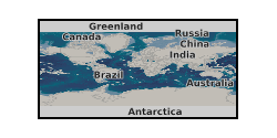
International Geomagnetic Reference Field
The IGRF is a global model of the geomagnetic field. It allows spot values of the geomagnetic field vector to be calculated anywhere from the Earth's core out into space. The IGRF is generally revised every five years by a group of modellers associated with the International Association of Geomagnetism and Aeronomy (IAGA).
Simple
- Alternate title
-
IGRF
- Date (Publication)
- 2014
- Citation identifier
- http://data.bgs.ac.uk/id/dataHolding/13607111
- Point of contact
-
Organisation name Individual name Electronic mail address Role British Geological Survey
Enquiries
Author British Geological Survey
Enquiries
Distributor British Geological Survey
Enquiries
Point of contact
- Maintenance and update frequency
- As needed
-
GEMET - INSPIRE themes, version 1.0
- dataCentre
- Keywords
-
-
NERC_DDC
-
- Access constraints
- Other restrictions
- Other constraints
- no limitations
- Other constraints
- The dataset is made freely available for access, e.g. via the Internet. Either no third party data / information is contained in the dataset or BGS has secured written permission from the owner(s) of any third party data / information contained in the dataset to make the dataset freely accessible.
- Use constraints
- Other restrictions
- Other constraints
-
The copyright of materials derived from the British Geological Survey's work is vested in the Natural Environment Research Council [NERC]. No part of this work may be reproduced or transmitted in any form or by any means, or stored in a retrieval system of any nature, without the prior permission of the copyright holder, via the BGS Intellectual Property Rights Manager. Use by customers of information provided by the BGS, is at the customer's own risk. In view of the disparate sources of information at BGS's disposal, including such material donated to BGS, that BGS accepts in good faith as being accurate, the Natural Environment Research Council (NERC) gives no warranty, expressed or implied, as to the quality or accuracy of the information supplied, or to the information's suitability for any use. NERC/BGS accepts no liability whatever in respect of loss, damage, injury or other occurence however caused.
- Other constraints
-
There are no restrictions on the use that may be made of the dataset, although an appropriate copyright acknowledgement must be made when any part of the dataset is reproduced. Either no third party data / information is contained in the dataset or BGS has secured written permission from the owner of any third party data / information contained in the dataset to make the dataset freely available without any use constraints - inclusion of any third party data / information will affect the copyright acknowledgement that needs to be made.
- Spatial representation type
- Grid
- Language
- English
- Topic category
-
- Geoscientific information
- Geographic identifier
-
WORLD [id=100000]
British Geological Survey Gazetteer: Geographical hierarchy from Geosaurus 1979 creation
))
- Begin date
- 1900
- End date
- 2025
Vertical extent
- Minimum value
- -100.0000
- Maximum value
- 3000.0000
Vertical datum
- Unique resource identifier
- WGS 84 (EPSG::4326)
- Distribution format
-
Name Version Fortran source code
12
- Distributor contact
-
Organisation name Individual name Electronic mail address Role British Geological Survey
Enquiries
Distributor
- OnLine resource
-
Protocol Linkage Name WWW:LINK-1.0-http--link
https://geomag.bgs.ac.uk/research/modelling/IGRF.html The IGRF Model
- OnLine resource
-
Protocol Linkage Name WWW:LINK-1.0-http--link
https://geomag.bgs.ac.uk/data_service/models_compass/igrf_calc.html International Geomagnetic Reference Field (IGRF), 14th Generation Calculator
- Hierarchy level
- Dataset
- Other
-
dataset
Conformance result
- Title
-
INSPIRE Implementing rules laying down technical arrangements for the interoperability and harmonisation of Geology
- Date (Publication)
- 2011
- Explanation
-
See the referenced specification
- Pass
- No
Conformance result
- Title
-
Commission Regulation (EU) No 1089/2010 of 23 November 2010 implementing Directive 2007/2/EC of the European Parliament and of the Council as regards interoperability of spatial data sets and services
- Date (Publication)
- 2010-12-08
- Explanation
-
See http://eur-lex.europa.eu/LexUriServ/LexUriServ.do?uri=OJ:L:2010:323:0011:0102:EN:PDF
- Pass
- No
- Statement
-
The IGRF is a global model of the geomagnetic field. It allows spot values of the geomagnetic field vector to be calculated anywhere from the Earth's core out into space. The IGRF is generally revised every five years by a group of modellers associated with the International Association of Geomagnetism and Aeronomy (IAGA). See http://geomag.bgs.ac.uk/data_service/models_compass/igrf.html
Metadata
- File identifier
- 4932d2d9-1839-3ea6-e054-002128a47908 XML
- Metadata language
- English
- Hierarchy level
- Dataset
- Date stamp
- 2026-06-23
- Metadata standard name
- UK GEMINI
- Metadata standard version
-
2.3
- Metadata author
-
Organisation name Individual name Electronic mail address Role British Geological Survey
Point of contact
- Dataset URI
)))
