BGS Data Catalogue
Stream sediment geochemistry (500m Grid) dataset
This dataset represents the first publication of complete national maps from the Geochemical Baseline Survey of the Environment (G-BASE) and TellusNI projects, whose aim was to conduct a national geochemical survey of the United Kingdom in order to improve understanding of our geology and environment and provide quantitative evidence against which to gauge future environmental change. This dataset consists of a series of interpolated raster (ASCII grid) maps displaying the concentrations of a suite of chemical elements (and oxides) in the stream sediments of the United Kingdom. The chemical elements are as follows: Arsenic, Barium, Calcium (CaO), Chromium, Cobalt, Copper, Iron (Fe2O3), Lanthanum, Lead, Magnesium (MgO), Manganese (MnO), Nickel, Potassium (K2O), Rubidium, Uranium, Vanadium, Zinc and Zirconium.
INSPIRE
Identification
- File identifier
- 4801e6b7-8e48-37fe-e054-002128a47908 XML
- Resource type
- dataset
Online resource
Resource identifier
- Metadata Language
- English (en)
Encoding
Projection
Classification of data and services
- Topic category
-
- Geoscientific information
Classification of data and services
Coupled resource
Coupled resource
Classification of data and services
Coupled resource
Coupled resource
Keywords
- GEMET - INSPIRE themes, version 1.0
- BGS Thesaurus of Geosciences
-
-
Barium
-
Iron
-
Potassium
-
Calcium
-
Uranium
-
Arsenic
-
Lanthanum
-
Manganese
-
Vanadium
-
data.gov.uk (non-INSPIRE)
-
Cobalt
-
Rubidium
-
Zinc
-
Fluvial sediments
-
Nickel
-
Copper
-
Geochemistry
-
Lead
-
Chromium
-
Magnesium
-
Zirconium
-
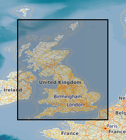
Geographic coverage
))
Temporal reference
Temporal extent
Temporal extent
- Dataset Reference Date ()
- 2017-02
Quality and validity
- Lineage
-
The source data for the product is; -Stream sediment analytical data generated by the G-BASE Project (and its predecessors) of the British Geological Survey between 1968 and 2013. -Stream sediment analytical data generated by the Tellus NI Project of the Geological Survey of Northern Ireland between 1994 and 2006. Throughout the lifetime of the G-BASE and Tellus NI projects, strict quality control procedures have been in place at all stages from sample collection to analytical data reporting. Analytical data have been closely monitored to ensure continuity during numerous field campaigns and between different analytical methods. All data have been conditioned with respect to primary reference materials in order to provide both accurate and precise element concentrations with a high degree of confidence. The data in the BGS_SedGC_500m dataset has been interpolated from the original stream sediment geochemistry point sample data using ordinary kriging. Each chemical element is presented as a national model of elemental concentration and includes a model of uncertainty (derived by the kriging process). The sample site data for G-BASE and TellusNI are available on request from BGS, and are provided in British National Grid or Irish National Grid coordinates as relevant. Further details can be found on the BGS website ( http://www.bgs.ac.uk/gbase/sampling.html).
Conformity
Conformity
Conformity
Conformity
Conformity
Conformity
- Explanation
-
See the referenced specification
Restrictions on access and use
- Access constraints
- copyright
- Access constraints
-
The copyright of materials derived from the British Geological Survey's work is vested in the Natural Environment Research Council [NERC]. No part of this work may be reproduced or transmitted in any form or by any means, or stored in a retrieval system of any nature, without the prior permission of the copyright holder, via the BGS Intellectual Property Rights Manager. Use by customers of information provided by the BGS, is at the customer's own risk. In view of the disparate sources of information at BGS's disposal, including such material donated to BGS, that BGS accepts in good faith as being accurate, the Natural Environment Research Council (NERC) gives no warranty, expressed or implied, as to the quality or accuracy of the information supplied, or to the information's suitability for any use. NERC/BGS accepts no liability whatever in respect of loss, damage, injury or other occurence however caused.
- Access constraints
-
There are no restrictions on the use that may be made of the dataset, although an appropriate copyright acknowledgement must be made when any part of the dataset is reproduced. Either no third party data / information is contained in the dataset or BGS has secured written permission from the owner of any third party data / information contained in the dataset to make the dataset freely available without any use constraints - inclusion of any third party data / information will affect the copyright acknowledgement that needs to be made.
Responsible organization (s)
Contact for the resource
- Organisation name
-
British Geological Survey
-
enquiries@bgs.ac enquiries@bgs.ac.uk
- Organisation name
-
British Geological Survey
-
enquiries@bgs.ac enquiries@bgs.ac.uk
Responsible organization (s)
Contact for the resource
- Organisation name
-
British Geological Survey
-
enquiries@bgs.ac enquiries@bgs.ac.uk
- Organisation name
-
British Geological Survey
-
enquiries@bgs.ac enquiries@bgs.ac.uk
Metadata information
Contact for the metadata
- Organisation name
-
British Geological Survey
-
enquiries@bgs.ac enquiries@bgs.ac.uk
- Metadata Date
- 2024-04-18
- Metadata Language
- English (en)