BGS Data Catalogue
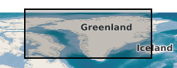
2013 Time lapse photography of Helheim glacier (NERC grant NE/I007148/1)
These high resolution high-oblique time-lapse images were collected in hourly intervals from 5 locations around Helheim glacier in SE Greenland in the summer of 2013. Three cameras (Cameras 1, 2 and 3) were aimed at the calving front ~3.5 km down glacier from the calving front and two cameras (Cameras 4 and 5) were aimed cross-glacier ~3 km up glacier from the calving front. The images are in two stereo groups allowing the extraction of 3D data with significant processing though there are some optical issues that will degrade quality. Links to Published Papers: 1, Extensive Retreat of Greenland Tidewater Glaciers 2000-2010. http://dx.doi.org/10.1657/AAAR0014-049 2, Dynamics of glacier calving at the ungrounded margin of Helheim Glacier South East Greenland. http://dx.doi.org/10.1002/2015JF003531 3, Reverse Glacier motion during Iceberg calving and the cause of Glacial Earthquakes. http://dx.doi.org/10.1126/science.aab0460. 5, A High-resolution Sensor Network for Monitoring Glacier Dynamics. http://dx.doi.org/10.1109/JSEN.2014.2348534. , On the Role of Buoyant Flexure in Glacier Calving. 6, Buoyant Flexure controls summer dynamic mass loss at Helheim Glacier Greenland
INSPIRE
Identification
- File identifier
- 46479a68-84b7-03c6-e054-002128a47908 XML
- Resource type
- dataset
Online resource
Resource identifier
- Metadata Language
- English (en)
- Spatial representation type
- grid
Encoding
- Format
-
zip files
- Format
-
Z files
- Format
-
CR2 files
Projection
Classification of data and services
- Topic category
-
- Geoscientific information
Classification of data and services
Coupled resource
Coupled resource
Classification of data and services
Coupled resource
Coupled resource
Keywords
- GEMET - INSPIRE themes, version 1.0
- BGS Thesaurus of Geosciences
-
-
Photogrammetry
-
Glaciers
-
NGDC Deposited Data
-
Geographic coverage
))
Temporal reference
Temporal extent
Temporal extent
- Dataset Reference Date ()
- 2015-03
Quality and validity
- Lineage
-
Cameras 1-3 were Canon EOS 50Ds and generated images of dimensions 4752 x 3168 at 4.6 um sensor resolution. Cameras 4-5 are Canon EOS 7Ds and generated images of dimensions 5184 x 3456 and 4.2 um sensor resolution. The imagery is in Canon .CR2 RAW format and have not undergone any processing.
Conformity
Conformity
Conformity
Conformity
Conformity
Conformity
- Explanation
-
See the referenced specification
Restrictions on access and use
- Access constraints
- no limitations
- Access constraints
- The dataset is made freely available for access, e.g. via the Internet. Either no third party data / information is contained in the dataset or BGS has secured written permission from the owner(s) of any third party data / information contained in the dataset to make the dataset freely accessible.
- Access constraints
-
The copyright of materials derived from the British Geological Survey's work is vested in the Natural Environment Research Council [NERC]. No part of this work may be reproduced or transmitted in any form or by any means, or stored in a retrieval system of any nature, without the prior permission of the copyright holder, via the BGS Intellectual Property Rights Manager. Use by customers of information provided by the BGS, is at the customer's own risk. In view of the disparate sources of information at BGS's disposal, including such material donated to BGS, that BGS accepts in good faith as being accurate, the Natural Environment Research Council (NERC) gives no warranty, expressed or implied, as to the quality or accuracy of the information supplied, or to the information's suitability for any use. NERC/BGS accepts no liability whatever in respect of loss, damage, injury or other occurence however caused.
- Access constraints
-
Available under the Open Government Licence subject to the following acknowledgement accompanying the reproduced NERC materials "Contains NERC materials ©NERC [year]"
Responsible organization (s)
Contact for the resource
- Organisation name
-
University of Swansea
-
not available
- Organisation name
-
University of Swansea
-
not available
- Organisation name
-
University of Swansea
-
not available
- Organisation name
-
British Geological Survey
-
not available
- Organisation name
-
British Geological Survey
-
not available
Metadata information
Contact for the metadata
- Organisation name
-
British Geological Survey
-
enquiries@bgs.ac enquiries@bgs.ac.uk
- Metadata Date
- 2024-04-25
- Metadata Language
- English (en)