 BGS Metadata Catalogue
Aquifer Designation Dataset for Wales version 2
This dataset classifies bedrock and superficial geologic units according to their aquifer designation - Principal Aquifers, Secondary Aquifers (Secondary A, Secondary B, and Secondary undifferentiated), and Unproductive Strata. The Environment Agency (EA) and Natural Resources Wales (NRW) help to protect groundwater by identifying different types of aquifers ‐ underground layers of water‐bearing, permeable rock or drift deposits from which groundwater can be extracted. The groundwater protection policies for the EA and Natural Resources Wales use aquifer designations that are consistent with the Water Framework Directive. These designations reflect the importance of aquifers in terms of groundwater as a resource (such as a drinking water supply) but also their role in supporting surface water flows and wetland ecosystems. The aquifer designation dataset is jointly owned by the British Geological Survey (BGS) and Natural Resources Wales (NRW). The dataset covers geologic units mapped in Wales, and is derived from BGS Geology 50k (DiGMapGB-50).
INSPIRE
Identification
- File identifier
- 45f8ef65-d50a-4908-e054-002128a47908 XML
- Title
-
Aquifer Designation Dataset for Wales version 2
- Hierarchy level
- Dataset
Online resource
- Protocol
-
WWW:LINK-1.0-http--link
- Protocol
-
WWW:LINK-1.0-http--link
Resource identifier
- Metadata language
- English
- Spatial representation type
- Vector
Encoding
- Format
-
ESRI Shapefile
Projection
Classification of data and services
- Topic category
-
- Geoscientific information
Keywords
-
GEMET - INSPIRE themes, version 1.0
-
BGS Thesaurus of Geosciences
-
-
Ground water movement
-
Groundwater
-
Aquifers
-
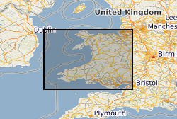
Geographic coverage
))
Temporal reference
Temporal extent
- End
- 2016 Before
Temporal extent
- Date (Creation)
- 2016
Quality and validity
- Lineage
-
Dataset derived from DiGMapGB-50 v6 linework. Aquifer designation status attributed to linework by BGS and Environment Agency (EA) staff. Data then passed from EA to Natural Resources Wales. BGS responsible for final geoprocessing steps (removing DiGMap attribution and merging shared boundaries).
- Denominator
- 50000
Conformity
Conformity
Conformity
- Title
-
INSPIRE Implementing rules laying down technical arrangements for the interoperability and harmonisation of Geology
- Title
-
Commission Regulation (EU) No 1089/2010 of 23 November 2010 implementing Directive 2007/2/EC of the European Parliament and of the Council as regards interoperability of spatial data sets and services
Restrictions on access and use
- Access constraints
- no limitations
- Access constraints
- The dataset is made freely available for access, e.g. via the Internet. Either no third party data / information is contained in the dataset or BGS has secured written permission from the owner(s) of any third party data / information contained in the dataset to make the dataset freely accessible.
- Access constraints
-
The copyright of materials derived from the British Geological Survey's work is vested in the Natural Environment Research Council [NERC]. No part of this work may be reproduced or transmitted in any form or by any means, or stored in a retrieval system of any nature, without the prior permission of the copyright holder, via the BGS Intellectual Property Rights Manager. Use by customers of information provided by the BGS, is at the customer's own risk. In view of the disparate sources of information at BGS's disposal, including such material donated to BGS, that BGS accepts in good faith as being accurate, the Natural Environment Research Council (NERC) gives no warranty, expressed or implied, as to the quality or accuracy of the information supplied, or to the information's suitability for any use. NERC/BGS accepts no liability whatever in respect of loss, damage, injury or other occurence however caused.
- Access constraints
-
The dataset is made available to external clients under BGS Digital Data Licence terms and conditions. Revert to the IPR Section ( iprdigital@bgs.ac.uk) if further advice is required with regard to permitted usage.
Responsible organization (s)
Contact for the resource
- Organisation name
-
British Geological Survey
- Organisation name
-
British Geological Survey
- Organisation name
-
British Geological Survey
- Organisation name
-
British Geological Survey
Metadata information
Contact for the metadata
- Organisation name
-
British Geological Survey
- Date stamp
- 2026-05-22
- Metadata language
- English
)))
