 BGS Metadata Catalogue
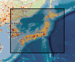
Tephra occurrences offshore Japan, collected from shipboard records of IODP, ODP and DSDP sediment cores. (NERC grant NE/I006125/1)
This MS Excel dataset contains tephra depth and age data from ocean drilling expeditions around Japan. IODP, ODP and DSDP shipboard core description records were examined for mentions of volcanic ash, tephra etc., according to criteria described in Mahony et al. 2014. Data are from shipboard visual core descriptions of ocean drilling expeditions located within a few hundred km of Japan. Cores without published age-depth data are not included in this dataset. The expeditions occurred between 1973 (DSDP 31) to 2013 (IODP 346). Tephra layers are dated as being deposited between 0.003-18.5 Ma. This data will be of interest to volcanologists or anyone interested in the location of volcanic ash layers within IODP cores.
Simple
- Date (Creation)
- 2014-05
- Citation identifier
- http://data.bgs.ac.uk/id/dataHolding/13607069
- Point of contact
-
Organisation name Individual name Electronic mail address Role University of Bristol
Professor Stephen Sparks
not available
Point of contact University of Bristol
Dr Sue Mahony
not available
Point of contact
- Maintenance and update frequency
- notApplicable
-
GEMET - INSPIRE themes, version 1.0
-
BGS Thesaurus of Geosciences
-
-
Volcanic ejecta
-
Volcanic ash
-
- dataCentre
- Keywords
-
-
NERC_DDC
-
- Access constraints
- Other restrictions
- Other constraints
- no limitations
- Other constraints
- The dataset is made freely available for access, e.g. via the Internet. Either no third party data / information is contained in the dataset or BGS has secured written permission from the owner(s) of any third party data / information contained in the dataset to make the dataset freely accessible.
- Use constraints
- Other restrictions
- Other constraints
-
The copyright of materials derived from the British Geological Survey's work is vested in the Natural Environment Research Council [NERC]. No part of this work may be reproduced or transmitted in any form or by any means, or stored in a retrieval system of any nature, without the prior permission of the copyright holder, via the BGS Intellectual Property Rights Manager. Use by customers of information provided by the BGS, is at the customer's own risk. In view of the disparate sources of information at BGS's disposal, including such material donated to BGS, that BGS accepts in good faith as being accurate, the Natural Environment Research Council (NERC) gives no warranty, expressed or implied, as to the quality or accuracy of the information supplied, or to the information's suitability for any use. NERC/BGS accepts no liability whatever in respect of loss, damage, injury or other occurence however caused.
- Other constraints
-
The dataset is made available to external clients under BGS Digital Data Licence terms and conditions. Revert to the IPR Section ( iprdigital@bgs.ac.uk) if further advice is required with regard to permitted usage.
- Language
- English
- Topic category
-
- Geoscientific information
- Geographic identifier
-
JAPAN SEA [id=2001431]
British Geological Survey Gazetteer: Gazetteer of sea areas 2010 revision
))
- End date
- 2014-05 Before
Reference System Information
- Distribution format
-
Name Version
- OnLine resource
-
Protocol Linkage Name WWW:LINK-1.0-http--related
http://dx.doi.org/10.1002/2016GC006362 Citation Information - Digital Object Identifier (DOI)
- OnLine resource
-
Protocol Linkage Name WWW:DOWNLOAD-1.0-http--download
https://webapps.bgs.ac.uk/services/ngdc/accessions/index.html#item71849 Data
- Hierarchy level
- Dataset
- Other
-
dataset
Conformance result
- Title
-
INSPIRE Implementing rules laying down technical arrangements for the interoperability and harmonisation of Geology
- Date (Publication)
- 2011
- Explanation
-
See the referenced specification
- Pass
- No
Conformance result
- Title
-
Commission Regulation (EU) No 1089/2010 of 23 November 2010 implementing Directive 2007/2/EC of the European Parliament and of the Council as regards interoperability of spatial data sets and services
- Date (Publication)
- 2010-12-08
- Explanation
-
See http://eur-lex.europa.eu/LexUriServ/LexUriServ.do?uri=OJ:L:2010:323:0011:0102:EN:PDF
- Pass
- No
- Statement
-
Tephra occurrences with descriptive terms are included if they have greater than 25% tephra/volcanic ash (see Mahony et al. 2014 for details). Core name follows the IODP naming protocol, e.g. 127-794A represents Expedition 127, Site 794, Hole A. Depth of ash is depth in metres to the bottom of the ash layer where known, either given in the VCD text or digital data file, or measured off the VCD diagram. Depth is measured in metres below sea floor (mbsf). Age of ash is the age in millions of years, calculated using the depth below sea floor and linear interpolation of points from appropriate age-depth models. The age-depth models used are listed in the other workbook tabs, with a link to the source of the age-depth model. Some are the age-depth models generated during the expedition, but where possible we have used post-cruise age-depth models, as they are likely to have improved or refined the original shipboard age-depth models.
Metadata
- File identifier
- 45d0d4cb-4a63-43a5-e054-002128a47908 XML
- Metadata language
- English
- Hierarchy level
- Dataset
- Date stamp
- 2026-07-11
- Metadata standard name
- UK GEMINI
- Metadata standard version
-
2.3
- Metadata author
-
Organisation name Individual name Electronic mail address Role British Geological Survey
Point of contact
- Dataset URI
)))
