 BGS Metadata Catalogue
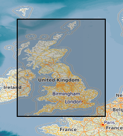
BGS Superficial Deposits Thickness Model 1 km hex grid
This dataset shows the variation of the thickness of superficial (Quaternary age) deposits across Great Britain. The data are presented as a vector map of interlocking hexagon cells (side length 1 km, area c. 2.6 km2) covering the landmass of Great Britain as a regular grid. Each hexagon cell is attributed with statistics about the thickness of the underlying Quaternary units (average thickness and maximum thickness) for that cell. Additional information relating to the coverage of the underpinning data is also provided. The data are derived from the BGS Basic Superficial Thickness Model (BSTM). The data is all derived by spatially summarising the information within the BGS Basic Superficial Thickness Model (BSTM), which is a 50 m cell size raster model of superficial thickness, first published in 2010.
Simple
- Date (Creation)
- 2017-10
- Citation identifier
- http://data.bgs.ac.uk/id/dataHolding/13607068
- Point of contact
-
Organisation name Individual name Electronic mail address Role British Geological Survey
Enquiries
Distributor British Geological Survey
Enquiries
Point of contact
- Maintenance and update frequency
- As needed
-
GEMET - INSPIRE themes, version 1.0
-
BGS Thesaurus of Geosciences
-
-
Geological models
-
Surficial geology
-
Geological data
-
Quaternary
-
- dataCentre
- Keywords
-
-
NERC_DDC
-
- Access constraints
- Other restrictions
- Other constraints
- no limitations
- Other constraints
- The dataset is made freely available for access, e.g. via the Internet. Either no third party data / information is contained in the dataset or BGS has secured written permission from the owner(s) of any third party data / information contained in the dataset to make the dataset freely accessible.
- Use constraints
- Other restrictions
- Other constraints
-
The copyright of materials derived from the British Geological Survey's work is vested in the Natural Environment Research Council [NERC]. No part of this work may be reproduced or transmitted in any form or by any means, or stored in a retrieval system of any nature, without the prior permission of the copyright holder, via the BGS Intellectual Property Rights Manager. Use by customers of information provided by the BGS, is at the customer's own risk. In view of the disparate sources of information at BGS's disposal, including such material donated to BGS, that BGS accepts in good faith as being accurate, the Natural Environment Research Council (NERC) gives no warranty, expressed or implied, as to the quality or accuracy of the information supplied, or to the information's suitability for any use. NERC/BGS accepts no liability whatever in respect of loss, damage, injury or other occurence however caused.
- Other constraints
-
Available under the Open Government Licence subject to the following acknowledgement accompanying the reproduced NERC materials "Contains NERC materials ©NERC [year]"
- Spatial representation type
- Vector
- Distance
- 1000 urn:ogc:def:uom:EPSG::9001
- Language
- English
- Topic category
-
- Geoscientific information
- Geographic identifier
-
GBN
ISO 3166_2 2009 revision
- Geographic identifier
-
GREAT BRITAIN [id=139600]
British Geological Survey Gazetteer: Geographical hierarchy from Geosaurus 1979 creation
))
- End date
- 2016-10 Before
- Unique resource identifier
- OSGB 1936 / British National Grid (EPSG::27700)
- Unique resource identifier
- WGS 84 (EPSG::4326)
- Distribution format
-
Name Version ESRI Shapefile
1994
OGC GeoPackage (GPKG)
- Distributor contact
-
Organisation name Individual name Electronic mail address Role British Geological Survey
Enquiries
Distributor
- OnLine resource
-
Protocol Linkage Name WWW:LINK-1.0-http--link
https://www.bgs.ac.uk/datasets/superficial-thickness-model-1-km-hex-grid/ Superficial thickness 1 km hex grid
- Hierarchy level
- Dataset
- Other
-
dataset
Conformance result
- Title
-
INSPIRE Implementing rules laying down technical arrangements for the interoperability and harmonisation of Geology
- Date (Publication)
- 2011
- Explanation
-
See the referenced specification
- Pass
- No
Conformance result
- Title
-
Commission Regulation (EU) No 1089/2010 of 23 November 2010 implementing Directive 2007/2/EC of the European Parliament and of the Council as regards interoperability of spatial data sets and services
- Date (Publication)
- 2010-12-08
- Explanation
-
See http://eur-lex.europa.eu/LexUriServ/LexUriServ.do?uri=OJ:L:2010:323:0011:0102:EN:PDF
- Pass
- No
- Statement
-
These data have been generalised (using spatial statistics) from the original, high resolution BGS Superficial Deposit Thickness Models, first published in 2010. Details of how the original models were made can found in their downloadable user guide: User Guide for the British Geological Survey Superficial Deposit Thickness (1Km Hex-Grid) dataset. British Geological Survey Open Report OR/16/57: http://www.bgs.ac.uk/products/onshore/superficialThickness.html. To create this new dataset, the original BSTM (Basic Superficial Thickness Model) was spatially summarised by aggregating the original 50 m resolution raster data into vector hexagons (of area 2.6 km2). A typical hexagon cell contains the equivalent of just over 1000 raster cells (50 m x 50 m) from the original model. This means that each hexagon can extract its summary values from up to c. 1000 input cells. All spatial processing was performed in ESRI ArcGIS 10.3 using the zonal statistics tool within the Spatial Analyst extension. The data have been checked via standard BGS publication procedures.
Metadata
- File identifier
- 45baa372-d5c6-6f64-e054-002128a47908 XML
- Metadata language
- English
- Hierarchy level
- Dataset
- Date stamp
- 2026-06-24
- Metadata standard name
- UK GEMINI
- Metadata standard version
-
2.3
- Metadata author
-
Organisation name Individual name Electronic mail address Role British Geological Survey
Point of contact
- Dataset URI
)))
