 BGS Metadata Catalogue
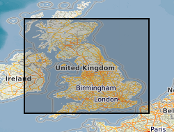
BGS UK Coal Resource for New Exploitation Technologies (Version 1)
The UK contains extensive resources of coal, both at surface and in the subsurface. It is estimated that onshore these surface and subsurface deposits cover an area of approximately 40,000 km2. This dataset is derived from a 2004 study to assess the potential of the UK onshore coal resources for both exploitation by conventional (mining) and new technologies. Digital data was created using a Geographic Information System (GIS) to produce the delivered output of the original project, a series of paper maps that would identify prospective areas. The dataset layers include: Mining Technologies: Area with technical potential for opencast workings (source Coal Resource Map of Great Britain BGS/Coal Authority 1999) Underground mining exploration prospects Good prospects for abandoned mine methane (AMM) (Mine workings not recovered) Resource area for coal mine methane (CMM) (source Coal Authority Underground Licences, May 2002) Extent of underground workings with 500m buffer zone (based on Coal Authority data, May 2002) New Technologies: Area greater than 1200m from surface with potential for CO2 sequestration Area with good coalbed methane (CBM) potential Underground coal gasification (UCG) potential Coalbed methane (CBM) resource area Coal-bearing strata
Simple
- Date (Creation)
- 2016-11
- Citation identifier
- http://data.bgs.ac.uk/id/dataHolding/13607055
- Point of contact
-
Organisation name Individual name Electronic mail address Role British Geological Survey
Enquiries
Distributor British Geological Survey
Enquiries
Point of contact
- Maintenance and update frequency
- Not planned
-
GEMET - INSPIRE themes, version 1.0
-
BGS Thesaurus of Geosciences
-
-
Carbon dioxide
-
Coal gasification
-
Coal resources
-
Coal
-
Coal exploration
-
Coalbed methane
-
Coal resource maps
-
Underground gasification
-
Abandoned mines
-
Mine exploration
-
Methane
-
Mining
-
- dataCentre
- Keywords
-
-
NERC_DDC
-
- Access constraints
- Other restrictions
- Other constraints
- intellectualPropertyRights
- Use constraints
- Other restrictions
- Other constraints
-
The copyright of materials derived from the British Geological Survey's work is vested in the Natural Environment Research Council [NERC]. No part of this work may be reproduced or transmitted in any form or by any means, or stored in a retrieval system of any nature, without the prior permission of the copyright holder, via the BGS Intellectual Property Rights Manager. Use by customers of information provided by the BGS, is at the customer's own risk. In view of the disparate sources of information at BGS's disposal, including such material donated to BGS, that BGS accepts in good faith as being accurate, the Natural Environment Research Council (NERC) gives no warranty, expressed or implied, as to the quality or accuracy of the information supplied, or to the information's suitability for any use. NERC/BGS accepts no liability whatever in respect of loss, damage, injury or other occurence however caused.
- Other constraints
-
Either: (i) the dataset is made freely available, e.g. via the Internet, for a restricted category of use (e.g. educational use only); or (ii) the dataset has not been formally approved by BGS for access and use by external clients under licence, but its use may be permitted under alternative formal arrangements; or (iii) the dataset contains 3rd party data or information obtained by BGS under terms and conditions that must be consulted in order to determine the permitted usage of the dataset. Refer to the BGS staff member responsible for the creation of the dataset if further advice is required. He / she should be familiar with the composition of the dataset, particularly with regard to 3rd party IPR contained in it, and any resultant use restrictions. This staff member should revert to the IPR Section ( ipr@bgs.ac.uk) for advice, should the position not be clear.
- Denominator
- 1000000
- Language
- English
- Topic category
-
- Geoscientific information
- Geographic identifier
-
GB
ISO 3166_1 alpha-3 2009 revision
- Geographic identifier
-
UK [id=139300]
British Geological Survey Gazetteer: Geographical hierarchy from Geosaurus 1979 creation
- Geographic identifier
-
UKM
ISO 3166_2 2009 revision
))
- End date
- 2016-11 Before
- Unique resource identifier
- OSGB 1936 / British National Grid (EPSG::27700)
- Distribution format
-
Name Version
- Distributor contact
-
Organisation name Individual name Electronic mail address Role British Geological Survey
Enquiries
Distributor
- OnLine resource
-
Protocol Linkage Name WWW:LINK-1.0-http--link
https://www.bgs.ac.uk/ BGS Homepage
- Hierarchy level
- Dataset
- Other
-
dataset
Conformance result
- Title
-
INSPIRE Implementing rules laying down technical arrangements for the interoperability and harmonisation of Geology
- Date (Publication)
- 2011
- Explanation
-
See the referenced specification
- Pass
- No
Conformance result
- Title
-
Commission Regulation (EU) No 1089/2010 of 23 November 2010 implementing Directive 2007/2/EC of the European Parliament and of the Council as regards interoperability of spatial data sets and services
- Date (Publication)
- 2010-12-08
- Explanation
-
See http://eur-lex.europa.eu/LexUriServ/LexUriServ.do?uri=OJ:L:2010:323:0011:0102:EN:PDF
- Pass
- No
- Statement
-
The data was originally created in 2004 as part of a project carried out by the British Geological Survey, with the assistance of Wardell Armstrong and Imperial College, London. It represents a summary of the results of the Study of the UK Coal Resource for New Exploitation Technologies Project, carried out for the DTI Cleaner Coal Technology Programme under the management of Future Energy Solutions. For more information please see the project report (Jones et al, 2004), available at http://www.bgs.ac.uk/downloads/start.cfm?id=1712. The 2004 study drew on both existing and new digital data to produce a summary paper map with a nominal scale of 1: 1,750,000. The paper publication included regional coal fields at 1: 600,000 scale .
Metadata
- File identifier
- 42ab5bc4-0767-34fb-e054-002128a47908 XML
- Metadata language
- English
- Hierarchy level
- Dataset
- Date stamp
- 2026-06-25
- Metadata standard name
- UK GEMINI
- Metadata standard version
-
2.3
- Metadata author
-
Organisation name Individual name Electronic mail address Role British Geological Survey
Point of contact
- Dataset URI
)))
