 BGS Metadata Catalogue
Litho-, bio- and chrono-stratigraphy of tidal marsh sediments from south-central Chile (NERC grant NE/K000446/1)
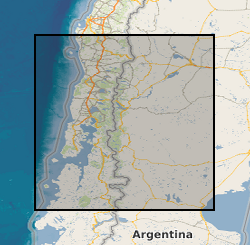
Stratigraphic and ecological data from tidal marsh sites in south-central Chile. Includes stratigraphy, diatom assemblages and radiocarbon dates from fossil cores and diatom assemblages from modern tidal marsh samples. Data were collected to provide evidence for multiple great earthquakes in south-central Chile, and enable the reconstruction of vertical land-level changes associated with these earthquakes. Data are from tidal marsh sites within the 1960 earthquake rupture area along the Chilean subduction zone (37.5 - 46 degrees South).
Simple
- Date (Creation)
- 2015-09
- Citation identifier
- http://data.bgs.ac.uk/id/dataHolding/13607023
- Point of contact
-
Organisation name Individual name Electronic mail address Role Northumbria University
Dr Emma Hocking
not available
Point of contact University of Durham
Dr Ed Garrett
not available
Point of contact
- Maintenance and update frequency
- notApplicable
-
GEMET - INSPIRE themes, version 1.0
-
BGS Thesaurus of Geosciences
-
-
Stratigraphy
-
Tidal flats
-
Carbon dating
-
Diatoms
-
Carbon isotopes
-
- dataCentre
- Keywords
-
-
NERC_DDC
-
- Access constraints
- Other restrictions
- Other constraints
- restricted
- Use constraints
- Other restrictions
- Other constraints
-
The copyright of materials derived from the British Geological Survey's work is vested in the Natural Environment Research Council [NERC]. No part of this work may be reproduced or transmitted in any form or by any means, or stored in a retrieval system of any nature, without the prior permission of the copyright holder, via the BGS Intellectual Property Rights Manager. Use by customers of information provided by the BGS, is at the customer's own risk. In view of the disparate sources of information at BGS's disposal, including such material donated to BGS, that BGS accepts in good faith as being accurate, the Natural Environment Research Council (NERC) gives no warranty, expressed or implied, as to the quality or accuracy of the information supplied, or to the information's suitability for any use. NERC/BGS accepts no liability whatever in respect of loss, damage, injury or other occurence however caused.
- Other constraints
-
Either: (i) the dataset is made freely available, e.g. via the Internet, for a restricted category of use (e.g. educational use only); or (ii) the dataset has not been formally approved by BGS for access and use by external clients under licence, but its use may be permitted under alternative formal arrangements; or (iii) the dataset contains 3rd party data or information obtained by BGS under terms and conditions that must be consulted in order to determine the permitted usage of the dataset. Refer to the BGS staff member responsible for the creation of the dataset if further advice is required. He / she should be familiar with the composition of the dataset, particularly with regard to 3rd party IPR contained in it, and any resultant use restrictions. This staff member should revert to the IPR Section ( ipr@bgs.ac.uk) for advice, should the position not be clear.
- Language
- English
- Topic category
-
- Geoscientific information
- Geographic identifier
-
CHILE [id=877000]
British Geological Survey Gazetteer: Geographical hierarchy from Geosaurus 1979 creation
- Geographic identifier
-
CHL
ISO 3166_1 alpha-3 2009 revision
- Geographic identifier
-
CL
ISO 3166_1 alpha-2 2009 revision
))
- End date
- 2015-09
- Supplemental Information
-
NERC grant NE/K000446/1
Reference System Information
- Distribution format
-
Name Version
- OnLine resource
-
Protocol Linkage Name WWW:DOWNLOAD-1.0-http--download
https://webapps.bgs.ac.uk/services/ngdc/accessions/index.html#item61175 Data
- Hierarchy level
- Dataset
- Other
-
dataset
Conformance result
- Title
-
INSPIRE Implementing rules laying down technical arrangements for the interoperability and harmonisation of Geology
- Date (Publication)
- 2011
- Explanation
-
See the referenced specification
- Pass
- No
Conformance result
- Title
-
Commission Regulation (EU) No 1089/2010 of 23 November 2010 implementing Directive 2007/2/EC of the European Parliament and of the Council as regards interoperability of spatial data sets and services
- Date (Publication)
- 2010-12-08
- Explanation
-
See http://eur-lex.europa.eu/LexUriServ/LexUriServ.do?uri=OJ:L:2010:323:0011:0102:EN:PDF
- Pass
- No
- Statement
-
Marsh front exposures, pits, gouge and Russian cores provided stratigraphic evidence for past earthquakes. We employed transects of cores to assess lateral continuity of stratigraphy. In order to obtain a training set of modern diatom assemblages, we sampled at low tide the top ~1 cm of sediment at regular vertical intervals along transects perpendicular to the direction of tidal inundation. Samples collected January 2013 and 2014. Samples were analysed for diatoms and plant macrofossils picked for radiocarbon dating. Radiocarbon dates were provided by the NERC Radiocarbon Facility. A diatom-based transfer function was developed in C2.
Metadata
- File identifier
- 3f5d93c7-378b-2fb2-e054-002128a47908 XML
- Metadata language
- English
- Hierarchy level
- Dataset
- Date stamp
- 2026-07-11
- Metadata standard name
- UK GEMINI
- Metadata standard version
-
2.3
- Metadata author
-
Organisation name Individual name Electronic mail address Role British Geological Survey
Point of contact
- Dataset URI
)))
