 BGS Metadata Catalogue
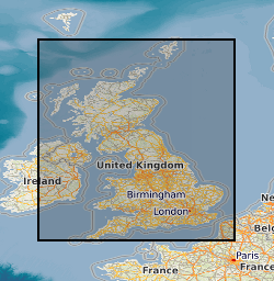
BGS Geology - 50k (DiGMapGB-50) Linear version 8
Linear features (shown as polylines) represent six classes of geological structural features e.g. faults, folds or landforms e.g. buried channels, glacial drainage channels at the ground or bedrock surface (beneath superficial deposits). Linear features are associated most closely with the bedrock theme either as an intrinsic part of it for example marine bands or affecting it in the case of faults. However landform elements are associated with both bedrock and superficial deposits. The linear features are organised into seven main categories: Alteration area indicating zones of change to the pre-existing rocks due to the application of heat and pressure that can occur round structural features such as faults and dykes. Fault where a body of bedrock has been fractured and displaced by a large scale process affecting the earth's crust. Fold where strata are bent or deformed resulting from changes or movement of the earth's surface creating heat and pressure to reshape and transform the original horizontal strata. Folds appear on all scales, in all rock types and from a variety of causes. Fossil horizons where prolific fossil assemblages occur and can be used to help establish the order in which deposits were laid down (stratigraphy). These horizons allow correlation where sediments of the same age look completely different due to variations in depositional environment. Mineral vein where concentrations of crystallised mineral occur within a rock, they are closely associated with faulting, but may occur independently. Landforms define the landscape by its surface form; these include glacial features such as drumlins, eskers and ice margins. Rock identifies key (marker) beds, recognised as showing distinct physical characteristics or fossil content. Examples include coal seams, gypsum beds and marine bands. The data are available in vector format (containing the geometry of each feature linked to a database record describing their attributes) as ESRI shapefiles and are available under BGS data licence.
Simple
- Date (Creation)
- 2016
- Citation identifier
- http://data.bgs.ac.uk/id/dataHolding/13607013
- Point of contact
-
Organisation name Individual name Electronic mail address Role British Geological Survey
Enquiries
Distributor British Geological Survey
Enquiries
Point of contact
- Maintenance and update frequency
- Not planned
-
GEMET - INSPIRE themes, version 1.0
-
BGS Thesaurus of Geosciences
-
-
Digital maps
-
Geology
-
Data
-
Maps
-
GIS
-
- dataCentre
- Keywords
-
-
NERC_DDC
-
- Access constraints
- Other restrictions
- Other constraints
- license
- Use constraints
- Other restrictions
- Other constraints
-
The copyright of materials derived from the British Geological Survey's work is vested in the Natural Environment Research Council [NERC]. No part of this work may be reproduced or transmitted in any form or by any means, or stored in a retrieval system of any nature, without the prior permission of the copyright holder, via the BGS Intellectual Property Rights Manager. Use by customers of information provided by the BGS, is at the customer's own risk. In view of the disparate sources of information at BGS's disposal, including such material donated to BGS, that BGS accepts in good faith as being accurate, the Natural Environment Research Council (NERC) gives no warranty, expressed or implied, as to the quality or accuracy of the information supplied, or to the information's suitability for any use. NERC/BGS accepts no liability whatever in respect of loss, damage, injury or other occurence however caused.
- Other constraints
-
The dataset is made available to external clients under BGS Digital Data Licence terms and conditions. Revert to the IPR Section ( iprdigital@bgs.ac.uk) if further advice is required with regard to permitted usage.
- Spatial representation type
- Vector
- Denominator
- 50000
- Language
- English
- Topic category
-
- Geoscientific information
- Geographic identifier
-
GBN
ISO 3166_2 2009 revision
- Geographic identifier
-
GREAT BRITAIN [id=139600]
British Geological Survey Gazetteer: Geographical hierarchy from Geosaurus 1979 creation
))
- End date
- 2016 Before
- Unique resource identifier
- OSGB 1936 / British National Grid (EPSG::27700)
- Distribution format
-
Name Version Other vector formats are available on request
witheld
ESRI Shapefile
1994
MapInfo (TAB)
witheld
- Distributor contact
-
Organisation name Individual name Electronic mail address Role British Geological Survey
Enquiries
Distributor
- OnLine resource
-
Protocol Linkage Name WWW:LINK-1.0-http--link
https://www.bgs.ac.uk/datasets/bgs-geology/ BGS Geology: onshore digital geological map of Great Britain data
- OnLine resource
-
Protocol Linkage Name WWW:LINK-1.0-http--related
https://doi.org/10.5285/df063ba2-008a-49f7-8727-176eb25fa65c Citation Information - Digital Object Identifier (DOI)
- Hierarchy level
- Dataset
- Other
-
dataset
Conformance result
- Title
-
INSPIRE Implementing rules laying down technical arrangements for the interoperability and harmonisation of Geology
- Date (Publication)
- 2011
- Explanation
-
See the referenced specification
- Pass
- No
Conformance result
- Title
-
Commission Regulation (EU) No 1089/2010 of 23 November 2010 implementing Directive 2007/2/EC of the European Parliament and of the Council as regards interoperability of spatial data sets and services
- Date (Publication)
- 2010-12-08
- Explanation
-
See http://eur-lex.europa.eu/LexUriServ/LexUriServ.do?uri=OJ:L:2010:323:0011:0102:EN:PDF
- Pass
- No
- Statement
-
The BGS Geology 50k dataset is a digital representation of the geology of Great Britain at 1: 50 000 scale (or 1:63 360 scale for areas surveyed and published prior to 1970). It is a compilation of digital tiles derived from previously published and unpublished maps, archive information and results of field mapping campaigns. The mapping, description and classification of rocks are based upon the interpretations and evidence available at the time of survey, or time of re-evaluation for modifications/correction. The data has been digitally captured from paper record, originally using Bentley MicroStation and latterly ESRI ArcGIS software. Post capture processing has occurred to combine geometry and attribution from existing BGS data resources. Quality control checks are run on individual data batches prior and subsequent to their integration into the main data mosaic. The source dataset is dynamic in nature with periodic comprehensive data releases.
Metadata
- File identifier
- 3e06e1a4-0b12-5b4a-e054-002128a47908 XML
- Metadata language
- English
- Hierarchy level
- Dataset
- Date stamp
- 2026-07-10
- Metadata standard name
- UK GEMINI
- Metadata standard version
-
2.3
- Metadata author
-
Organisation name Individual name Electronic mail address Role British Geological Survey
Point of contact
- Dataset URI
)))
