 BGS Metadata Catalogue
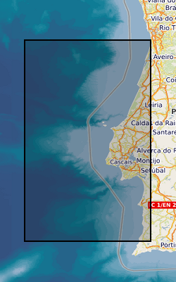
IODP Survey of the "Shackleton sites" on the Southwest Iberian Margin NERC grant NE/J00653X/1
Advances in our understanding of the Earth's climate system will rely on our ability to link high-resolution sedimentary archives from the oceans, ice-cores and terrestrial sequences, and to interpret these records in the context of novel Earth system modeling approaches. Few places exist in the world where sufficiently detailed and unambiguous marine-ice-terrestrial linkages are possible. One challenge for IODP, and the broader drilling community in general, is to identify and recover marine, ice and terrestrial sequences from appropriate locations and with adequate temporal resolution to study processes of the integrated climate system. One such region is the southwest Iberian Margin where it has been demonstrated that the surface oxygen isotopic record could be correlated precisely to temperature variations (i.e., d18O) in Greenland ice cores. By comparison, the benthic d18O signal in the same core resembled the temperature record from Antarctica. Moreover, the narrow continental shelf and proximity of the Tagus River results in the rapid delivery of terrestrial material to the deep-sea environment off Portugal, thereby providing a record of atmospheric changes and permitting correlation of marine and ice core records to European terrestrial sequences. This is the only place in the ocean where such marine-ice-terrestrial correlations have been demonstrated unambiguously. It is therefore highly desirable to extend the Iberian Margin record to encompass the full range of Plio-Pleistocene glacial-interglacial cycles by drilling with the JOIDES Resolution (JR). Towards this end, Proposal 771-Full was submitted to IODP by an international group of 16 proponents led by the UK. The proposal was well received and reviewed by the Science Steering and Evaluation Panel (SSEP), but the IODP Site Survey Panel (SSP) identified major inadequacies in the quality of the seismic data: "The panel raised several concerns on the suitability of the submitted data with regard to its appropriateness, both to image the target properly and with regard to the site location. The panel also discussed the need for 2 high-resolution lines and considered that places where Mass Transport Deposits (MTDs) or closely spaced faults were present deserved these 2 high-resolution lines." This proposal requests 25 days of ship time to collect the necessary seismic and sediment data needed to meet the SSP requirements and recommendations. Several "stand-alone" scientific objectives are also proposed related to the modern hydrography and sedimentary processes on the southwest Iberian Margin, and calibration of palaeoceanographic proxies used for reconstructing past changes in deep-water circulation. This value-added science will make effective use of ship time and contribute key information needed to interpret the downcore records to be obtained by IODP.
Simple
- Date (Creation)
- 2015-12
- Citation identifier
- http://data.bgs.ac.uk/id/dataHolding/13606921
- Point of contact
-
Organisation name Individual name Electronic mail address Role University of Cambridge
Professor D A Hodell
not available
Point of contact
- Maintenance and update frequency
- notApplicable
-
GEMET - INSPIRE themes, version 1.0
- dataCentre
- Keywords
-
-
NERC_DDC
-
- Access constraints
- Other restrictions
- Other constraints
- no limitations
- Other constraints
- The dataset is made freely available for access, e.g. via the Internet. Either no third party data / information is contained in the dataset or BGS has secured written permission from the owner(s) of any third party data / information contained in the dataset to make the dataset freely accessible.
- Use constraints
- Other restrictions
- Other constraints
-
The copyright of materials derived from the British Geological Survey's work is vested in the Natural Environment Research Council [NERC]. No part of this work may be reproduced or transmitted in any form or by any means, or stored in a retrieval system of any nature, without the prior permission of the copyright holder, via the BGS Intellectual Property Rights Manager. Use by customers of information provided by the BGS, is at the customer's own risk. In view of the disparate sources of information at BGS's disposal, including such material donated to BGS, that BGS accepts in good faith as being accurate, the Natural Environment Research Council (NERC) gives no warranty, expressed or implied, as to the quality or accuracy of the information supplied, or to the information's suitability for any use. NERC/BGS accepts no liability whatever in respect of loss, damage, injury or other occurence however caused.
- Other constraints
-
There are no restrictions on the use that may be made of the dataset, although an appropriate copyright acknowledgement must be made when any part of the dataset is reproduced. Either no third party data / information is contained in the dataset or BGS has secured written permission from the owner of any third party data / information contained in the dataset to make the dataset freely available without any use constraints - inclusion of any third party data / information will affect the copyright acknowledgement that needs to be made.
- Other constraints
-
Either: (i) the dataset is made freely available, e.g. via the Internet, for a restricted category of use (e.g. educational use only); or (ii) the dataset has not been formally approved by BGS for access and use by external clients under licence, but its use may be permitted under alternative formal arrangements; or (iii) the dataset contains 3rd party data or information obtained by BGS under terms and conditions that must be consulted in order to determine the permitted usage of the dataset. Refer to the BGS staff member responsible for the creation of the dataset if further advice is required. He / she should be familiar with the composition of the dataset, particularly with regard to 3rd party IPR contained in it, and any resultant use restrictions. This staff member should revert to the IPR Section ( ipr@bgs.ac.uk) for advice, should the position not be clear.
- Language
- English
- Topic category
-
- Geoscientific information
))
- Begin date
- 2013-01
- End date
- 2015-12
- Supplemental Information
-
NERC grant, split award, lead grant NE/J00653X/1, child grants NE/J006556/1 and NE/J006521/1 All the data produced during the cruise (JC089) has been deposited with the BODC ( https://www.bodc.ac.uk/data/information_and_inventories/cruise_inventory/report/13392/). The seismic lines have been deposited with the IODP Site Survey Data Bank ( https://ssdb.iodp.org/). Archive halves of the piston cores collected on JC089 have been depostied with BOSCORF ( http://www.boscorf.org/).
Reference System Information
- Distribution format
-
Name Version
- OnLine resource
-
Protocol Linkage Name https://www.bodc.ac.uk/data/information_and_inventories/cruise_inventory/report/13392/
- OnLine resource
-
Protocol Linkage Name WWW:DOWNLOAD-1.0-http--download
https://webapps.bgs.ac.uk/services/ngdc/accessions/index.html#item72009 Data
- Hierarchy level
- Dataset
- Other
-
dataset
Conformance result
- Title
-
INSPIRE Implementing rules laying down technical arrangements for the interoperability and harmonisation of Geology
- Date (Publication)
- 2011
- Explanation
-
See the referenced specification
- Pass
- No
Conformance result
- Title
-
Commission Regulation (EU) No 1089/2010 of 23 November 2010 implementing Directive 2007/2/EC of the European Parliament and of the Council as regards interoperability of spatial data sets and services
- Date (Publication)
- 2010-12-08
- Explanation
-
See http://eur-lex.europa.eu/LexUriServ/LexUriServ.do?uri=OJ:L:2010:323:0011:0102:EN:PDF
- Pass
- No
- Statement
-
Lineage information may be available in the cruise report https://www.bodc.ac.uk/data/information_and_inventories/cruise_inventory/report/13392/
Metadata
- File identifier
- 34487d7e-fe49-0119-e054-002128a47908 XML
- Metadata language
- English
- Hierarchy level
- Dataset
- Date stamp
- 2026-07-04
- Metadata standard name
- UK GEMINI
- Metadata standard version
-
2.3
- Metadata author
-
Organisation name Individual name Electronic mail address Role British Geological Survey
Point of contact
- Dataset URI
)))
